
The Riverdale Tower
3745 Riverdale Ave,
The Bronx, NY 10463
$2,200 - $4,500
Studio - 2 Beds
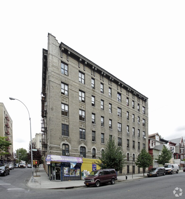
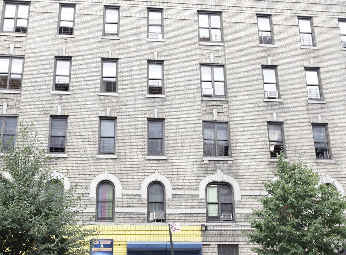
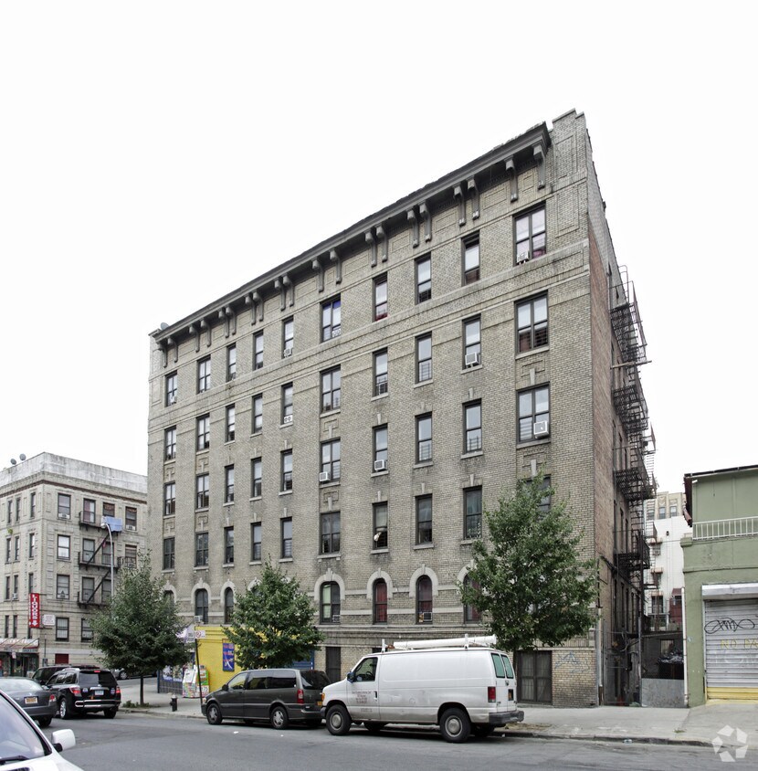

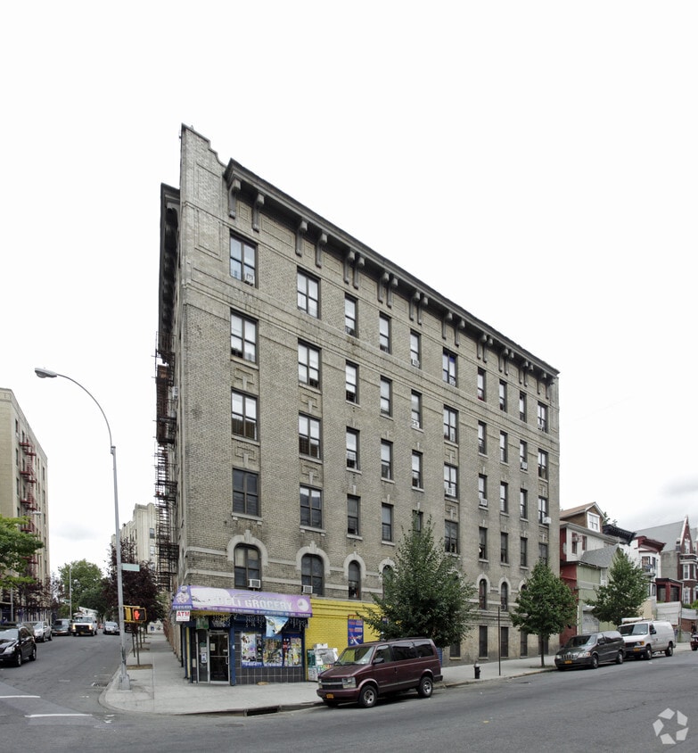
Explore your new home at 1667 Clay Ave in Bronx, NY. This community can be found on Clay Ave in Bronx. Here at this community, the leasing team is excited to help you find the perfect fit. Make sure you to see the current floorplan options. Come be a part of 1667 Clay Ave. Stop by the leasing office to talk about leasing your new apartment.
1667 Clay Ave is an apartment community located in Bronx County and the 10457 ZIP Code. This area is served by the New York City Geographic District # 9 attendance zone.
Claremont is a vibrant, diverse neighborhood nestled in the South Bronx. The Bronx, the northernmost of the five New York City boroughs, touts a rich culture along with renowned attractions such as the Bronx Zoo, Yankee Stadium, and the New York Botanical Garden.
Claremont is convenient to all of these attractions and more, boasting a vast namesake park with baseball fields, basketball courts, playgrounds, and a seasonal pool. The neighborhood is also close to Crotona Park and Highbridge Park, providing plenty of lush reprieves from the bustle of city life.
Claremont offers a wide variety of affordable apartments, condos, and townhomes available for rent in a walkable locale. The neighborhood is just steps away from the thriving businesses strewn along 170th Street and Jerome Avenue in neighboring Mount Eden. Commuting from Claremont is simple with access to Interstate 95 as well as the B and D trains.
Learn more about living in ClaremontCompare neighborhood and city base rent averages by bedroom.
| Claremont | Bronx, NY | |
|---|---|---|
| Studio | $1,457 | $1,628 |
| 1 Bedroom | $1,352 | $1,632 |
| 2 Bedrooms | $1,726 | $2,099 |
| 3 Bedrooms | $1,390 | $2,368 |
| Colleges & Universities | Distance | ||
|---|---|---|---|
| Colleges & Universities | Distance | ||
| Drive: | 5 min | 1.7 mi | |
| Drive: | 5 min | 1.9 mi | |
| Drive: | 5 min | 2.0 mi | |
| Drive: | 4 min | 2.0 mi |


Transportation options available in Bronx include 174-175 Streets, located 0.5 mile from 1667 Clay Ave. 1667 Clay Ave is near LaGuardia, located 10.3 miles or 19 minutes away, and John F Kennedy International, located 19.0 miles or 28 minutes away.
| Transit / Subway | Distance | ||
|---|---|---|---|
| Transit / Subway | Distance | ||
|
|
Walk: | 10 min | 0.5 mi |
|
|
Walk: | 11 min | 0.6 mi |
|
|
Walk: | 11 min | 0.6 mi |
|
|
Walk: | 12 min | 0.6 mi |
|
|
Walk: | 14 min | 0.7 mi |
| Commuter Rail | Distance | ||
|---|---|---|---|
| Commuter Rail | Distance | ||
|
|
Walk: | 9 min | 0.5 mi |
|
|
Drive: | 3 min | 1.4 mi |
|
|
Drive: | 4 min | 1.6 mi |
|
|
Drive: | 6 min | 2.2 mi |
|
|
Drive: | 7 min | 2.9 mi |
| Airports | Distance | ||
|---|---|---|---|
| Airports | Distance | ||
|
LaGuardia
|
Drive: | 19 min | 10.3 mi |
|
John F Kennedy International
|
Drive: | 28 min | 19.0 mi |
Scores provided by
Traffic
-Airport
-Businesses
-Scores provided by
HowLoud What is a Sound Score Rating? A Sound Score Rating aggregates noise caused by vehicle traffic, airplane traffic and local sources. How It WorksTime and distance from 1667 Clay Ave.
| Shopping Centers | Distance | ||
|---|---|---|---|
| Shopping Centers | Distance | ||
| Walk: | 16 min | 0.8 mi | |
| Drive: | 4 min | 1.3 mi | |
| Drive: | 5 min | 1.8 mi |
| Parks and Recreation | Distance | ||
|---|---|---|---|
| Parks and Recreation | Distance | ||
|
Claremont Park
|
Walk: | 5 min | 0.3 mi |
|
Crotona Park
|
Walk: | 10 min | 0.5 mi |
|
Roberto Clemente State Park
|
Drive: | 7 min | 2.3 mi |
|
Starlight Park
|
Drive: | 7 min | 2.5 mi |
|
Sherman Creek and Swindler Cove
|
Drive: | 10 min | 4.8 mi |
| Hospitals | Distance | ||
|---|---|---|---|
| Hospitals | Distance | ||
| Drive: | 3 min | 1.3 mi | |
| Drive: | 4 min | 1.5 mi | |
| Drive: | 7 min | 2.4 mi |
| Military Bases | Distance | ||
|---|---|---|---|
| Military Bases | Distance | ||
| Drive: | 18 min | 9.5 mi | |
| Drive: | 31 min | 14.5 mi |
What Are Walk Score®, Transit Score®, and Bike Score® Ratings?
Walk Score® measures the walkability of any address. Transit Score® measures access to public transit. Bike Score® measures the bikeability of any address.
What is a Sound Score Rating?
A Sound Score Rating aggregates noise caused by vehicle traffic, airplane traffic and local sources.
1667 Clay Ave
Bronx, NY 10457


