

$1,800 / Month
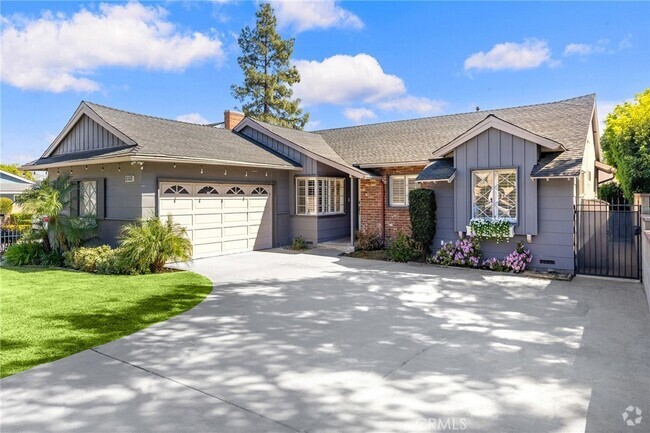
1650 Vejar St
Pomona, CA 91766
2 Weeks Ago
Favorites
1650 Vejar St

Favorites
Check Back Soon for Upcoming Availability
| Beds | Baths | Average SF |
|---|---|---|
| 1 Bedroom 1 Bedroom 1 Br | 1 Bath 1 Bath 1 Ba | 650 SF |
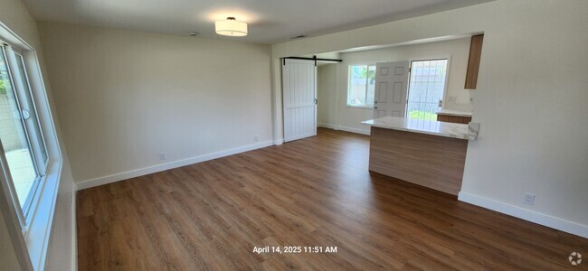
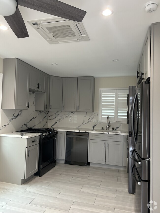
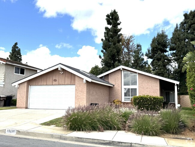
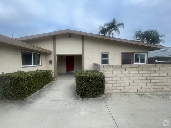
About This Property
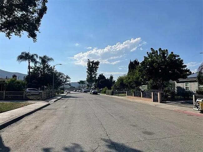
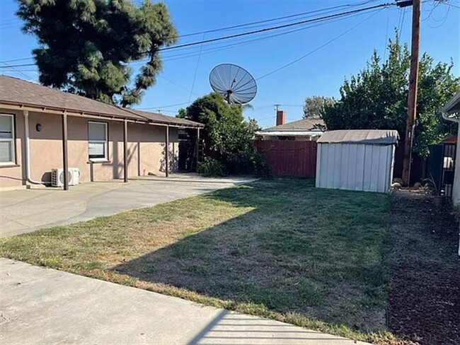
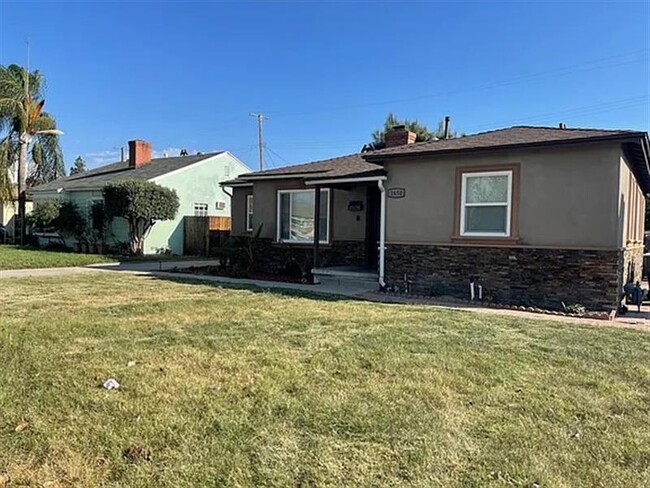
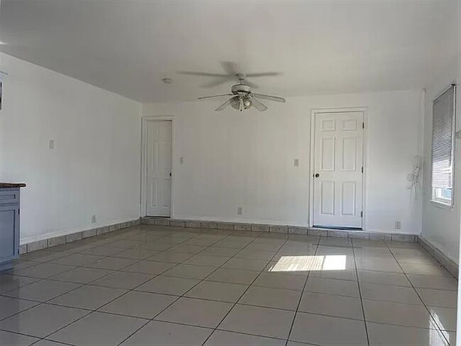
Nice Rental Property Located At 1650 Vejar St
1650 Vejar St is a house located in Los Angeles County and the 91766 ZIP Code. This area is served by the Pomona Unified attendance zone.
Fees and Policies
The fees below are based on community-supplied data and may exclude additional fees and utilities.
- Dogs Allowed
-
Fees not specified
- Cats Allowed
-
Fees not specified
Details
Utilities Included
-
Water
Location
Get Directions
Tucked in the Pomona Valley, Pomona is known for gorgeous mountainous views—especially those of Mount Baldy, the highest peak in the San Gabriel Mountains. Formerly a fruitful agricultural town, Pomona is now a busy city and a college town, home to California State Polytechnic University-Pomona, Western University of Health Sciences, and Western University College of Veterinary Medicine. Two additional college campuses, Claremont Colleges and Mount San Antonio College, are located just outside of the city. Pomona pays homage to its past be preserving historic buildings like the Fox Theater Pomona. The fully restored theater is surrounded by restaurants, pubs, shops, and art galleries in Downtown Pomona's Arts Colony.
Renters in Pomona are about 30 miles west of Downtown Los Angeles. If you prefer mass transit, take the train from Pomona Station or travel by car along Interstate 10.
Learn more about living in Pomona
Expenses
Utilities Included
Water
Included
Education
| Colleges & Universities | Distance | ||
|---|---|---|---|
| Colleges & Universities | Distance | ||
| Drive: | 4 min | 2.1 mi | |
| Drive: | 7 min | 2.9 mi | |
| Drive: | 9 min | 3.9 mi | |
| Drive: | 10 min | 4.6 mi |
1650 Vejar St is within 4 minutes or 2.1 miles from Western Health Scis., Pomono. It is also near DeVry University-California and Cal Poly Pomona.
Schools

Public Elementary School
Grades K-6
356 Students
Attendance Zone
Public Middle & High School
Grades 7-12
719 Students
Attendance Zone
Public High School
Grades 9-12
936 Students
Attendance Zone
Private Elementary, Middle & High School
Grades PK-12
Nearby
Private Elementary, Middle & High School
Grades K-12
Nearby
School data provided by
 The GreatSchools Rating helps parents compare schools within a state based on a variety of school quality indicators and provides a helpful picture of how effectively each school serves all of its students. Ratings are on a scale of 1 (below average) to 10 (above average) and can include test scores, college readiness, academic progress, advanced courses, equity, discipline and attendance data. We also advise parents to visit schools, consider other information on school performance and programs, and consider family needs as part of the school selection process.
View GreatSchools Rating Methodology
View GreatSchools Rating Methodology
Transportation options available in Pomona include Apu / Citrus College Station, located 11.8 miles from 1650 Vejar St. 1650 Vejar St is near Ontario International, located 10.9 miles or 19 minutes away, and John Wayne/Orange County, located 32.2 miles or 40 minutes away.
| Transit / Subway | Distance | ||
|---|---|---|---|
| Transit / Subway | Distance | ||
| Drive: | 18 min | 11.8 mi | |
| Drive: | 17 min | 12.4 mi |
| Commuter Rail | Distance | ||
|---|---|---|---|
| Commuter Rail | Distance | ||
|
|
Drive: | 4 min | 1.9 mi |
|
|
Drive: | 9 min | 4.7 mi |
|
|
Drive: | 11 min | 6.1 mi |
|
|
Drive: | 12 min | 7.2 mi |
|
|
Drive: | 12 min | 7.7 mi |
| Airports | Distance | ||
|---|---|---|---|
| Airports | Distance | ||
|
Ontario International
|
Drive: | 19 min | 10.9 mi |
|
John Wayne/Orange County
|
Drive: | 40 min | 32.2 mi |
Time and distance from 1650 Vejar St.
| Shopping Centers | Distance | ||
|---|---|---|---|
| Shopping Centers | Distance | ||
| Walk: | 5 min | 0.3 mi | |
| Drive: | 4 min | 1.6 mi | |
| Drive: | 4 min | 1.7 mi |
1650 Vejar St has 3 shopping centers within 1.7 miles, which is about a 4-minute walk. The miles and minutes will be for the farthest away property.
| Parks and Recreation | Distance | ||
|---|---|---|---|
| Parks and Recreation | Distance | ||
|
Frank G. Bonelli Regional Park
|
Drive: | 9 min | 5.1 mi |
|
Millikan Planetarium
|
Drive: | 12 min | 6.6 mi |
|
Pitzer College Arboretum
|
Drive: | 13 min | 7.3 mi |
|
Rancho Santa Ana Botanic Garden
|
Drive: | 13 min | 7.4 mi |
|
San Dimas Canyon Nature Center
|
Drive: | 14 min | 8.5 mi |
1650 Vejar St has 5 parks within 8.5 miles, including Frank G. Bonelli Regional Park, Millikan Planetarium, and Rancho Santa Ana Botanic Garden.
| Hospitals | Distance | ||
|---|---|---|---|
| Hospitals | Distance | ||
| Drive: | 6 min | 3.3 mi | |
| Drive: | 9 min | 4.7 mi | |
| Drive: | 10 min | 6.0 mi |
1650 Vejar St has 3 hospitals within 6.0 miles, the nearest is Pomona Valley Hospital Medical Center which is 3.3 miles away and a 6 minute drive.
| Military Bases | Distance | ||
|---|---|---|---|
| Military Bases | Distance | ||
| Drive: | 44 min | 32.1 mi |
1650 Vejar St is 32.1 miles and a 44 minute drive from Los Alamitos Army Airfield.
You May Also Like
Similar Rentals Nearby


What Are Walk Score®, Transit Score®, and Bike Score® Ratings?
Walk Score® measures the walkability of any address. Transit Score® measures access to public transit. Bike Score® measures the bikeability of any address.
What is a Sound Score Rating?
A Sound Score Rating aggregates noise caused by vehicle traffic, airplane traffic and local sources
1650 Vejar St
Pomona, CA 91766