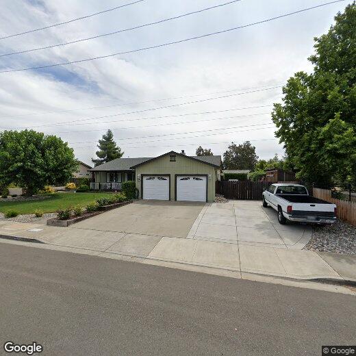
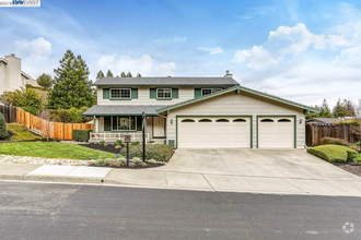
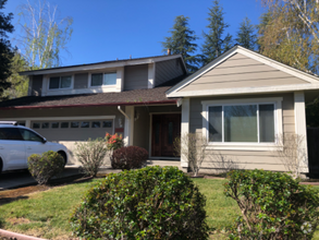
1645 Heather Ln
1645 Heather Ln
Livermore, CA 94551
2 Weeks Ago
Favorites
1645 Heather Ln

Favorites
Check Back Soon for Upcoming Availability
| Beds | Baths | Average SF |
|---|---|---|
| 3 Bedrooms 3 Bedrooms 3 Br | 2 Baths 2 Baths 2 Ba | — |
Location
Get Directions
About halfway between San Francisco and Modesto, Livermore’s local economy represents some of California’s oldest and youngest industries: the city is home to two major DOE laboratories and was the site of the state’s first commercial vineyards (several world-class wineries still operate there today).
The downtown area along First Street is a gorgeous tree-lined corridor of cafes, shops, and entertainment venues. Two ACE train stations in town give residents easy access to practically anywhere in the region. The local schools are top-notch and several quality parks are scattered throughout the community.
Learn more about living in Livermore
Education
| Colleges & Universities | Distance | ||
|---|---|---|---|
| Colleges & Universities | Distance | ||
| Drive: | 11 min | 5.7 mi | |
| Drive: | 17 min | 12.0 mi | |
| Drive: | 22 min | 14.3 mi | |
| Drive: | 32 min | 21.0 mi |
1645 Heather Ln is within 11 minutes or 5.7 miles from Las Positas College. It is also near San Joaquin Delta, Mtn. House and Diablo Valley Coll, San Ramon.
Transportation options available in Livermore include Dublin Pleasanton Station, located 11.1 miles from 1645 Heather Ln. 1645 Heather Ln is near Metro Oakland International, located 29.9 miles or 38 minutes away, and Norman Y Mineta San Jose International, located 35.7 miles or 49 minutes away.
| Transit / Subway | Distance | ||
|---|---|---|---|
| Transit / Subway | Distance | ||
|
|
Drive: | 15 min | 11.1 mi |
| Commuter Rail | Distance | ||
|---|---|---|---|
| Commuter Rail | Distance | ||
| Drive: | 4 min | 2.4 mi | |
| Drive: | 9 min | 3.7 mi | |
| Drive: | 21 min | 10.4 mi | |
| Drive: | 27 min | 21.0 mi | |
| Drive: | 39 min | 24.9 mi |
| Airports | Distance | ||
|---|---|---|---|
| Airports | Distance | ||
|
Metro Oakland International
|
Drive: | 38 min | 29.9 mi |
|
Norman Y Mineta San Jose International
|
Drive: | 49 min | 35.7 mi |
Time and distance from 1645 Heather Ln.
| Shopping Centers | Distance | ||
|---|---|---|---|
| Shopping Centers | Distance | ||
| Walk: | 13 min | 0.7 mi | |
| Walk: | 14 min | 0.8 mi | |
| Walk: | 19 min | 1.0 mi |
1645 Heather Ln has 3 shopping centers within 1.0 mile, which is about a 19-minute walk. The miles and minutes will be for the farthest away property.
| Parks and Recreation | Distance | ||
|---|---|---|---|
| Parks and Recreation | Distance | ||
|
Brushy Peak Regional Preserve
|
Drive: | 9 min | 4.1 mi |
|
Los Vaqueros Watershed
|
Drive: | 9 min | 4.9 mi |
|
Shadow Cliffs Regional Recreation Area
|
Drive: | 17 min | 8.0 mi |
|
Del Valle Regional Park
|
Drive: | 28 min | 10.9 mi |
|
Bethany Reservoir State Recreation Area
|
Drive: | 23 min | 13.0 mi |
1645 Heather Ln has 5 parks within 13.0 miles, including Brushy Peak Regional Preserve, Los Vaqueros Watershed, and Shadow Cliffs Regional Recreation Area.
| Hospitals | Distance | ||
|---|---|---|---|
| Hospitals | Distance | ||
| Drive: | 14 min | 9.4 mi |
1645 Heather Ln is 9.4 miles and a 14 minute drive from Stanford Health Care - ValleyCare.
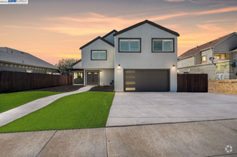
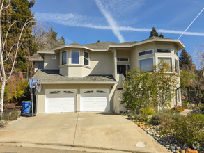
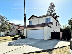
You May Also Like
Similar Rentals Nearby


What Are Walk Score®, Transit Score®, and Bike Score® Ratings?
Walk Score® measures the walkability of any address. Transit Score® measures access to public transit. Bike Score® measures the bikeability of any address.
What is a Sound Score Rating?
A Sound Score Rating aggregates noise caused by vehicle traffic, airplane traffic and local sources

1645 Heather Ln
Livermore, CA 94551