
Centro Callan
100 Callan Ave,
San Leandro, CA 94577
$2,599 - $7,826
Studio - 3 Beds

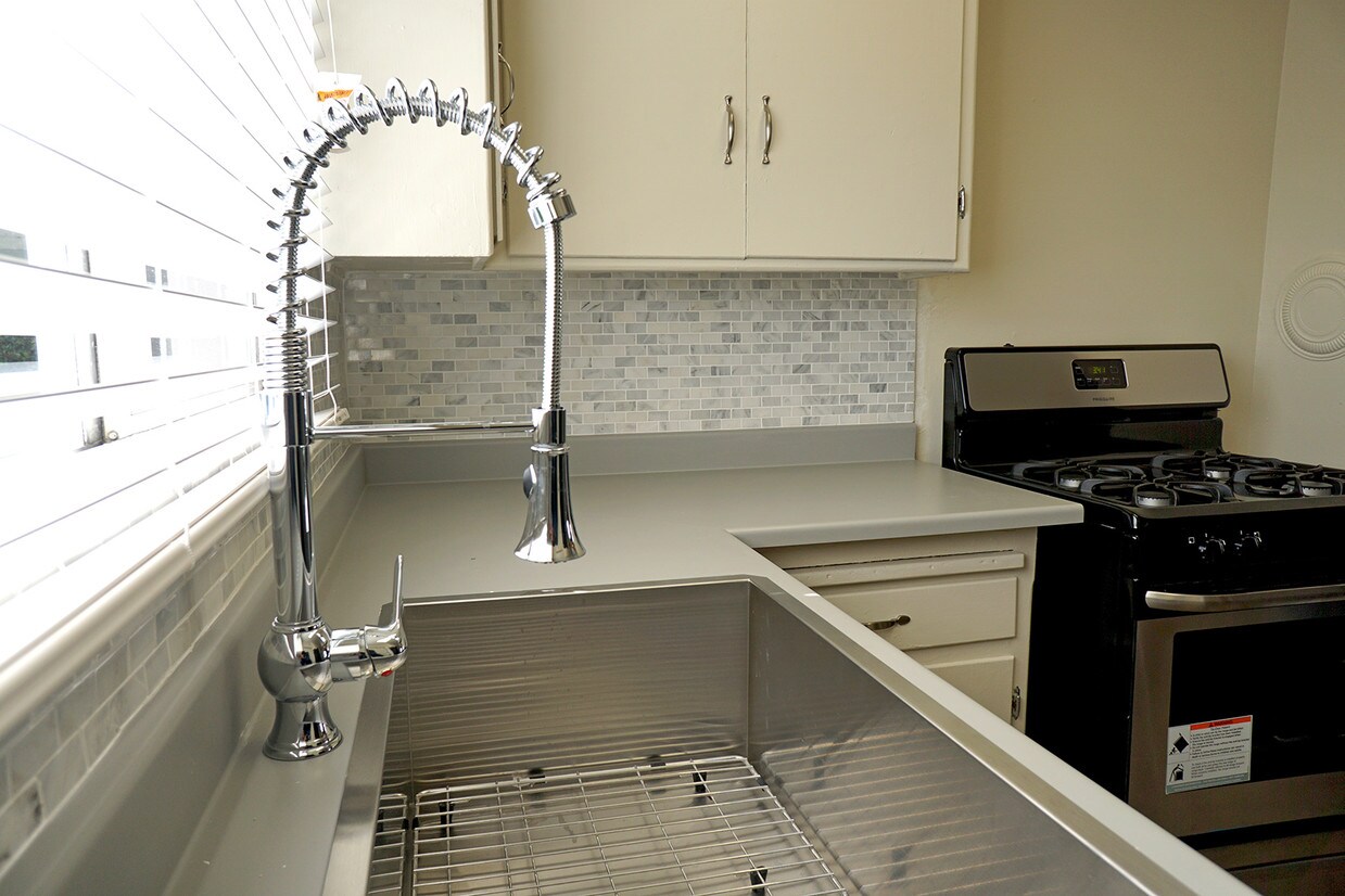
Our small, quiet community consists of 13 semi-attached homes with attached garage and is located within walking distance to shopping, great food options and even public transportation! It's just a short 10 minute drive to the San Leandro BART station and our location offers our residents easy freeway access. With spacious floor plans, new interiors and ample parking, you couldn't ask for more. We are happy to offer an array of online services for our residents: online rental payments, service request submission and you can easily contact our management any time day or night with just a few computer or mobile device clicks. Furry family members are welcome. Come see why our residents love living at 163rd Ave, call now to schedule a tour of your new home!
163rd Ave is an apartment community located in Alameda County and the 94578 ZIP Code. This area is served by the San Lorenzo Unified School District attendance zone.
Ashland is a neighborhood conveniently located near the Interstate 238 and 580 junction and less than five miles east of the San Francisco Bay. The neighborhood is a residential area popular for commuters to Silicon Valley and other surrounding areas, so renters have several options to choose from. A variety of styles of apartments, condos, townhomes, and single-family houses are available in average Bay Area prices. Within town, residents can enjoy several restaurants and shopping destinations located along the neighborhood’s main roads. A few green spaces dot the area as well, but outdoor enthusiasts will appreciate the proximity of the Anthony Chabot Regional Park and the relaxing Bay Area beaches.
Learn more about living in AshlandCompare neighborhood and city base rent averages by bedroom.
| Ashland | San Leandro, CA | |
|---|---|---|
| Studio | $1,080 | $1,827 |
| 1 Bedroom | $1,727 | $1,875 |
| 2 Bedrooms | $2,139 | $2,301 |
| 3 Bedrooms | $2,495 | $2,879 |
| Colleges & Universities | Distance | ||
|---|---|---|---|
| Colleges & Universities | Distance | ||
| Drive: | 11 min | 4.8 mi | |
| Drive: | 13 min | 7.6 mi | |
| Drive: | 15 min | 8.9 mi | |
| Drive: | 36 min | 18.2 mi |


Transportation options available in San Leandro include Bay Fair Station, located 1.2 miles from 163rd Ave. 163rd Ave is near Metro Oakland International, located 9.1 miles or 14 minutes away, and San Francisco International, located 26.9 miles or 36 minutes away.
| Transit / Subway | Distance | ||
|---|---|---|---|
| Transit / Subway | Distance | ||
|
|
Drive: | 4 min | 1.2 mi |
|
|
Drive: | 6 min | 2.8 mi |
|
|
Drive: | 7 min | 3.6 mi |
|
|
Drive: | 7 min | 5.0 mi |
|
|
Drive: | 14 min | 5.9 mi |
| Commuter Rail | Distance | ||
|---|---|---|---|
| Commuter Rail | Distance | ||
|
|
Drive: | 8 min | 3.4 mi |
| Drive: | 8 min | 3.4 mi | |
|
|
Drive: | 17 min | 13.2 mi |
| Drive: | 21 min | 14.0 mi | |
| Drive: | 22 min | 14.1 mi |
| Airports | Distance | ||
|---|---|---|---|
| Airports | Distance | ||
|
Metro Oakland International
|
Drive: | 14 min | 9.1 mi |
|
San Francisco International
|
Drive: | 36 min | 26.9 mi |
Scores provided by
Traffic
-Airport
-Businesses
-Scores provided by
HowLoud What is a Sound Score Rating? A Sound Score Rating aggregates noise caused by vehicle traffic, airplane traffic and local sources. How It WorksTime and distance from 163rd Ave.
| Shopping Centers | Distance | ||
|---|---|---|---|
| Shopping Centers | Distance | ||
| Drive: | 2 min | 1.1 mi | |
| Drive: | 4 min | 1.2 mi | |
| Drive: | 4 min | 1.5 mi |
| Parks and Recreation | Distance | ||
|---|---|---|---|
| Parks and Recreation | Distance | ||
|
Lake Chabot Regional Park
|
Drive: | 7 min | 3.1 mi |
|
Don Castro Regional Recreation Area
|
Drive: | 5 min | 3.4 mi |
|
Sulphur Creek Nature Center
|
Drive: | 9 min | 4.8 mi |
|
Cull Canyon Regional Recreation Area
|
Drive: | 9 min | 5.0 mi |
|
Hayward Regional Shoreline
|
Drive: | 13 min | 5.2 mi |
| Hospitals | Distance | ||
|---|---|---|---|
| Hospitals | Distance | ||
| Drive: | 3 min | 1.3 mi | |
| Drive: | 9 min | 5.5 mi | |
| Drive: | 12 min | 7.4 mi |
| Military Bases | Distance | ||
|---|---|---|---|
| Military Bases | Distance | ||
| Drive: | 26 min | 16.6 mi | |
| Drive: | 26 min | 16.8 mi | |
| Drive: | 26 min | 16.8 mi |
Pets Allowed Fitness Center In Unit Washer & Dryer Walk-In Closets Stainless Steel Appliances Hardwood Floors EV Charging
Pets Allowed Fitness Center In Unit Washer & Dryer Stainless Steel Appliances Business Center Package Service Elevator
What Are Walk Score®, Transit Score®, and Bike Score® Ratings?
Walk Score® measures the walkability of any address. Transit Score® measures access to public transit. Bike Score® measures the bikeability of any address.
What is a Sound Score Rating?
A Sound Score Rating aggregates noise caused by vehicle traffic, airplane traffic and local sources.
1579-1593 163rd Ave
San Leandro, CA 94578


