-
Studio Apartment 204

$2,895
/ Month
1618 Sand Hill Rd Unit 204
Palo Alto, CA 94304
2 Weeks Ago
|
Edit
Favorites
1618 Sand Hill Rd Unit 204

Favorites
Check Back Soon for Upcoming Availability
| Beds | Baths | Average SF |
|---|---|---|
| Studio Studio 0 Br | 1 Bath 1 Bath 1 Ba | 508 SF |
Fees and Policies
The fees below are based on community-supplied data and may exclude additional fees and utilities.
- Parking
-
Covered--
Details
Utilities Included
-
Water
-
Trash Removal
-
Sewer
About This Property
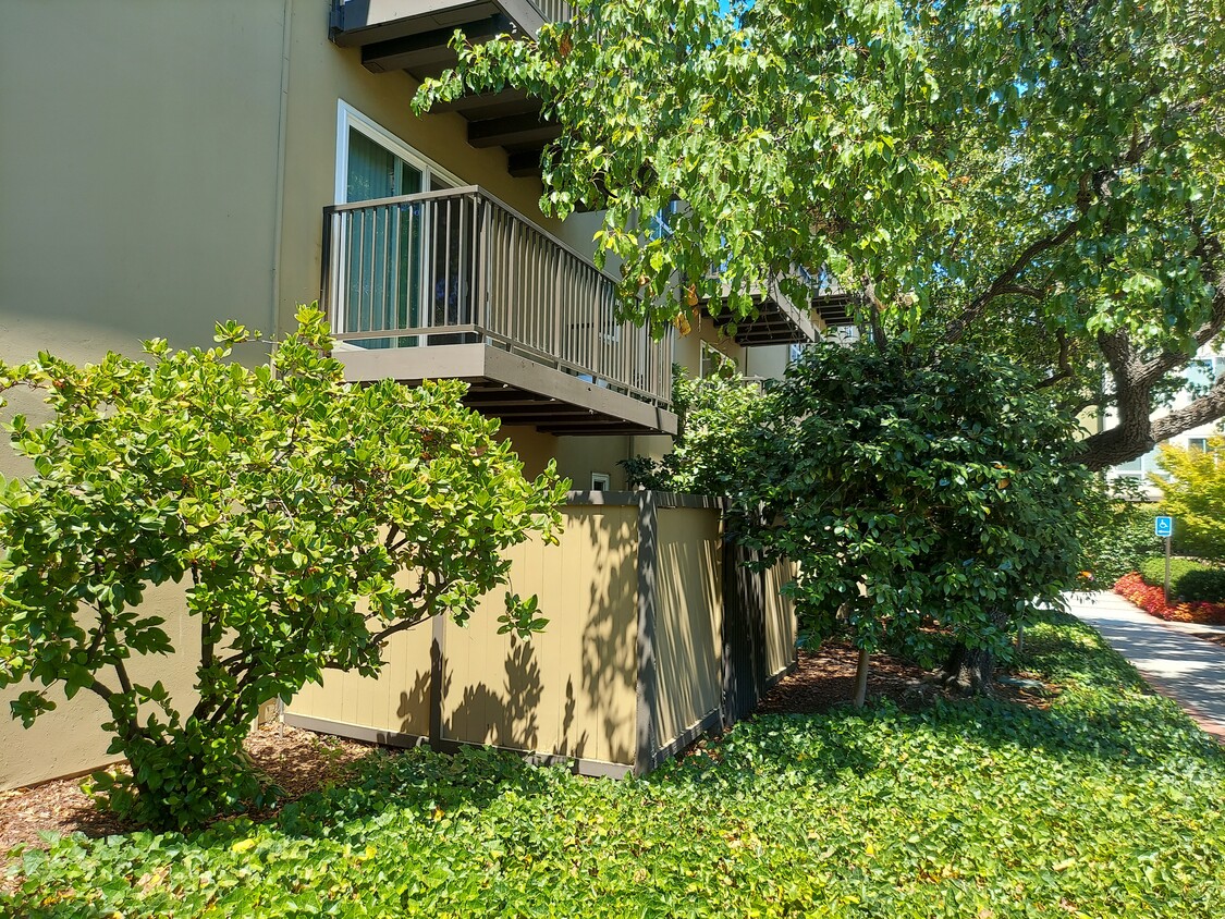
Studio Apartment Lease Take Over A studio apartment at Oak Creek Apartments located at Palo Alto, Sand Hill Road near Stanford Hospital is available for a lease take over starting August 1, 2021. The lease term ends December 2021 with an option to renew. The rent is $2,865. Interested parties have to complete an application process with Oak Creek Apartments. The studio unit features a built-in dresser with room for queen size bed. The kitchen is equipped with a stove, refrigerator and microwave. It has a spacious patio/balcony. Washer and Dryer are available in the building. Water, trash and sewer charges are included in the rent. Assigned parking and storage space are also included.
1618 Sand Hill Rd is an apartment community located in Santa Clara County and the 94304 ZIP Code.
Apartment Features
Washer/Dryer
Air Conditioning
Microwave
Refrigerator
- Washer/Dryer
- Air Conditioning
- Smoke Free
- Kitchen
- Microwave
- Refrigerator
- Laundry Facilities
- Elevator
- Storage Space
- Fitness Center
- Pool
- Balcony
- Patio
Location
Get Directions
Living in Palo Alto places you in Silicon Valley, where historic neighborhoods complement the city's technological presence. Tree-lined streets wind through the community, which is anchored by Stanford University. University Avenue features local boutiques and restaurants housed in preserved historic buildings, while the Stanford Shopping Center offers high-end retail destinations. The city maintains 36 parks and preserves, including the Baylands Nature Preserve and Foothills Park, where residents enjoy hiking trails and outdoor activities. Palo Alto's infrastructure supports alternative transportation, with dedicated bike lanes throughout the city.
The rental market in Palo Alto reflects the area's popularity, with current average rents ranging from $2,634 for studios to $6,139 for four-bedroom homes. Recent trends show steady growth, with rent increases varying from 1.8% to 17% across different unit sizes over the past year.
Learn more about living in Palo Alto
Amenities
- Washer/Dryer
- Air Conditioning
- Smoke Free
- Kitchen
- Microwave
- Refrigerator
- Laundry Facilities
- Elevator
- Storage Space
- Balcony
- Patio
- Fitness Center
- Pool
Expenses
Utilities Included
Water, Trash Removal, Sewer
Included
Education
| Colleges & Universities | Distance | ||
|---|---|---|---|
| Colleges & Universities | Distance | ||
| Drive: | 8 min | 2.7 mi | |
| Drive: | 9 min | 3.5 mi | |
| Drive: | 11 min | 5.8 mi | |
| Drive: | 16 min | 6.2 mi |
1618 Sand Hill Rd Unit 204 is within 8 minutes or 2.7 miles from Stanford University. It is also near Menlo College and Foothill College, Middlefield.
Transportation options available in Palo Alto include Mountain View Station, located 7.8 miles from 1618 Sand Hill Rd Unit 204. 1618 Sand Hill Rd Unit 204 is near Norman Y Mineta San Jose International, located 17.2 miles or 29 minutes away, and San Francisco International, located 22.7 miles or 33 minutes away.
| Transit / Subway | Distance | ||
|---|---|---|---|
| Transit / Subway | Distance | ||
| Drive: | 17 min | 7.8 mi | |
|
|
Drive: | 17 min | 7.8 mi |
|
|
Drive: | 20 min | 9.0 mi |
| Drive: | 19 min | 9.7 mi | |
|
|
Drive: | 19 min | 9.8 mi |
| Commuter Rail | Distance | ||
|---|---|---|---|
| Commuter Rail | Distance | ||
| Drive: | 6 min | 2.3 mi | |
| Drive: | 7 min | 2.8 mi | |
| Drive: | 9 min | 3.5 mi | |
| Drive: | 9 min | 3.5 mi | |
| Drive: | 14 min | 6.1 mi |
| Airports | Distance | ||
|---|---|---|---|
| Airports | Distance | ||
|
Norman Y Mineta San Jose International
|
Drive: | 29 min | 17.2 mi |
|
San Francisco International
|
Drive: | 33 min | 22.7 mi |
Time and distance from 1618 Sand Hill Rd Unit 204.
| Shopping Centers | Distance | ||
|---|---|---|---|
| Shopping Centers | Distance | ||
| Walk: | 17 min | 0.9 mi | |
| Drive: | 4 min | 1.5 mi | |
| Drive: | 4 min | 1.6 mi |
1618 Sand Hill Rd Unit 204 has 3 shopping centers within 1.6 miles, which is about a 4-minute drive. The miles and minutes will be for the farthest away property.
| Parks and Recreation | Distance | ||
|---|---|---|---|
| Parks and Recreation | Distance | ||
|
Stanford Hills Park
|
Walk: | 19 min | 1.0 mi |
|
Jack W. Lyle Park
|
Drive: | 4 min | 1.7 mi |
|
Sharon Hills Park
|
Drive: | 4 min | 1.8 mi |
|
Fremont Park
|
Drive: | 6 min | 2.2 mi |
|
El Palo Alto Park
|
Drive: | 9 min | 3.6 mi |
1618 Sand Hill Rd Unit 204 has 5 parks within 3.6 miles, including Stanford Hills Park, Jack W. Lyle Park, and El Palo Alto Park.
| Hospitals | Distance | ||
|---|---|---|---|
| Hospitals | Distance | ||
| Walk: | 11 min | 0.6 mi | |
| Drive: | 3 min | 1.2 mi | |
| Drive: | 15 min | 6.3 mi |
1618 Sand Hill Rd Unit 204 has 3 hospitals within 6.3 miles, the nearest is Stanford Health Care which is 0.6 mile away and a 11 minute walk.
| Military Bases | Distance | ||
|---|---|---|---|
| Military Bases | Distance | ||
| Drive: | 22 min | 10.1 mi |
1618 Sand Hill Rd Unit 204 is 10.1 miles and a 22 minute drive from Ames Research Center.
You May Also Like
Similar Rentals Nearby


What Are Walk Score®, Transit Score®, and Bike Score® Ratings?
Walk Score® measures the walkability of any address. Transit Score® measures access to public transit. Bike Score® measures the bikeability of any address.
What is a Sound Score Rating?
A Sound Score Rating aggregates noise caused by vehicle traffic, airplane traffic and local sources
1618 Sand Hill Rd
Palo Alto, CA 94304