
16049 Meadowside St
La Puente, CA 91744
-
Bedrooms
1
-
Bathrooms
1
-
Square Feet
600 sq ft
-
Available
Available Now

Fees and Policies
The fees listed below are community-provided and may exclude utilities or add-ons. All payments are made directly to the property and are non-refundable unless otherwise specified.
- Parking
-
Surface Lot--
Details
Utilities Included
-
Gas
-
Water
-
Electricity
-
Heat
-
Trash Removal
-
Sewer
-
Air Conditioning
Contact
- Phone Number
- Contact
Located about 18 miles east of Los Angeles, Valinda is a large neighborhood located south of West Covina and north of La Puente. The Dwight D. Eisenhower Golf Course starts at its southern edge, with Francisquito Avenue on the north end. This cozy, residential neighborhood features wide sidewalks, palm trees, and a scenic view of the mountains. A variety of shops and restaurants line North Hacienda Boulevard, and Woodside Village Shopping Center is located on Azusa Avenue, near the intersection with Amar Road.
Valinda features one large park, Rimgrove Park, in the neighborhood. This park includes a splash pad, a playground, picnic areas, a baseball diamond, a fitness station, and a basketball court. Other parks are located just outside the neighborhood, including Galster Wilderness Park and Woodgrove Park. La Puente City Park, just outside the neighborhood on its southeastern corner, provides lighted ball fields, basketball courts, and a playground.
Learn more about living in Valinda| Colleges & Universities | Distance | ||
|---|---|---|---|
| Colleges & Universities | Distance | ||
| Drive: | 11 min | 6.4 mi | |
| Drive: | 16 min | 8.7 mi | |
| Drive: | 15 min | 8.9 mi | |
| Drive: | 16 min | 9.8 mi |
Transportation options available in La Puente include Irwindale Station, located 6.7 miles from 16049 Meadowside St. 16049 Meadowside St is near Ontario International, located 22.7 miles or 31 minutes away, and Long Beach (Daugherty Field), located 27.9 miles or 39 minutes away.
| Transit / Subway | Distance | ||
|---|---|---|---|
| Transit / Subway | Distance | ||
| Drive: | 13 min | 6.7 mi | |
| Drive: | 14 min | 8.0 mi | |
| Drive: | 18 min | 9.1 mi | |
| Drive: | 18 min | 9.9 mi | |
| Drive: | 19 min | 11.4 mi |
| Commuter Rail | Distance | ||
|---|---|---|---|
| Commuter Rail | Distance | ||
|
|
Drive: | 10 min | 4.2 mi |
|
|
Drive: | 12 min | 6.0 mi |
|
|
Drive: | 14 min | 7.2 mi |
|
|
Drive: | 14 min | 8.5 mi |
|
|
Drive: | 20 min | 13.9 mi |
| Airports | Distance | ||
|---|---|---|---|
| Airports | Distance | ||
|
Ontario International
|
Drive: | 31 min | 22.7 mi |
|
Long Beach (Daugherty Field)
|
Drive: | 39 min | 27.9 mi |
Time and distance from 16049 Meadowside St.
| Shopping Centers | Distance | ||
|---|---|---|---|
| Shopping Centers | Distance | ||
| Walk: | 10 min | 0.5 mi | |
| Walk: | 12 min | 0.7 mi | |
| Walk: | 18 min | 0.9 mi |
| Parks and Recreation | Distance | ||
|---|---|---|---|
| Parks and Recreation | Distance | ||
|
Galster Wilderness Park Nature Center
|
Drive: | 7 min | 2.7 mi |
|
Covina Park
|
Drive: | 10 min | 5.3 mi |
|
Schabarum Regional Park
|
Drive: | 12 min | 5.9 mi |
|
Santa Fe Dam Recreation Area
|
Drive: | 21 min | 7.6 mi |
|
Santa Fe Dam Nature Center
|
Drive: | 21 min | 7.6 mi |
| Hospitals | Distance | ||
|---|---|---|---|
| Hospitals | Distance | ||
| Drive: | 6 min | 2.7 mi | |
| Drive: | 8 min | 4.5 mi | |
| Drive: | 11 min | 5.6 mi |
| Military Bases | Distance | ||
|---|---|---|---|
| Military Bases | Distance | ||
| Drive: | 38 min | 21.3 mi |
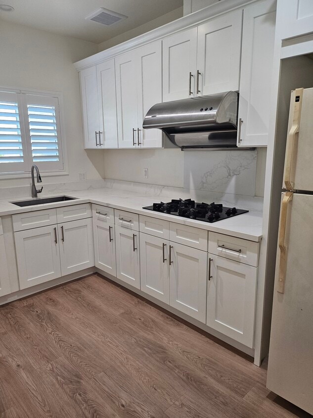
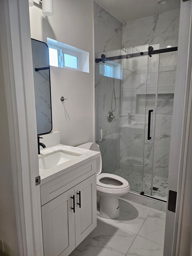
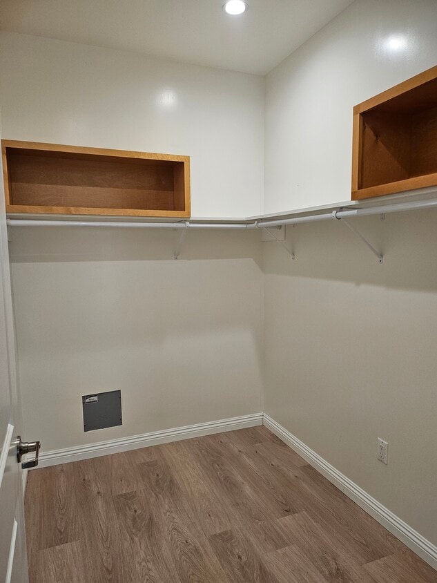
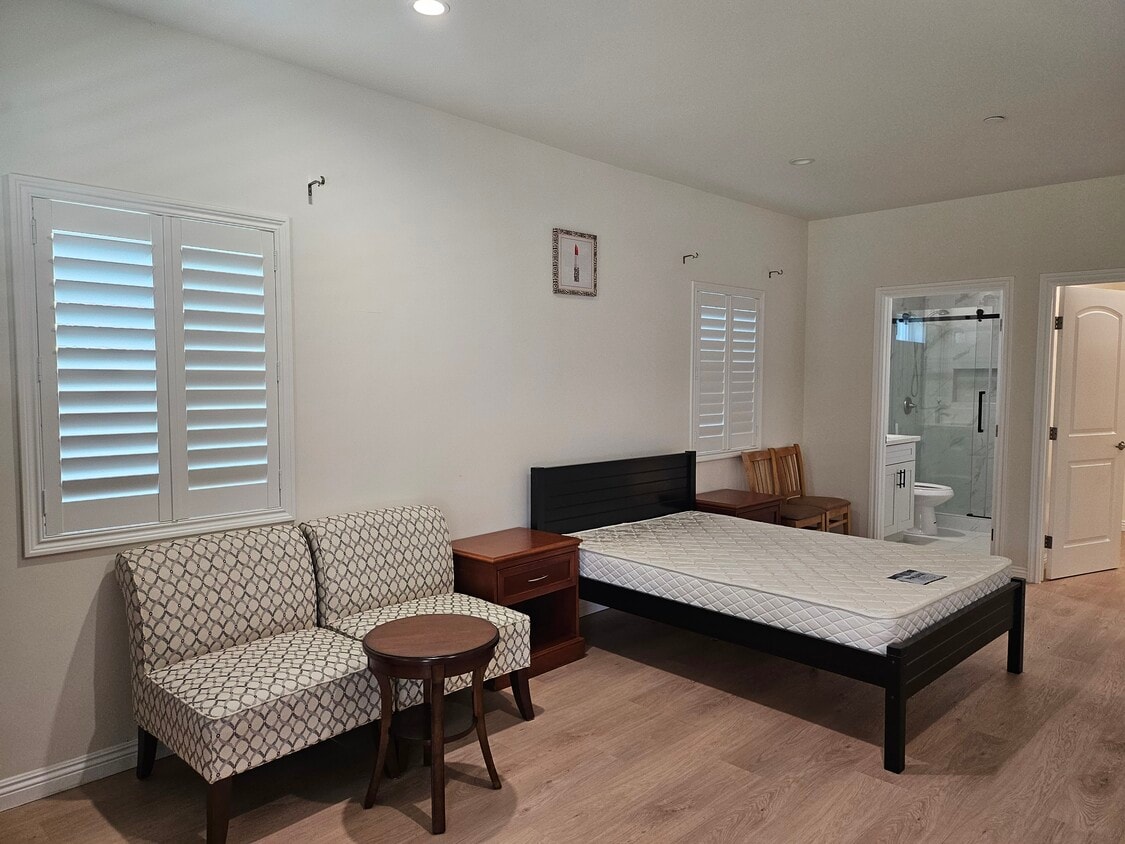
16049 Meadowside St Photos
What Are Walk Score®, Transit Score®, and Bike Score® Ratings?
Walk Score® measures the walkability of any address. Transit Score® measures access to public transit. Bike Score® measures the bikeability of any address.
What is a Sound Score Rating?
A Sound Score Rating aggregates noise caused by vehicle traffic, airplane traffic and local sources.
16049 Meadowside St
La Puente, CA 91744