

$1,650
/ Month
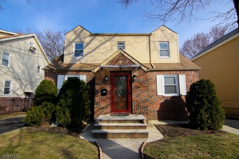
158 Union Ave Unit 2
Belleville, NJ 07109
2 Weeks Ago
|
Edit
Favorites
158 Union Ave Unit 2

Favorites
Check Back Soon for Upcoming Availability
| Beds | Baths | Average SF |
|---|---|---|
| 2 Bedrooms 2 Bedrooms 2 Br | 1 Bath 1 Bath 1 Ba | — |
Fees and Policies
The fees listed below are community-provided and may exclude utilities or add-ons. All payments are made directly to the property and are non-refundable unless otherwise specified.
About This Property
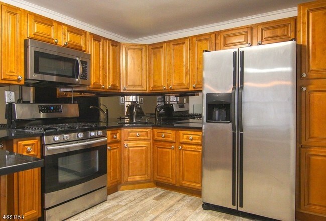
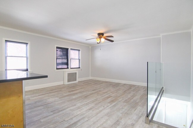
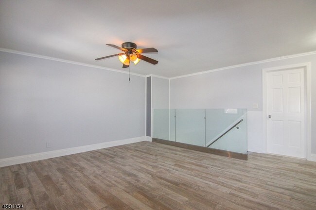
Fully renovated open concept 2 bedroom apartment featuring modern kitchen and bathroom. Kitchen includes stainless steel appliances, mirrored back splash,
158 Union Ave is an apartment community located in Essex County and the 07109 ZIP Code.
Features
- Air Conditioning
- Microwave
158 Union Ave,
Belleville,
NJ
07109
Located in Essex County, bordering Bloomfield and Newark, Belleville is considered to be the Cherry Blossom Capital of America. Every year, Belleville hosts a festival celebrating the cherry blossom trees in Branch Brook Park, complete with live musical performances, cultural demonstrations, food, and children’s activities for thousands of visitors.
Shopping options are plentiful in Belleville, with several strip malls and a commercial corridor along Washington Avenue. Belleville is also home to the Motorcycle Mall, a massive destination for everything pertaining to motorcycles and powersports. Belleville residents enjoy access to multiple golf courses, a wide variety of international cuisine, public transportation, and highways. New York City is just minutes away from this New Jersey suburb.
Learn more about living in Belleville
Amenities
- Air Conditioning
- Microwave
Education
| Colleges & Universities | Distance | ||
|---|---|---|---|
| Colleges & Universities | Distance | ||
| Drive: | 4 min | 2.5 mi | |
| Drive: | 6 min | 3.6 mi | |
| Drive: | 8 min | 4.1 mi | |
| Drive: | 11 min | 5.3 mi |
158 Union Ave Unit 2 is within 4 minutes or 2.5 miles from Bloomfield College. It is also near Rutgers, Newark Campus and N.J. Inst. of Technology.
Transportation options available in Belleville include Branch Brook Park, located 1.8 miles from 158 Union Ave Unit 2. 158 Union Ave Unit 2 is near Newark Liberty International, located 9.6 miles or 16 minutes away, and LaGuardia, located 22.9 miles or 42 minutes away.
| Transit / Subway | Distance | ||
|---|---|---|---|
| Transit / Subway | Distance | ||
|
|
Drive: | 3 min | 1.8 mi |
|
|
Drive: | 4 min | 2.1 mi |
|
|
Drive: | 4 min | 2.2 mi |
|
|
Drive: | 6 min | 2.8 mi |
|
|
Drive: | 5 min | 2.9 mi |
| Commuter Rail | Distance | ||
|---|---|---|---|
| Commuter Rail | Distance | ||
|
|
Drive: | 5 min | 2.9 mi |
|
|
Drive: | 6 min | 3.0 mi |
|
|
Drive: | 6 min | 3.1 mi |
|
|
Drive: | 7 min | 3.7 mi |
|
|
Drive: | 9 min | 4.3 mi |
| Airports | Distance | ||
|---|---|---|---|
| Airports | Distance | ||
|
Newark Liberty International
|
Drive: | 16 min | 9.6 mi |
|
LaGuardia
|
Drive: | 42 min | 22.9 mi |
Walkability Near 158 Union Ave Belleville, NJ 07109
Getting Around
 What do Walkability, Transit, Drivability, and Bikeability mean?
Walkability measures the walking distance to day-to-day needs.
Transit measures access to public transportation.
Drivability measures congestion, parking availability, and access to major roads.
Bikeability measures the suitability for cycling.
How It Works
What do Walkability, Transit, Drivability, and Bikeability mean?
Walkability measures the walking distance to day-to-day needs.
Transit measures access to public transportation.
Drivability measures congestion, parking availability, and access to major roads.
Bikeability measures the suitability for cycling.
How It Works
Moderately Walkable
Walkability
70
/ 100
Some Public Transit
Transit
40
/ 100
Exceptionally Drivable
Drivability
90
/ 100
Fairly Bikeable
Bikeability
50
/ 100
Scores provided by
-
Soundscore™
-
/ 100
Traffic
-Airport
-Businesses
-Scores provided by
HowLoud What is a Sound Score Rating? A Sound Score Rating aggregates noise caused by vehicle traffic, airplane traffic and local sources. How It WorksTime and distance from 158 Union Ave Unit 2.
| Shopping Centers | Distance | ||
|---|---|---|---|
| Shopping Centers | Distance | ||
| Walk: | 7 min | 0.4 mi | |
| Walk: | 14 min | 0.8 mi | |
| Walk: | 19 min | 1.0 mi |
158 Union Ave Unit 2 has 3 shopping centers within 1.0 mile, which is about a 19-minute walk. The miles and minutes will be for the farthest away property.
| Parks and Recreation | Distance | ||
|---|---|---|---|
| Parks and Recreation | Distance | ||
|
Branch Brook Park
|
Drive: | 6 min | 2.8 mi |
|
Richard W. DeKorte Park
|
Drive: | 8 min | 3.2 mi |
|
Kearny Marsh
|
Drive: | 7 min | 3.2 mi |
|
Meadowlands Environment Center
|
Drive: | 17 min | 6.0 mi |
|
McDowell Observatory
|
Drive: | 17 min | 6.0 mi |
158 Union Ave Unit 2 has 5 parks within 6.0 miles, including Branch Brook Park, Kearny Marsh, and Richard W. DeKorte Park.
| Hospitals | Distance | ||
|---|---|---|---|
| Hospitals | Distance | ||
| Drive: | 7 min | 3.6 mi | |
| Drive: | 8 min | 4.1 mi | |
| Drive: | 9 min | 5.0 mi |
158 Union Ave Unit 2 has 3 hospitals within 5.0 miles, the nearest is Saint Michael's Medical Center which is 3.6 miles away and a 7 minute drive.
| Military Bases | Distance | ||
|---|---|---|---|
| Military Bases | Distance | ||
| Drive: | 27 min | 12.7 mi | |
| Drive: | 21 min | 13.4 mi |
158 Union Ave Unit 2 is 12.7 miles from Governors Island Support Center, and is convenient to other military bases, including Military Ocean Terminal.
You May Also Like
How do I access Social Services in New Jersey?
Statewide service is free, confidential, multilingual and always open. Three easy ways to reach Social Services in NJ: Dial 2-1-1; text your zip code to 898-211; or chat at https://www.nj211.org
Similar Rentals Nearby


What Are Walk Score®, Transit Score®, and Bike Score® Ratings?
Walk Score® measures the walkability of any address. Transit Score® measures access to public transit. Bike Score® measures the bikeability of any address.
What is a Sound Score Rating?
A Sound Score Rating aggregates noise caused by vehicle traffic, airplane traffic and local sources.
158 Union Ave
Belleville, NJ 07109