


$1,100
/ Month
15603 HWY 29
Buchanan Dam, TX 78609
Favorites
15603 HWY 29

Favorites
Check Back Soon for Upcoming Availability
| Beds | Baths | Average SF |
|---|---|---|
| 1 Bedroom 1 Bedroom 1 Br | 1 Bath 1 Bath 1 Ba | — |
About This Property
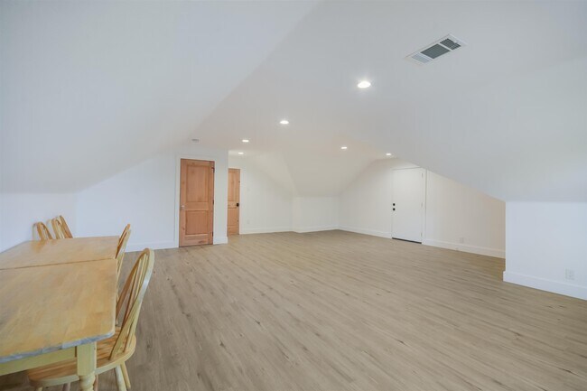
FRESH REMODEL & SUPER CLEAN STUDIO SPACE NESTLED IN THE HEART OF THE LAKE BUCHANAN AREA * UNIT IS VERY LIGHT & BRIGHT WITH COOL LOFT TYPE AMBIANCE * UNIT INCLUDES FULL KITCHENETTE WITH FULL OVEN,SINK AREA,ISLAND WITH READY TO EAT SPACE ON ISLAND,BATHROOM,LARGE OPEN SPACE & CLOSET*PRIVATE STAIRCASE LEADS UP TO ENTRANCE OF SPACE*ALL HARD SURFACES - HIGH-END VINYL ON THE FLOOR*HILL COUNTRY VIEWS AND EASY ACCESS TO BURNET & LLANO*PROPERTY IS READY TO GO AND HAS A UNIQUE CHARM Based on information submitted to the MLS GRID as of [see last changed date above]. All data is obtained from various sources and may not have been verified by broker or MLS GRID. Supplied Open House Information is subject to change without notice. All information should be independently reviewed and verified for accuracy. Properties may or may not be listed by the office/agent presenting the information. Some IDX listings have been excluded from this website. Prices displayed on all Sold listings are the Last Known Listing Price and may not be the actual selling price.
15603 Hwy 29 is a condo located in Llano County and the 78609 ZIP Code. This area is served by the Llano Independent School District attendance zone.
15603 HWY 29,
Buchanan Dam,
TX
78609
Education
Schools


Public Elementary School
Grades PK-5
596 Students
Attendance Zone
Public Middle School
Grades 6-8
423 Students
Attendance Zone
Public High School
Grades 9-12
552 Students
Attendance Zone
Private Elementary, Middle & High School
Grades PK-12
318 Students
Nearby
Private Elementary School
Grades PK-5
Nearby
School data provided by
 The GreatSchools Rating helps parents compare schools within a state based on a variety of school quality indicators and provides a helpful picture of how effectively each school serves all of its students. Ratings are on a scale of 1 (below average) to 10 (above average) and can include test scores, college readiness, academic progress, advanced courses, equity, discipline and attendance data. We also advise parents to visit schools, consider other information on school performance and programs, and consider family needs as part of the school selection process.
View GreatSchools Rating Methodology
Data provided by GreatSchools.org © 2026. All rights reserved.
View GreatSchools Rating Methodology
Data provided by GreatSchools.org © 2026. All rights reserved.
Walkability Near 15603 HWY 29 Buchanan Dam, TX 78609
Getting Around
 What do Walkability, Transit, Drivability, and Bikeability mean?
Walkability measures the walking distance to day-to-day needs.
Transit measures access to public transportation.
Drivability measures congestion, parking availability, and access to major roads.
Bikeability measures the suitability for cycling.
How It Works
What do Walkability, Transit, Drivability, and Bikeability mean?
Walkability measures the walking distance to day-to-day needs.
Transit measures access to public transportation.
Drivability measures congestion, parking availability, and access to major roads.
Bikeability measures the suitability for cycling.
How It Works
Not Walkable
Walkability
10
/ 100
Exceptionally Drivable
Drivability
100
/ 100
Not Bikeable
Bikeability
10
/ 100
Scores provided by
-
Soundscore™
-
/ 100
Traffic
-Airport
-Businesses
-Scores provided by
HowLoud What is a Sound Score Rating? A Sound Score Rating aggregates noise caused by vehicle traffic, airplane traffic and local sources. How It WorksYou May Also Like
Similar Rentals Nearby
-
-

-

-

-
 3 Beds, 2 Baths, 1,672 sq ft$4,37582 Island Dr Unit 8202
 -
 3 Beds, 2 Baths, 1,250 sq ft$2,200Total Monthly Price12 Month LeaseTotal Monthly Price NewPrices include all required monthly fees.104 Cove E Unit 107
 -

-

-
 2 Beds, 2 Baths, 1,243 sq ft$2,150100 Bay Point Dr Unit 7
 -
 Condo for Rent3 Beds | 2 Baths | 1,248 sq ft
What Are Walk Score®, Transit Score®, and Bike Score® Ratings?
Walk Score® measures the walkability of any address. Transit Score® measures access to public transit. Bike Score® measures the bikeability of any address.
What is a Sound Score Rating?
A Sound Score Rating aggregates noise caused by vehicle traffic, airplane traffic and local sources.

15603 HWY 29
Buchanan Dam, TX 78609