
$2,000
/ Month
156 N State St
Newtown, PA 18940
Favorites
156 N State St

Favorites
Check Back Soon for Upcoming Availability
| Beds | Baths | Average SF |
|---|---|---|
| 1 Bedroom 1 Bedroom 1 Br | 1 Bath 1 Bath 1 Ba | — |
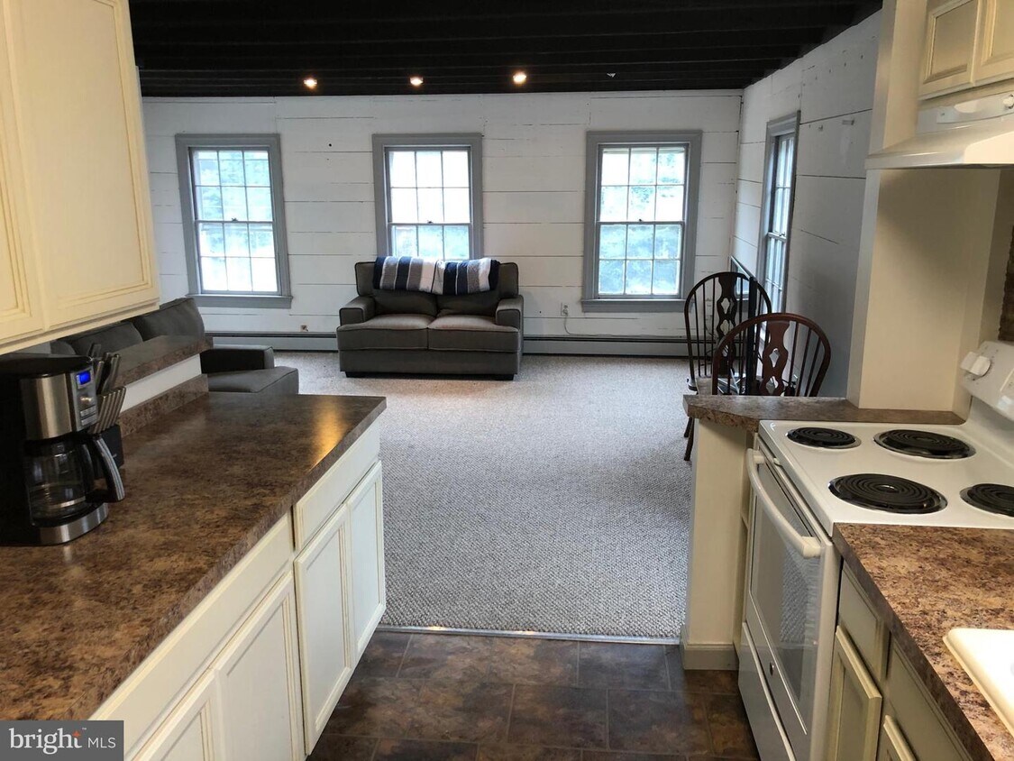
About This Property
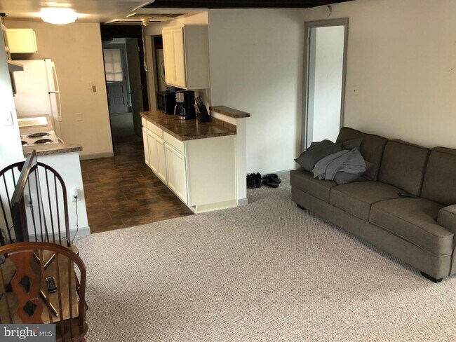
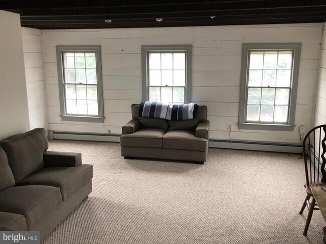
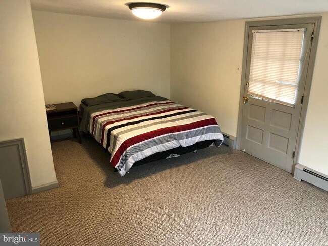
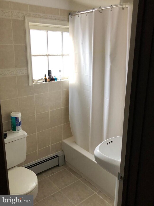
Charming 1 Bedroom apartment in the heart of Newtown Borough. 2nd Floor unit with back balcony, in-unit Washer and Dryer, 1 Bathroom, and Central Air Conditioning. Off street parking Pets are considered case by case basis. Dog grooming business is located below the unit. Tenant pays electric Tenant pays flat rate of $185/mth for Oil, water, sewer, trash, and property maintenance. 1 year lease then month to month 1st Month rent, Last Month Rent, and Security Deposit Due at signing
156 N State St is an apartment community located in Bucks County and the 18940 ZIP Code.
156 N State St,
Newtown,
PA
18940
Education
| Colleges & Universities | Distance | ||
|---|---|---|---|
| Colleges & Universities | Distance | ||
| Drive: | 5 min | 2.0 mi | |
| Drive: | 19 min | 10.6 mi | |
| Drive: | 20 min | 11.2 mi | |
| Drive: | 23 min | 13.5 mi |
156 N State St is within 5 minutes or 2.0 miles from Bucks County Community College. It is also near Mercer Co. C.C., Kerney and C.C. of Philadelphia, NE Ctr.
Transportation options available in Newtown include Hamilton Avenue, located 11.3 miles from 156 N State St. 156 N State St is near Trenton Mercer, located 9.3 miles or 16 minutes away, and Philadelphia International, located 38.0 miles or 59 minutes away.
| Transit / Subway | Distance | ||
|---|---|---|---|
| Transit / Subway | Distance | ||
|
|
Drive: | 20 min | 11.3 mi |
| Drive: | 20 min | 11.4 mi | |
|
|
Drive: | 23 min | 12.8 mi |
| Commuter Rail | Distance | ||
|---|---|---|---|
| Commuter Rail | Distance | ||
|
|
Drive: | 11 min | 5.4 mi |
|
|
Drive: | 12 min | 6.5 mi |
|
|
Drive: | 11 min | 6.7 mi |
|
|
Drive: | 15 min | 7.6 mi |
|
|
Drive: | 17 min | 9.9 mi |
| Airports | Distance | ||
|---|---|---|---|
| Airports | Distance | ||
|
Trenton Mercer
|
Drive: | 16 min | 9.3 mi |
|
Philadelphia International
|
Drive: | 59 min | 38.0 mi |
Walkability Near 156 N State St Newtown, PA 18940
Getting Around
 What do Walkability, Transit, Drivability, and Bikeability mean?
Walkability measures the walking distance to day-to-day needs.
Transit measures access to public transportation.
Drivability measures congestion, parking availability, and access to major roads.
Bikeability measures the suitability for cycling.
How It Works
What do Walkability, Transit, Drivability, and Bikeability mean?
Walkability measures the walking distance to day-to-day needs.
Transit measures access to public transportation.
Drivability measures congestion, parking availability, and access to major roads.
Bikeability measures the suitability for cycling.
How It Works
Moderately Walkable
Walkability
60
/ 100
Limited Public Transit
Transit
30
/ 100
Exceptionally Drivable
Drivability
100
/ 100
Fairly Bikeable
Bikeability
50
/ 100
Scores provided by
-
Soundscore™
-
/ 100
Traffic
-Airport
-Businesses
-Scores provided by
HowLoud What is a Sound Score Rating? A Sound Score Rating aggregates noise caused by vehicle traffic, airplane traffic and local sources. How It WorksTime and distance from 156 N State St.
| Shopping Centers | Distance | ||
|---|---|---|---|
| Shopping Centers | Distance | ||
| Walk: | 6 min | 0.3 mi | |
| Walk: | 9 min | 0.5 mi | |
| Walk: | 10 min | 0.5 mi |
156 N State St has 3 shopping centers within 0.5 mile, which is about a 10-minute walk. The miles and minutes will be for the farthest away property.
| Parks and Recreation | Distance | ||
|---|---|---|---|
| Parks and Recreation | Distance | ||
|
Tyler State Park
|
Drive: | 8 min | 3.6 mi |
|
Core Creek Park
|
Drive: | 9 min | 4.1 mi |
|
Churchville Nature Center
|
Drive: | 10 min | 5.4 mi |
|
Washington Crossing State Park
|
Drive: | 16 min | 7.6 mi |
|
Bowman's Hill Wildflower Preserve
|
Drive: | 15 min | 8.3 mi |
156 N State St has 5 parks within 8.3 miles, including Tyler State Park, Core Creek Park, and Churchville Nature Center.
| Hospitals | Distance | ||
|---|---|---|---|
| Hospitals | Distance | ||
| Drive: | 14 min | 8.2 mi | |
| Drive: | 18 min | 10.2 mi | |
| Drive: | 21 min | 10.8 mi |
156 N State St has 3 hospitals within 10.8 miles, the nearest is Jefferson Bucks Hospital which is 8.2 miles away and a 14 minute drive.
| Military Bases | Distance | ||
|---|---|---|---|
| Military Bases | Distance | ||
| Drive: | 19 min | 9.6 mi | |
| Drive: | 29 min | 15.0 mi | |
| Drive: | 47 min | 29.7 mi |
156 N State St has 3 military bases within 29.7 miles, the nearest is Naval Air Development Center which is 9.6 miles away and a 19 minute drive.
You May Also Like
Similar Rentals Nearby


What Are Walk Score®, Transit Score®, and Bike Score® Ratings?
Walk Score® measures the walkability of any address. Transit Score® measures access to public transit. Bike Score® measures the bikeability of any address.
What is a Sound Score Rating?
A Sound Score Rating aggregates noise caused by vehicle traffic, airplane traffic and local sources.
156 N State St
Newtown, PA 18940