1 / 19


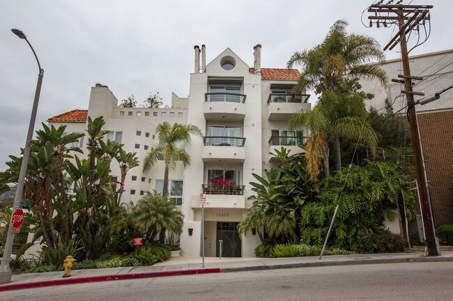
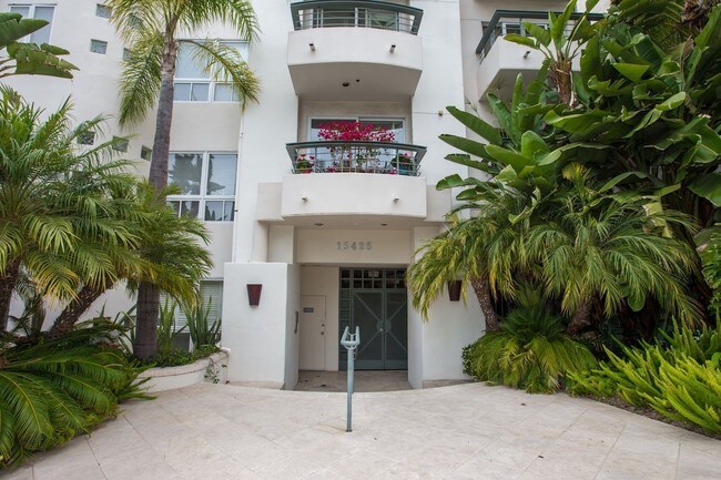
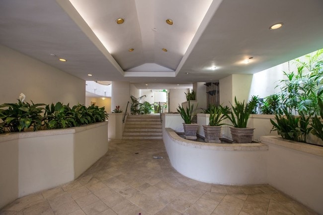
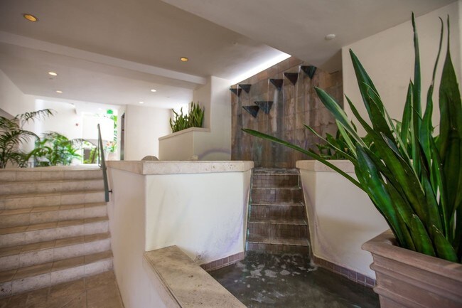

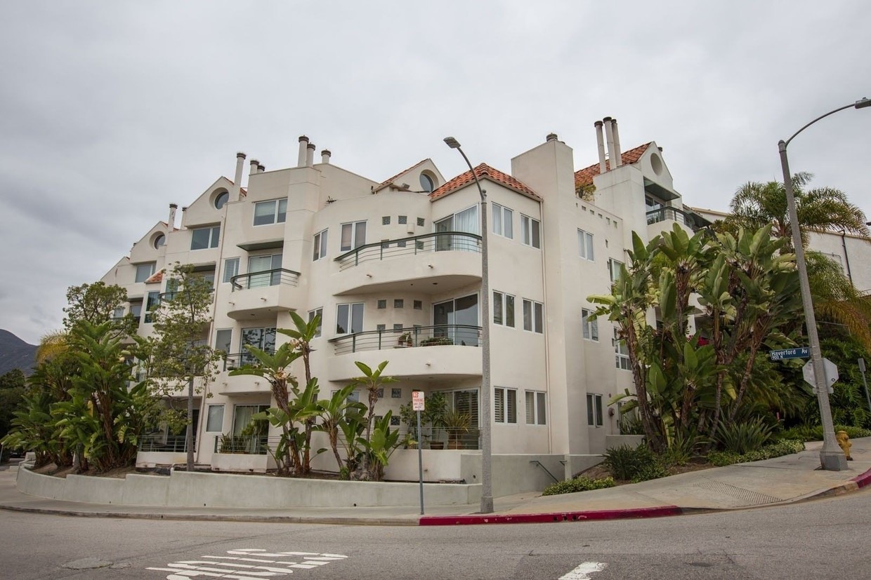
Luxurious Condo | Central Air |Balcony | 6-9 Month Lease Available Front units in 18-unit building. 2-car Tandem Parking. Very private 2 Bed 2 Bath end condo unit. Only 1 shared wall (ceiling).Slate floors in kitchen and dining. Carpet in living room and bedrooms. 2 balconies, 2 fireplaces. Jacuzzi tub in master bath. Located in village next to Gelson's market, restaurants, and blocks from the Caruso Palisades Village Project and hiking trails, walk to beach. Quiet residential area. Waterfalls in lobby. Direct access on elevator from garage to unit. Near Temescal park. Renters insurance required. No cats. T.V's provided in Living Room and Master Bedroom. ***6 to 9 month lease available on request***
15425 Antioch St is a condo located in Los Angeles County and the 90272 ZIP Code. This area is served by the Los Angeles Unified attendance zone.
Air Conditioning
Microwave
Refrigerator
Fireplace
From mountain hikes to beach volleyball, everything you've heard about Pacific Palisades is true -- it is gorgeous, filled with outdoor adventures, and is home to some of California's most beautiful stretches of beach. Situated directly north of Santa Monica and just 16 miles west of Downtown Los Angeles, it's easy to see why this is the playground for movie stars and celebrities. Cruise along the Pacific Coast Highway to Sunset Beach, play volleyball at Will Rogers State Beach, or go bicycling along the ocean at Marvin Braude Bike Trail.
On days you'd rather be hiking than surfing, Temescal Canyon State Park, Rivas Canyon Park, and Will Rogers State Historic Park are all on the east side of Pacific Palisades. Palisades Park features a rec center, a playground, ball fields, and picnic areas. Topanga State Park features 36 miles of hiking trails. While Pacific Palisades is primarily a residential area, Sunset Boulevard is home to several shops, restaurants, and other businesses.
Learn more about living in Pacific Palisades| Colleges & Universities | Distance | ||
|---|---|---|---|
| Colleges & Universities | Distance | ||
| Drive: | 8 min | 3.7 mi | |
| Drive: | 10 min | 4.4 mi | |
| Drive: | 11 min | 6.2 mi | |
| Drive: | 20 min | 7.2 mi |


Transportation options available in Pacific Palisades include Downtown Santa Monica, located 4.2 miles from 15425 Antioch St. 15425 Antioch St is near Los Angeles International, located 12.7 miles or 24 minutes away, and Bob Hope, located 21.5 miles or 37 minutes away.
| Transit / Subway | Distance | ||
|---|---|---|---|
| Transit / Subway | Distance | ||
|
|
Drive: | 9 min | 4.2 mi |
|
|
Drive: | 11 min | 5.5 mi |
|
|
Drive: | 12 min | 6.2 mi |
|
|
Drive: | 12 min | 7.1 mi |
| Drive: | 14 min | 8.0 mi |
| Commuter Rail | Distance | ||
|---|---|---|---|
| Commuter Rail | Distance | ||
|
|
Drive: | 30 min | 17.9 mi |
|
|
Drive: | 37 min | 21.5 mi |
|
|
Drive: | 37 min | 21.6 mi |
|
|
Drive: | 37 min | 21.6 mi |
|
|
Drive: | 44 min | 22.3 mi |
| Airports | Distance | ||
|---|---|---|---|
| Airports | Distance | ||
|
Los Angeles International
|
Drive: | 24 min | 12.7 mi |
|
Bob Hope
|
Drive: | 37 min | 21.5 mi |
Time and distance from 15425 Antioch St.
| Shopping Centers | Distance | ||
|---|---|---|---|
| Shopping Centers | Distance | ||
| Drive: | 5 min | 2.2 mi | |
| Drive: | 8 min | 3.7 mi | |
| Drive: | 9 min | 3.8 mi |
| Parks and Recreation | Distance | ||
|---|---|---|---|
| Parks and Recreation | Distance | ||
|
Temescal Gateway Park
|
Walk: | 3 min | 0.2 mi |
|
Will Rogers State Beach
|
Drive: | 3 min | 1.4 mi |
|
Will Rogers State Historic Park
|
Drive: | 7 min | 2.2 mi |
|
Santa Monica State Beach
|
Drive: | 7 min | 3.5 mi |
|
Topanga State Park
|
Drive: | 15 min | 6.0 mi |
| Hospitals | Distance | ||
|---|---|---|---|
| Hospitals | Distance | ||
| Drive: | 10 min | 4.6 mi | |
| Drive: | 11 min | 6.1 mi | |
| Drive: | 18 min | 10.6 mi |
| Military Bases | Distance | ||
|---|---|---|---|
| Military Bases | Distance | ||
| Drive: | 25 min | 18.1 mi |


What Are Walk Score®, Transit Score®, and Bike Score® Ratings?
Walk Score® measures the walkability of any address. Transit Score® measures access to public transit. Bike Score® measures the bikeability of any address.
What is a Sound Score Rating?
A Sound Score Rating aggregates noise caused by vehicle traffic, airplane traffic and local sources
15425 Antioch St
Pacific Palisades, CA 90272


