
The Station Apartments
5959 Broadway,
Bronx, NY 10463
$1,750 - $2,300
Studio - 1 Bed
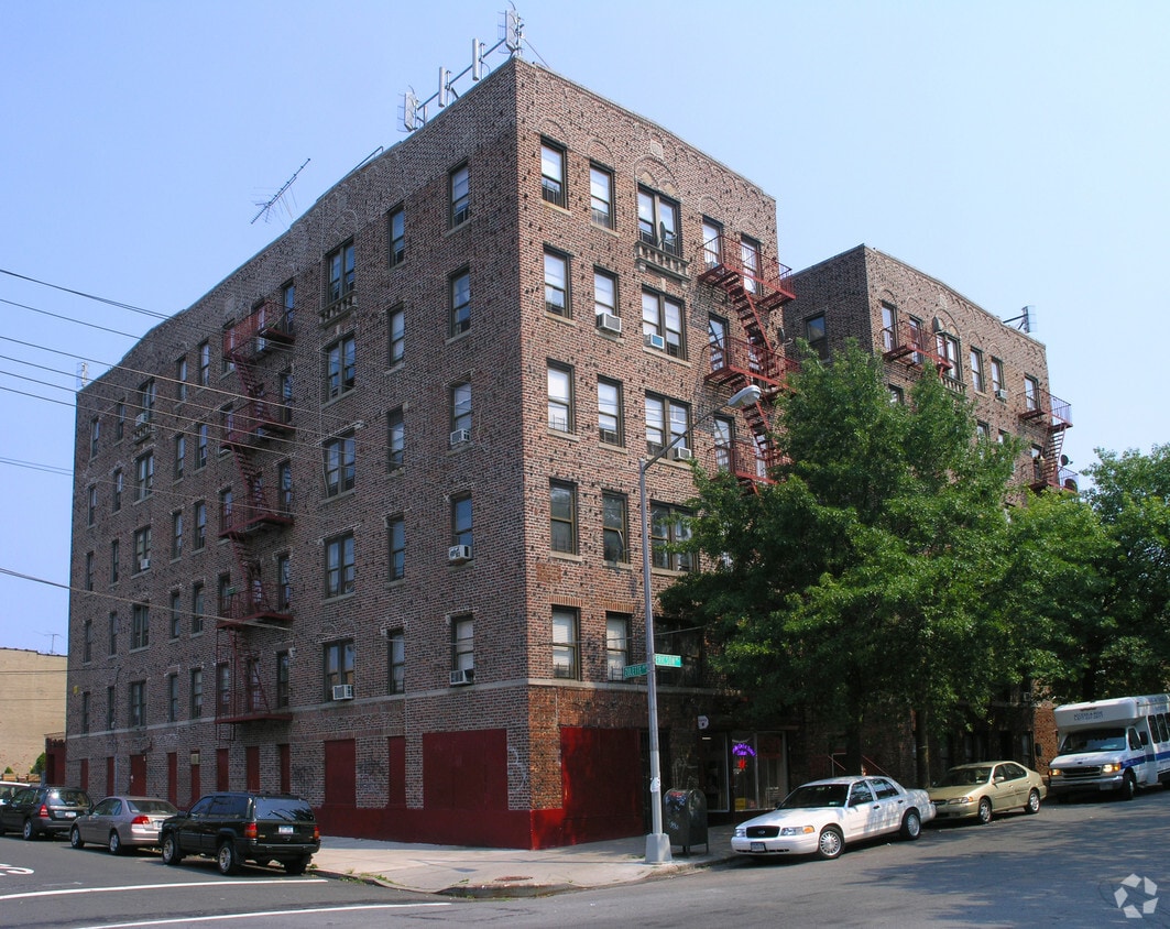
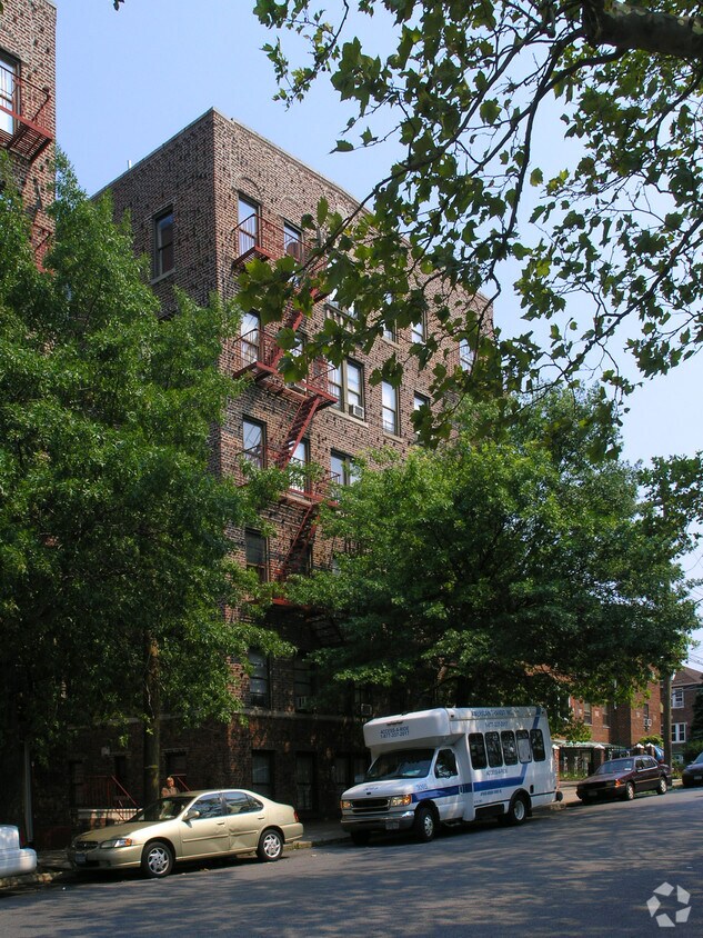
Discover your new place at 1534 Ericson Pl in Bronx. A convenient Ericson Pl setting in the 10461 Zip code of Bronx is a unique place to move to. Here at this community, the leasing team is ready to match you with the perfect fit. Make sure you to view the available floorplans. Stop by the leasing office to find out the current floorplan availability.
1534 Ericson Pl is an apartment community located in Bronx County and the 10461 ZIP Code. This area is served by the New York City Geographic District # 8 attendance zone.
High Speed Internet Access
Refrigerator
Tub/Shower
Smoke Free
Located 10 miles northeast from midtown Manhattan, Schuylerville gives residents the quiet leafy streets of the suburbs while keeping the energy of New York within reach. Pre-war apartment buildings and detached two-family homes make up much of the rental stock. Commuters take the 6 train into Manhattan, about 45 minutes to midtown.
Locals find dinner along East Tremont Avenue or Middletown Road, where three popular pizzerias vie for the coveted title of best slice, along with sit-down Italian and Latin cuisine. Residents love the relaxed, nostalgic vibe at Havana Cafe, where they dish up Cuban favorites with a nod to nouveau cuisine. On warm days, kids come to the playground at the small Bufano Park, or take the bus to Pelham Bay Park, the city's largest public park.
Learn more about living in SchuylervilleCompare neighborhood and city base rent averages by bedroom.
| Schuylerville | Bronx, NY | |
|---|---|---|
| Studio | - | $1,616 |
| 1 Bedroom | $958 | $1,634 |
| 2 Bedrooms | $1,248 | $2,097 |
| 3 Bedrooms | - | $2,357 |
| Colleges & Universities | Distance | ||
|---|---|---|---|
| Colleges & Universities | Distance | ||
| Drive: | 2 min | 1.1 mi | |
| Drive: | 10 min | 3.7 mi | |
| Drive: | 12 min | 5.2 mi | |
| Drive: | 12 min | 6.1 mi |


Transportation options available in Bronx include Middletown Road, located 0.2 mile from 1534 Ericson Pl. 1534 Ericson Pl is near LaGuardia, located 8.7 miles or 17 minutes away, and John F Kennedy International, located 16.3 miles or 23 minutes away.
| Transit / Subway | Distance | ||
|---|---|---|---|
| Transit / Subway | Distance | ||
|
|
Walk: | 2 min | 0.2 mi |
|
|
Walk: | 8 min | 0.4 mi |
|
|
Walk: | 8 min | 0.5 mi |
|
|
Walk: | 14 min | 0.7 mi |
|
|
Drive: | 3 min | 1.2 mi |
| Commuter Rail | Distance | ||
|---|---|---|---|
| Commuter Rail | Distance | ||
|
|
Drive: | 9 min | 3.8 mi |
|
|
Drive: | 8 min | 4.0 mi |
|
|
Drive: | 8 min | 4.3 mi |
|
|
Drive: | 10 min | 5.1 mi |
|
|
Drive: | 11 min | 5.3 mi |
| Airports | Distance | ||
|---|---|---|---|
| Airports | Distance | ||
|
LaGuardia
|
Drive: | 17 min | 8.7 mi |
|
John F Kennedy International
|
Drive: | 23 min | 16.3 mi |
Scores provided by
Traffic
-Airport
-Businesses
-Scores provided by
HowLoud What is a Sound Score Rating? A Sound Score Rating aggregates noise caused by vehicle traffic, airplane traffic and local sources. How It WorksTime and distance from 1534 Ericson Pl.
| Shopping Centers | Distance | ||
|---|---|---|---|
| Shopping Centers | Distance | ||
| Walk: | 14 min | 0.8 mi | |
| Drive: | 4 min | 1.7 mi | |
| Drive: | 5 min | 1.9 mi |
| Parks and Recreation | Distance | ||
|---|---|---|---|
| Parks and Recreation | Distance | ||
|
Bronx Zoo
|
Drive: | 8 min | 2.9 mi |
|
Pelham Bay Park
|
Drive: | 5 min | 3.0 mi |
|
Ferry Point Park
|
Drive: | 9 min | 3.4 mi |
|
Starlight Park
|
Drive: | 8 min | 3.5 mi |
|
Bronx Park
|
Drive: | 13 min | 4.9 mi |
| Hospitals | Distance | ||
|---|---|---|---|
| Hospitals | Distance | ||
| Walk: | 10 min | 0.5 mi | |
| Drive: | 5 min | 2.1 mi | |
| Drive: | 11 min | 4.1 mi |
| Military Bases | Distance | ||
|---|---|---|---|
| Military Bases | Distance | ||
| Drive: | 13 min | 6.8 mi | |
| Drive: | 33 min | 17.8 mi | |
| Drive: | 45 min | 25.1 mi |
What Are Walk Score®, Transit Score®, and Bike Score® Ratings?
Walk Score® measures the walkability of any address. Transit Score® measures access to public transit. Bike Score® measures the bikeability of any address.
What is a Sound Score Rating?
A Sound Score Rating aggregates noise caused by vehicle traffic, airplane traffic and local sources.

1534 Ericson Pl
Bronx, NY 10461


