

$1,200
/ Month
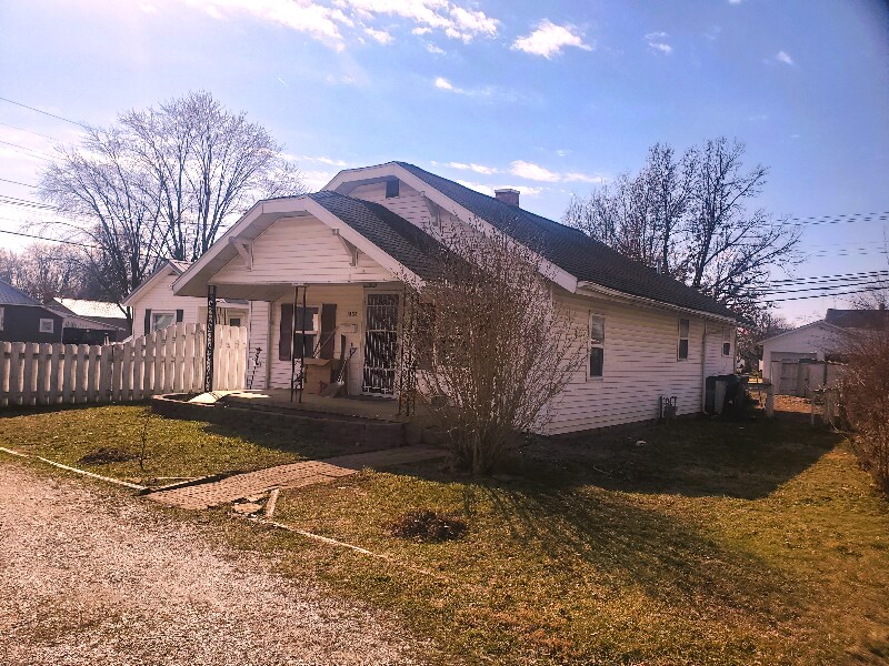
1533 Prairie St
Vincennes, IN 47591
2 Weeks Ago
|
Edit
Favorites
1533 Prairie St

Favorites
Check Back Soon for Upcoming Availability
| Beds | Baths | Average SF |
|---|---|---|
| 3 Bedrooms 3 Bedrooms 3 Br | 1.5 Baths 1.5 Baths 1.5 Ba | 1,000 SF |
Fees and Policies
The fees listed below are community-provided and may exclude utilities or add-ons. All payments are made directly to the property and are non-refundable unless otherwise specified.
- Dogs Allowed
-
Fees not specified
-
Weight limit--
-
Pet Limit--
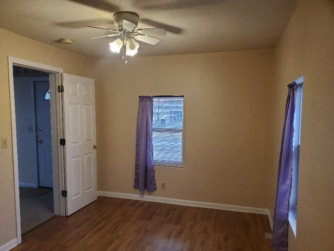
About This Property
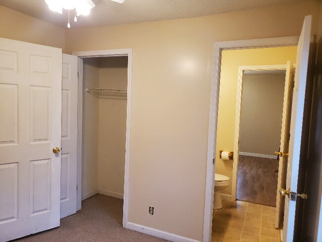
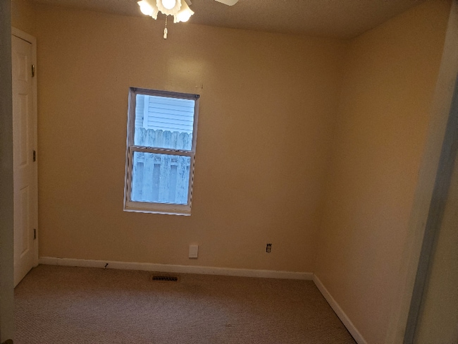
Property Id: 1391513 Quaint 3 bedroom home in a peaceful neighborhood of Vincennes. Offers indoor laundry, Central Air and Heat and partially fenced back yard. Home has a large master bedroom with a Jack and Jill Powder Room for other 2 bedrooms. Lots of natural light. Has an open floor plan. Great family location.
1533 Prairie St is a house located in Knox County and the 47591 ZIP Code. This area is served by the Vincennes Community Sch Corp attendance zone.
House Features
Microwave
Refrigerator
Disposal
Oven
- Disposal
- Microwave
- Oven
- Refrigerator
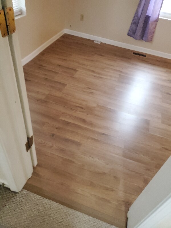
- Vinyl Flooring
- Lawn
1533 Prairie St,
Vincennes,
IN
47591
Amenities
- Disposal
- Microwave
- Oven
- Refrigerator
- Vinyl Flooring
- Lawn
Education
| Colleges & Universities | Distance | ||
|---|---|---|---|
| Colleges & Universities | Distance | ||
| Drive: | 6 min | 2.3 mi | |
| Drive: | 53 min | 36.6 mi |
1533 Prairie St is within 6 minutes or 2.3 miles from Vincennes University. It is also near Oakland City University.
Schools


Public Elementary School
Grades PK-5
347 Students
Attendance Zone
Public Middle School
Grades 6-8
609 Students
Attendance Zone
Public High School
Grades 9-12
765 Students
Attendance Zone
Private Elementary School
Grades PK-5
221 Students
Nearby
Private Middle & High School
Grades 6-12
157 Students
Nearby
School data provided by
 The GreatSchools Rating helps parents compare schools within a state based on a variety of school quality indicators and provides a helpful picture of how effectively each school serves all of its students. Ratings are on a scale of 1 (below average) to 10 (above average) and can include test scores, college readiness, academic progress, advanced courses, equity, discipline and attendance data. We also advise parents to visit schools, consider other information on school performance and programs, and consider family needs as part of the school selection process.
View GreatSchools Rating Methodology
Data provided by GreatSchools.org © 2026. All rights reserved.
View GreatSchools Rating Methodology
Data provided by GreatSchools.org © 2026. All rights reserved.
Walkability Near 1533 Prairie St Vincennes, IN 47591
Getting Around
 What do Walkability, Transit, Drivability, and Bikeability mean?
Walkability measures the walking distance to day-to-day needs.
Transit measures access to public transportation.
Drivability measures congestion, parking availability, and access to major roads.
Bikeability measures the suitability for cycling.
How It Works
What do Walkability, Transit, Drivability, and Bikeability mean?
Walkability measures the walking distance to day-to-day needs.
Transit measures access to public transportation.
Drivability measures congestion, parking availability, and access to major roads.
Bikeability measures the suitability for cycling.
How It Works
Fairly Walkable
Walkability
50
/ 100
Exceptionally Drivable
Drivability
90
/ 100
Moderately Bikeable
Bikeability
70
/ 100
Scores provided by
-
Soundscore™
-
/ 100
Traffic
-Airport
-Businesses
-Scores provided by
HowLoud What is a Sound Score Rating? A Sound Score Rating aggregates noise caused by vehicle traffic, airplane traffic and local sources. How It WorksSimilar Rentals Nearby
-
-

-

-
 3 Beds, 2 Baths, 1,056 sq ft$1,350113 Sundale Trailer Ct
What Are Walk Score®, Transit Score®, and Bike Score® Ratings?
Walk Score® measures the walkability of any address. Transit Score® measures access to public transit. Bike Score® measures the bikeability of any address.
What is a Sound Score Rating?
A Sound Score Rating aggregates noise caused by vehicle traffic, airplane traffic and local sources.
1533 Prairie St
Vincennes, IN 47591