


$1,900
/ Month
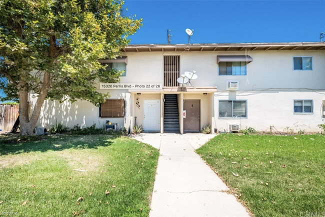
15320 Perris Blvd
Moreno Valley, CA 92551
2 Weeks Ago
|
Edit
Favorites
-
Bedrooms
2
-
Bathrooms
2
-
Square Feet
1,000 sq ft
15320 Perris Blvd

Favorites
About This Home
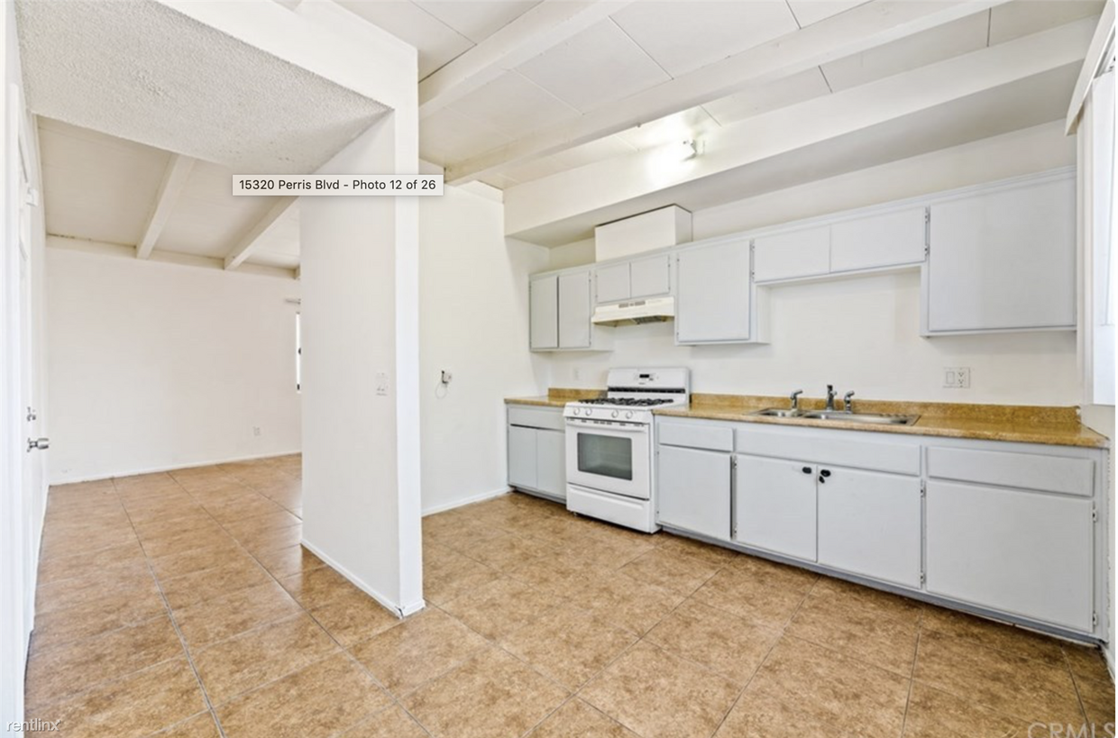
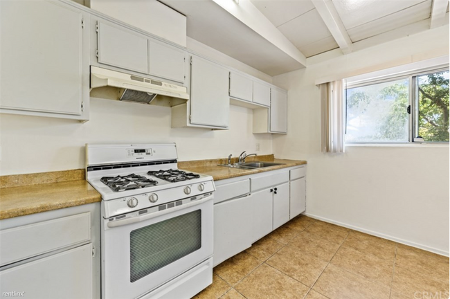
- Great convenient location, near Starbucks, plenty of grocery stores, minutes away from the new Amazon Logistics center. This will be a great place for someone who wants a clean 2 bedroom 2 bath who respects their neighbors in a 4 plex. You have your own garage parking spot as well. Application: (RLNE8347209) Other Amenities: Unfurnished, Parking, Smoke Free, Garage, Yard, Patio, Balcony. Appliances: Dishwasher, Air Conditioning (Wall Unit), Air Conditioning, Refrigerator, Oven, Garbage Disposal, Microwave, Washer & Dryer On-Site. Utilities: Resident Pays Heat, Resident Pays Electricity, Resident Pays Gas, Water Included, Trash Pick-up Included. Pet policies: Cats Allowed.
Unique Features
- Oven, Garage, Yard
15320 Perris Blvd is a condo located in Riverside County and the 92551 ZIP Code.
* Price shown is base rent. Excludes user-selected optional fees and variable or usage-based fees and required charges due at or prior to move-in or at move-out. Price, availability, fees, and any applicable rent special are subject to change without notice.
* Square footage definitions vary. Displayed square footage is approximate.
Condo Features
- Air Conditioning
- Dishwasher
- Laundry Facilities
Fees and Policies
The fees listed below are community-provided and may exclude utilities or add-ons. All payments are made directly to the property and are non-refundable unless otherwise specified.
- Cats Allowed
-
Fees not specified
-
Weight limit--
-
Pet Limit--
Details
Utilities Included
-
Water
Contact
- Listed by Hemlane
Location
Get Directions
Situated about 62 miles east of Downtown Los Angeles, Moreno Valley West is an expansive community in the Inland Empire area. Nicknamed "Mo-Val," the west end of Moreno Valley holds a distinct quality by providing residents a serene, desert-like setting as well as several restaurants and retail shops. Rental options in Moreno Valley West range from luxury apartments to charming houses and everything in between.
If you travel along Pigeon Pass Road and head toward the Sunnymead Ranch community, you may have to stop for crossing animals. To accommodate the neighborhood animals, street signs line the roads to warn drivers of donkey crossings.
With temperatures reaching 112 degrees, summers grow hot in Moreno Valley, while winters loom cold. Heading up Heacock Street to Reche Canyon, residents catch stunning views of snow-capped mountains during the winter months. In contrast to Los Angeles, life in Riverside County offers locals a distinct change in seasons.
Learn more about living in Moreno Valley West
Amenities
- Air Conditioning
- Dishwasher
- Laundry Facilities
- Oven, Garage, Yard
Expenses
Utilities Included
Water
Included
Education
| Colleges & Universities | Distance | ||
|---|---|---|---|
| Colleges & Universities | Distance | ||
| Drive: | 5 min | 2.4 mi | |
| Drive: | 19 min | 10.8 mi | |
| Drive: | 21 min | 13.4 mi | |
| Drive: | 27 min | 15.1 mi |
15320 Perris Blvd is within 5 minutes or 2.4 miles from Moreno Valley College. It is also near UC Riverside and Riverside City College.
Getting Around
 What do Walkability, Transit, Drivability, and Bikeability mean?
Walkability measures the walking distance to day-to-day needs.
Transit measures access to public transportation.
Drivability measures congestion, parking availability, and access to major roads.
Bikeability measures the suitability for cycling.
How It Works
What do Walkability, Transit, Drivability, and Bikeability mean?
Walkability measures the walking distance to day-to-day needs.
Transit measures access to public transportation.
Drivability measures congestion, parking availability, and access to major roads.
Bikeability measures the suitability for cycling.
How It Works
Fairly Walkable
Walkability
40
/ 100
Good Public Transit
Transit
70
/ 100
Exceptionally Drivable
Drivability
100
/ 100
Fairly Bikeable
Bikeability
40
/ 100
Scores provided by
-
Soundscore™
-
/ 100
Traffic
-Airport
-Businesses
-Scores provided by
HowLoud What is a Sound Score Rating? A Sound Score Rating aggregates noise caused by vehicle traffic, airplane traffic and local sources. How It WorksYou May Also Like
Similar Rentals Nearby


What Are Walk Score®, Transit Score®, and Bike Score® Ratings?
Walk Score® measures the walkability of any address. Transit Score® measures access to public transit. Bike Score® measures the bikeability of any address.
What is a Sound Score Rating?
A Sound Score Rating aggregates noise caused by vehicle traffic, airplane traffic and local sources.

15320 Perris Blvd
Moreno Valley, CA 92551