


$650
Total Monthly Price
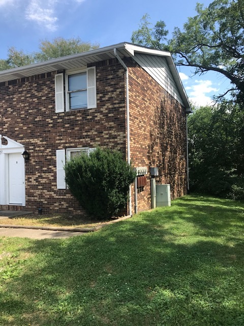
152 S Mill St Unit D
Dalton, OH 44618
Favorites
152 S Mill St Unit D

Favorites
Check Back Soon for Upcoming Availability
| Beds | Baths | Average SF |
|---|---|---|
| 2 Bedrooms 2 Bedrooms 2 Br | 1 Bath 1 Bath 1 Ba | 1,152 SF |
Fees and Policies
The fees listed below are community-provided and may exclude utilities or add-ons. All payments are made directly to the property and are non-refundable unless otherwise specified.
- Parking
-
Surface Lot--
Details
Utilities Included
-
Trash Removal
Lease Options
-
12 Months
About This Property
152 S Mill St is an apartment community located in Wayne County and the 44618 ZIP Code.
Apartment Features
Dishwasher
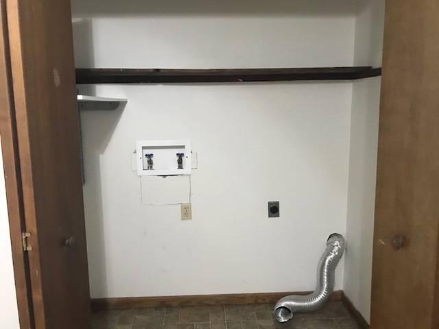
Washer/Dryer Hookup
Walk-In Closets
Refrigerator
- Washer/Dryer Hookup
- Heating
- Smoke Free
- Tub/Shower
- Dishwasher
- Eat-in Kitchen
- Range
- Refrigerator
- Carpet
- Vinyl Flooring
- Walk-In Closets
- Porch
152 S Mill St,
Dalton,
OH
44618
Amenities
- Washer/Dryer Hookup
- Heating
- Smoke Free
- Tub/Shower
- Dishwasher
- Eat-in Kitchen
- Range
- Refrigerator
- Carpet
- Vinyl Flooring
- Walk-In Closets
- Porch
Expenses
Utilities Included
Trash Removal
Included
Education
| Colleges & Universities | Distance | ||
|---|---|---|---|
| Colleges & Universities | Distance | ||
| Drive: | 21 min | 15.1 mi | |
| Drive: | 33 min | 18.4 mi | |
| Drive: | 33 min | 18.9 mi | |
| Drive: | 30 min | 22.2 mi |
152 S Mill St Unit D is within 21 minutes or 15.1 miles from The College of Wooster. It is also near Kent State University, Stark and Stark State College.
Walkability Near 152 S Mill St Dalton, OH 44618
Getting Around
 What do Walkability, Transit, Drivability, and Bikeability mean?
Walkability measures the walking distance to day-to-day needs.
Transit measures access to public transportation.
Drivability measures congestion, parking availability, and access to major roads.
Bikeability measures the suitability for cycling.
How It Works
What do Walkability, Transit, Drivability, and Bikeability mean?
Walkability measures the walking distance to day-to-day needs.
Transit measures access to public transportation.
Drivability measures congestion, parking availability, and access to major roads.
Bikeability measures the suitability for cycling.
How It Works
Somewhat Walkable
Walkability
20
/ 100
Exceptionally Drivable
Drivability
100
/ 100
Somewhat Bikeable
Bikeability
20
/ 100
Scores provided by
-
Soundscore™
-
/ 100
Traffic
-Airport
-Businesses
-Scores provided by
HowLoud What is a Sound Score Rating? A Sound Score Rating aggregates noise caused by vehicle traffic, airplane traffic and local sources. How It WorksYou May Also Like
Similar Rentals Nearby


What Are Walk Score®, Transit Score®, and Bike Score® Ratings?
Walk Score® measures the walkability of any address. Transit Score® measures access to public transit. Bike Score® measures the bikeability of any address.
What is a Sound Score Rating?
A Sound Score Rating aggregates noise caused by vehicle traffic, airplane traffic and local sources.

152 S Mill St
Dalton, OH 44618