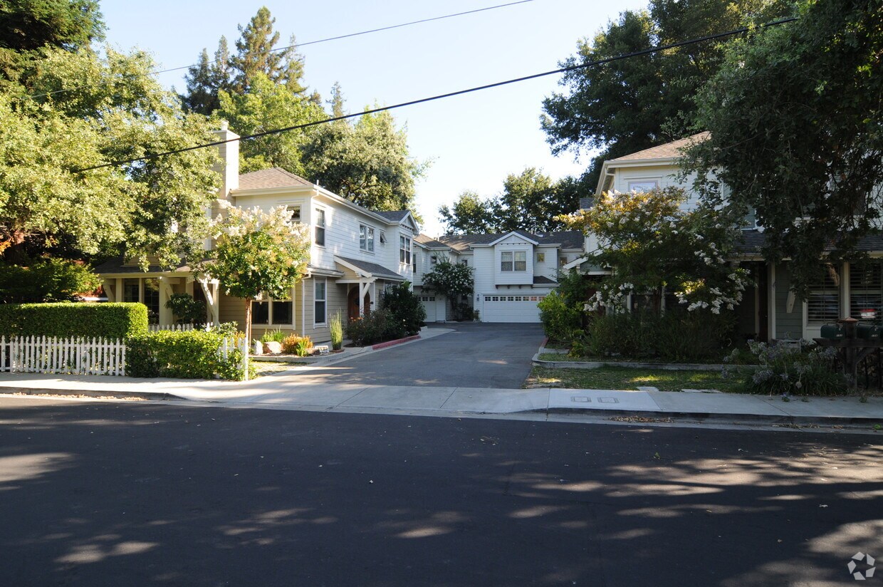
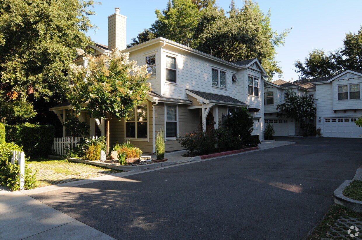
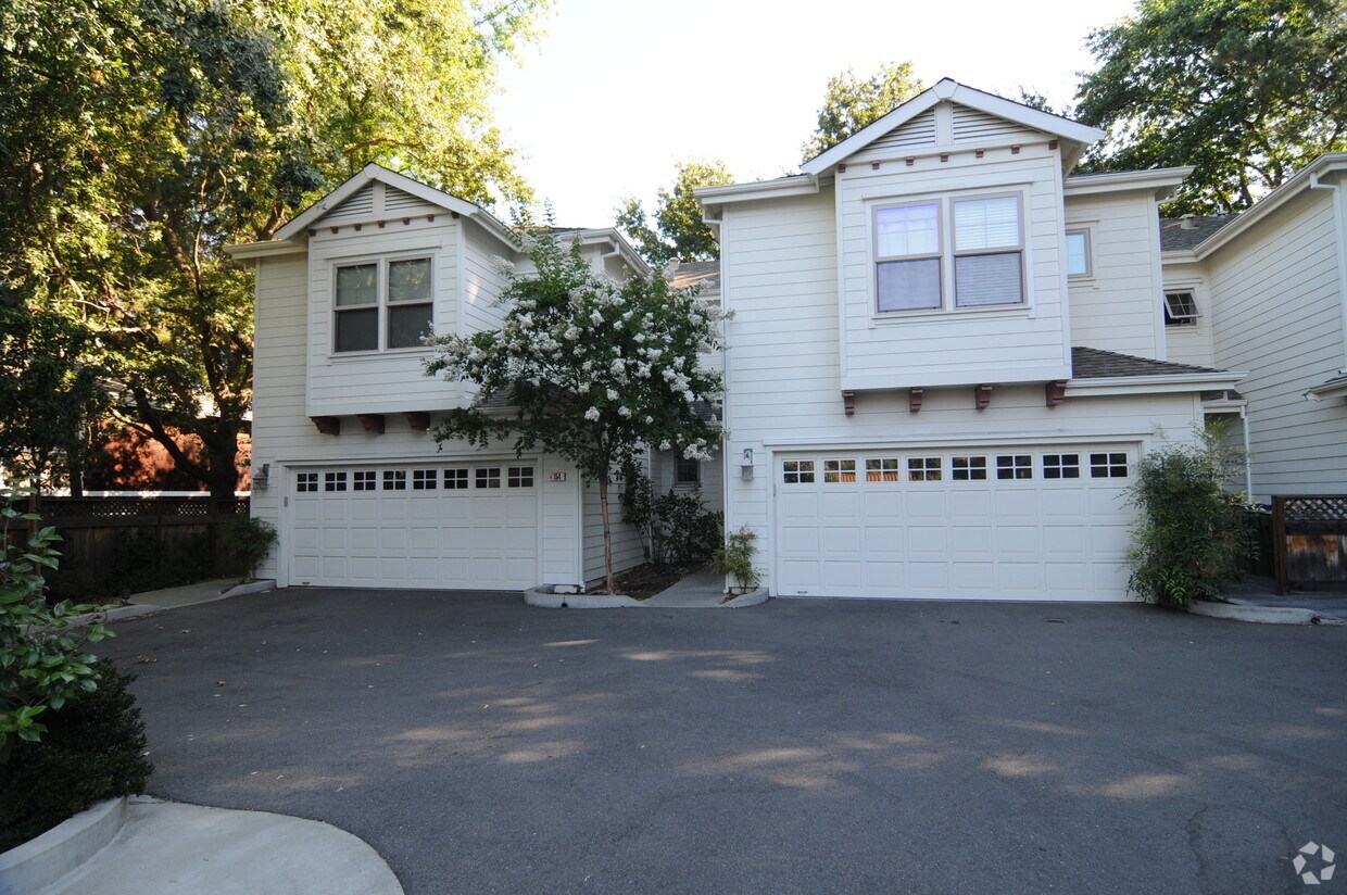
152 & 154 El Dorado Ave
152 & 154 El Dorado Ave,
Danville,
CA
94526
2 Weeks Ago
Favorites
152 & 154 El Dorado Ave
Favorites
Check Back Soon for Upcoming Availability
Fees and Policies
Details
Property Information
-
Built in 1952
-
2 units
About 152 & 154 El Dorado Ave Danville, CA 94526
Explore your new place at 152 & 154 El Dorado Ave. The address for this community is at 152 & 154 El Dorado Ave in the 94526 area of Danville. Schedule a time to see the current floorplan options. The leasing team is ready and waiting for you to come take a tour. Contact us or drop by the leasing office to talk about leasing your new apartment and find your new home at 152 & 154 El Dorado Ave.
152 & 154 El Dorado Ave is an apartment community located in Contra Costa County and the 94526 ZIP Code. This area is served by the San Ramon Valley Unified attendance zone.
Location
Get Directions
Danville is an upscale suburban community located just south of Walnut Creek and about twenty miles east of Oakland. Residents enjoy an ideal location, surrounded by scenic rolling hills and lush greenery while still being within minutes of the Bay Area’s biggest cities. The thriving Downtown district along Hartz Boulevard is packed with terrific restaurants, specialty shops, and bars, as well as unique attractions like the Village Theatre and Art Gallery and the Danville Farmers’ Market. The surrounding landscape offers terrific opportunities to make the most of California’s natural beauty, with Las Trampas Regional Wilderness and the Diablo Foothills just outside of town providing great venues for hiking and camping.
Learn more about living in Danville
Education
| Colleges & Universities | Distance | ||
|---|---|---|---|
| Colleges & Universities | Distance | ||
| Drive: | 17 min | 9.6 mi | |
| Drive: | 24 min | 12.7 mi | |
| Drive: | 21 min | 13.0 mi | |
| Drive: | 36 min | 24.2 mi |
152 & 154 El Dorado Ave is within 17 minutes or 9.6 miles from Diablo Valley Coll, San Ramon. It is also near Saint Marys Coll. of Calif. and Diablo Valley, Pleasant Hill.
Schools


Public Elementary School
Grades K-5
503 Students
Attendance Zone
Public Elementary School
Grades K-5
844 Students
Nearby
Public Elementary & Middle School
Grades K-8
656 Students
Nearby
Public Middle School
Grades 6-8
580 Students
Attendance Zone
Public High School
Grades 9-12
1,981 Students
Attendance Zone
Private Elementary & Middle School
Grades K-8
631 Students
Nearby
Private Elementary & Middle School
Grades K-8
355 Students
Nearby
Private Elementary & Middle School
Grades PK-8
Nearby
School data provided by
 The GreatSchools Rating helps parents compare schools within a state based on a variety of school quality indicators and provides a helpful picture of how effectively each school serves all of its students. Ratings are on a scale of 1 (below average) to 10 (above average) and can include test scores, college readiness, academic progress, advanced courses, equity, discipline and attendance data. We also advise parents to visit schools, consider other information on school performance and programs, and consider family needs as part of the school selection process.
View GreatSchools Rating Methodology
Data provided by GreatSchools.org © 2025. All rights reserved.
View GreatSchools Rating Methodology
Data provided by GreatSchools.org © 2025. All rights reserved.
Transportation options available in Danville include Walnut Creek Station, located 8.1 miles from 152 & 154 El Dorado Ave. 152 & 154 El Dorado Ave is near Metro Oakland International, located 27.9 miles or 36 minutes away, and San Francisco International, located 37.0 miles or 55 minutes away.
| Transit / Subway | Distance | ||
|---|---|---|---|
| Transit / Subway | Distance | ||
|
|
Drive: | 13 min | 8.1 mi |
|
|
Drive: | 12 min | 9.4 mi |
|
|
Drive: | 14 min | 9.7 mi |
|
|
Drive: | 15 min | 10.2 mi |
|
|
Drive: | 14 min | 10.5 mi |
| Commuter Rail | Distance | ||
|---|---|---|---|
| Commuter Rail | Distance | ||
| Drive: | 18 min | 13.9 mi | |
| Drive: | 19 min | 13.9 mi | |
|
|
Drive: | 28 min | 14.9 mi |
| Drive: | 28 min | 14.9 mi | |
|
|
Drive: | 32 min | 23.3 mi |
| Airports | Distance | ||
|---|---|---|---|
| Airports | Distance | ||
|
Metro Oakland International
|
Drive: | 36 min | 27.9 mi |
|
San Francisco International
|
Drive: | 55 min | 37.0 mi |
Time and distance from 152 & 154 El Dorado Ave.
| Shopping Centers | Distance | ||
|---|---|---|---|
| Shopping Centers | Distance | ||
| Walk: | 5 min | 0.3 mi | |
| Walk: | 5 min | 0.3 mi | |
| Walk: | 5 min | 0.3 mi |
152 & 154 El Dorado Ave has 3 shopping centers within 0.3 mile, which is about a 5-minute walk. The miles and minutes will be for the farthest away property.
| Parks and Recreation | Distance | ||
|---|---|---|---|
| Parks and Recreation | Distance | ||
|
Eugene O'Neill National Historic Site
|
Drive: | 8 min | 2.3 mi |
|
Rudgear Park
|
Drive: | 11 min | 5.5 mi |
|
Bishop Ranch Regional Preserve
|
Drive: | 9 min | 5.6 mi |
|
Little Hills Picnic Ranch (By Reservation)
|
Drive: | 22 min | 8.3 mi |
|
Las Trampas Regional Wilderness
|
Drive: | 24 min | 8.8 mi |
152 & 154 El Dorado Ave has 5 parks within 8.8 miles, including Eugene O'Neill National Historic Site, Las Trampas Regional Wilderness, and Little Hills Picnic Ranch (By Reservation).
| Hospitals | Distance | ||
|---|---|---|---|
| Hospitals | Distance | ||
| Drive: | 8 min | 4.5 mi | |
| Drive: | 10 min | 6.5 mi | |
| Drive: | 14 min | 9.4 mi |
152 & 154 El Dorado Ave has 3 hospitals within 9.4 miles, the nearest is San Ramon Regional Medical Center which is 4.5 miles away and a 8 minute drive.
You May Also Like
Similar Rentals Nearby


What Are Walk Score®, Transit Score®, and Bike Score® Ratings?
Walk Score® measures the walkability of any address. Transit Score® measures access to public transit. Bike Score® measures the bikeability of any address.
What is a Sound Score Rating?
A Sound Score Rating aggregates noise caused by vehicle traffic, airplane traffic and local sources
Responded To This Review