
10 Halletts Point
10, 20, 30 Halletts Pt,
Astoria, NY 11102
$3,300 - $6,971
Studio - 2 Beds

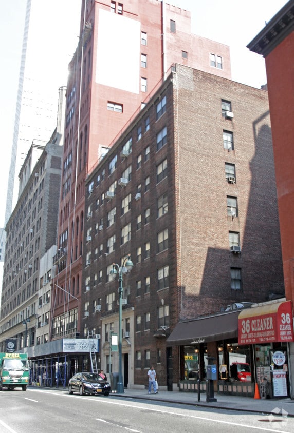
Find your new place at 15 E 36th St in New York, NY. This property is situated in the Empire State Building area of New York. The leasing staff is eager for you to come see our property. Stop looking and get moving. Contact or stop by 15 E 36th St to see available floor plans!
15 E 36th St is an apartment community located in New York County and the 10016 ZIP Code. This area is served by the New York City Geographic District # 2 attendance zone.
Walk-In Closets
Granite Countertops
Microwave
Heating
Midtown South Central is the center stage for everything grand about New York’s commercial districts. This premier location in central Manhattan boasts more restaurants and retailers than you could imagine, all nestled along bustling urban streets.
Because this neighborhood blends commercial enterprises, office buildings, and residences into one central location, often even in the same building, most residents are able to walk to work, eateries, shops, and entertainment venues around town. And if work is a bit farther, don’t worry. Public transportation is out and about in this urban neighborhood.
Imagine being able to walk past the Empire State Building every single day. Sounds like a dream, right? Actually, this could be your reality if you choose to rent any of the incredible luxury apartments, condos, or occasional houses and townhomes in this neighborhood.
Learn more about living in Empire State BuildingCompare neighborhood and city base rent averages by bedroom.
| Empire State Building | New York, NY | |
|---|---|---|
| Studio | $3,523 | $3,371 |
| 1 Bedroom | $4,808 | $4,150 |
| 2 Bedrooms | $8,178 | $5,713 |
| 3 Bedrooms | - | $7,191 |
| Colleges & Universities | Distance | ||
|---|---|---|---|
| Colleges & Universities | Distance | ||
| Walk: | 3 min | 0.2 mi | |
| Walk: | 3 min | 0.2 mi | |
| Walk: | 5 min | 0.3 mi | |
| Walk: | 8 min | 0.4 mi |


Transportation options available in New York include 33 Street (4,6 Line), located 0.3 mile from 15 E 36th St. 15 E 36th St is near LaGuardia, located 8.5 miles or 16 minutes away, and Newark Liberty International, located 14.6 miles or 20 minutes away.
| Transit / Subway | Distance | ||
|---|---|---|---|
| Transit / Subway | Distance | ||
|
|
Walk: | 5 min | 0.3 mi |
| Walk: | 6 min | 0.3 mi | |
|
|
Walk: | 6 min | 0.3 mi |
| Walk: | 7 min | 0.4 mi | |
|
|
Walk: | 9 min | 0.5 mi |
| Commuter Rail | Distance | ||
|---|---|---|---|
| Commuter Rail | Distance | ||
|
|
Walk: | 8 min | 0.4 mi |
|
|
Walk: | 9 min | 0.5 mi |
|
|
Walk: | 12 min | 0.6 mi |
|
|
Walk: | 12 min | 0.7 mi |
|
|
Walk: | 16 min | 0.8 mi |
| Airports | Distance | ||
|---|---|---|---|
| Airports | Distance | ||
|
LaGuardia
|
Drive: | 16 min | 8.5 mi |
|
Newark Liberty International
|
Drive: | 20 min | 14.6 mi |
Scores provided by
Traffic
-Airport
-Businesses
-Scores provided by
HowLoud What is a Sound Score Rating? A Sound Score Rating aggregates noise caused by vehicle traffic, airplane traffic and local sources. How It WorksTime and distance from 15 E 36th St.
| Shopping Centers | Distance | ||
|---|---|---|---|
| Shopping Centers | Distance | ||
| Walk: | 9 min | 0.5 mi | |
| Walk: | 14 min | 0.8 mi | |
| Walk: | 16 min | 0.8 mi |
| Parks and Recreation | Distance | ||
|---|---|---|---|
| Parks and Recreation | Distance | ||
|
Bryant Park
|
Walk: | 8 min | 0.5 mi |
|
Madison Square Park
|
Walk: | 11 min | 0.6 mi |
|
Bellevue South Park
|
Drive: | 4 min | 1.3 mi |
|
Sony Wonder Technology Lab
|
Drive: | 4 min | 1.3 mi |
|
Chelsea Park
|
Drive: | 6 min | 1.9 mi |
| Hospitals | Distance | ||
|---|---|---|---|
| Hospitals | Distance | ||
| Walk: | 15 min | 0.8 mi | |
| Drive: | 4 min | 1.2 mi | |
| Drive: | 4 min | 1.5 mi |
| Military Bases | Distance | ||
|---|---|---|---|
| Military Bases | Distance | ||
| Drive: | 14 min | 6.8 mi | |
| Drive: | 24 min | 11.7 mi | |
| Drive: | 35 min | 18.0 mi |
What Are Walk Score®, Transit Score®, and Bike Score® Ratings?
Walk Score® measures the walkability of any address. Transit Score® measures access to public transit. Bike Score® measures the bikeability of any address.
What is a Sound Score Rating?
A Sound Score Rating aggregates noise caused by vehicle traffic, airplane traffic and local sources.
15 E 36th St
New York, NY 10016


