
Seaview Apartments
520-550 Seaview Ave,
Staten Island, NY 10305
$3,050 - $3,300
2 Beds


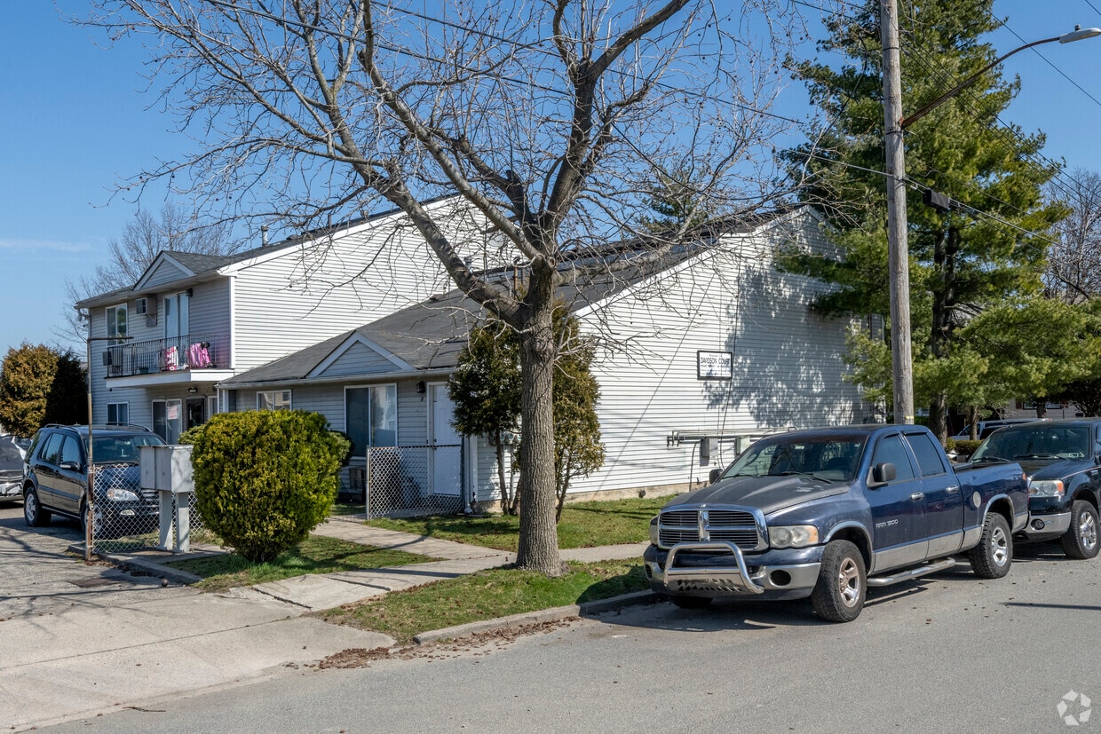
At 15 Davidson Ct, experience stylish living. The 10303 location has so much to offer its residents. Apartments here offer a unique mix of comfort and convenience like lawns, high-speed internet access, and balconies. Here at this community, the leasing staff is ready to help match you with your perfect fit. At 15 Davidson Ct you're new apartment awaits. Stop by the community today.
15 Davidson Ct is an apartment community located in Richmond County and the 10303 ZIP Code. This area is served by the New York City Geographic District #31 attendance zone.
Air Conditioning
High Speed Internet Access
Refrigerator
Smoke Free
Staten Island occupies a singular position as New York City's southernmost borough, physically separate from the rest of the city yet firmly connected to it through the iconic, round-the-clock Staten Island Ferry. As the least densely populated of the five boroughs, it carries a noticeably quieter, more residential character than Manhattan or Brooklyn, covering roughly 59 square miles with a population near 490,000. The College of Staten Island anchors the borough's educational presence, while Snug Harbor Cultural Center and Botanical Garden reflects a deep commitment to the arts and green space. During the American Revolution, Staten Island served as a primary staging ground for British forces and remained under British control longer than any other part of what would become the United States.
Neighborhoods vary considerably across the island. St. George on the North Shore functions as the civic and cultural hub, while Tottenville anchors the quieter South Shore.
Learn more about living in Staten Island| Colleges & Universities | Distance | ||
|---|---|---|---|
| Colleges & Universities | Distance | ||
| Drive: | 10 min | 3.5 mi | |
| Drive: | 12 min | 5.3 mi | |
| Drive: | 14 min | 5.3 mi | |
| Drive: | 15 min | 7.0 mi |


Transportation options available in Staten Island include 8Th Street Light Rail Station, located 4.0 miles from 15 Davidson Ct. 15 Davidson Ct is near Newark Liberty International, located 11.7 miles or 20 minutes away, and LaGuardia, located 26.6 miles or 46 minutes away.
| Transit / Subway | Distance | ||
|---|---|---|---|
| Transit / Subway | Distance | ||
| Drive: | 9 min | 4.0 mi | |
|
|
Drive: | 10 min | 5.2 mi |
|
|
Drive: | 12 min | 6.1 mi |
|
|
Drive: | 14 min | 7.5 mi |
|
|
Drive: | 15 min | 8.2 mi |
| Commuter Rail | Distance | ||
|---|---|---|---|
| Commuter Rail | Distance | ||
|
|
Drive: | 11 min | 5.4 mi |
|
|
Drive: | 15 min | 5.6 mi |
|
|
Drive: | 15 min | 6.2 mi |
|
|
Drive: | 14 min | 7.2 mi |
|
|
Drive: | 18 min | 8.4 mi |
| Airports | Distance | ||
|---|---|---|---|
| Airports | Distance | ||
|
Newark Liberty International
|
Drive: | 20 min | 11.7 mi |
|
LaGuardia
|
Drive: | 46 min | 26.6 mi |
Scores provided by
Traffic
-Airport
-Businesses
-Scores provided by
HowLoud What is a Sound Score Rating? A Sound Score Rating aggregates noise caused by vehicle traffic, airplane traffic and local sources. How It WorksTime and distance from 15 Davidson Ct.
| Shopping Centers | Distance | ||
|---|---|---|---|
| Shopping Centers | Distance | ||
| Drive: | 4 min | 1.1 mi | |
| Drive: | 4 min | 1.5 mi | |
| Drive: | 5 min | 1.9 mi |
| Parks and Recreation | Distance | ||
|---|---|---|---|
| Parks and Recreation | Distance | ||
|
Faber Park
|
Drive: | 4 min | 1.7 mi |
|
Staten Island Industrial Park
|
Drive: | 6 min | 2.1 mi |
|
Westerleigh Park
|
Drive: | 7 min | 2.8 mi |
|
Willowbrook Park
|
Drive: | 9 min | 3.3 mi |
|
Astrophysical Observatory at College of Staten Island
|
Drive: | 10 min | 3.4 mi |
| Hospitals | Distance | ||
|---|---|---|---|
| Hospitals | Distance | ||
| Drive: | 9 min | 3.6 mi | |
| Drive: | 11 min | 5.0 mi | |
| Drive: | 11 min | 5.8 mi |
| Military Bases | Distance | ||
|---|---|---|---|
| Military Bases | Distance | ||
| Drive: | 16 min | 5.8 mi | |
| Drive: | 15 min | 7.2 mi |
What Are Walk Score®, Transit Score®, and Bike Score® Ratings?
Walk Score® measures the walkability of any address. Transit Score® measures access to public transit. Bike Score® measures the bikeability of any address.
What is a Sound Score Rating?
A Sound Score Rating aggregates noise caused by vehicle traffic, airplane traffic and local sources.
15 Davidson Ct
Staten Island, NY 10303


