
$2,450 / Month
15 Church St Unit 8
Natick, MA 01760
Today
Favorites
781-858-9408
-
Bedrooms
2
-
Bathrooms
2
-
Square Feet
864 sq ft
-
Available
Available Now
15 Church St Unit 8

Favorites
About This Home
$2,450 deposit,
Available Now
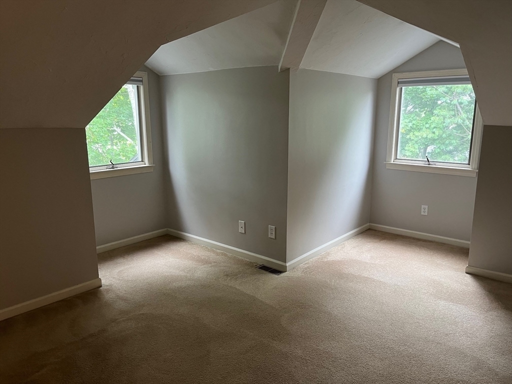
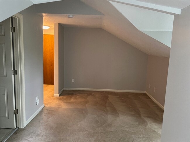
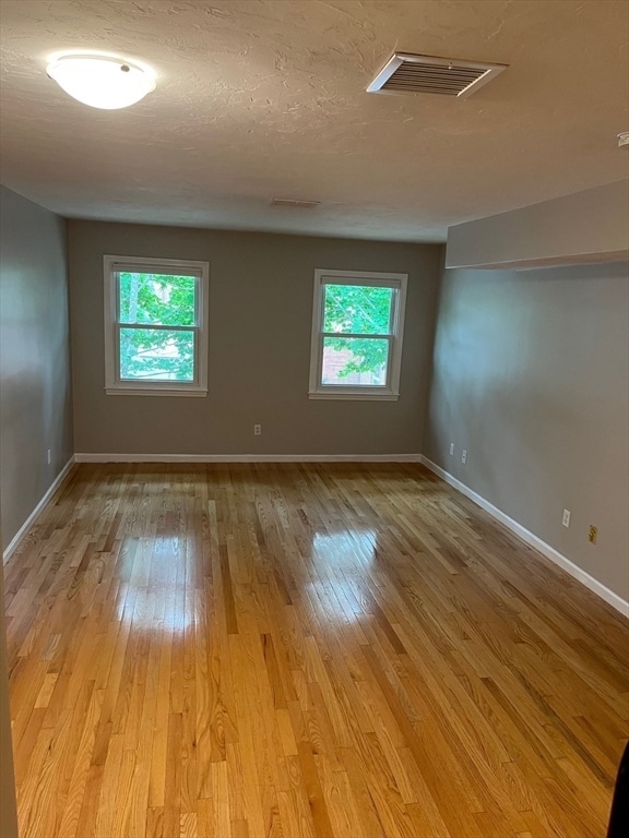
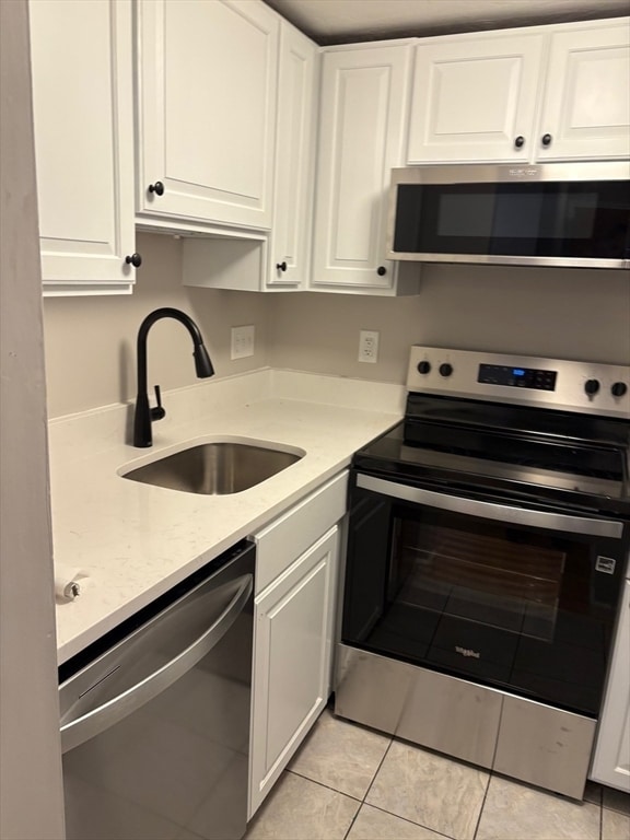
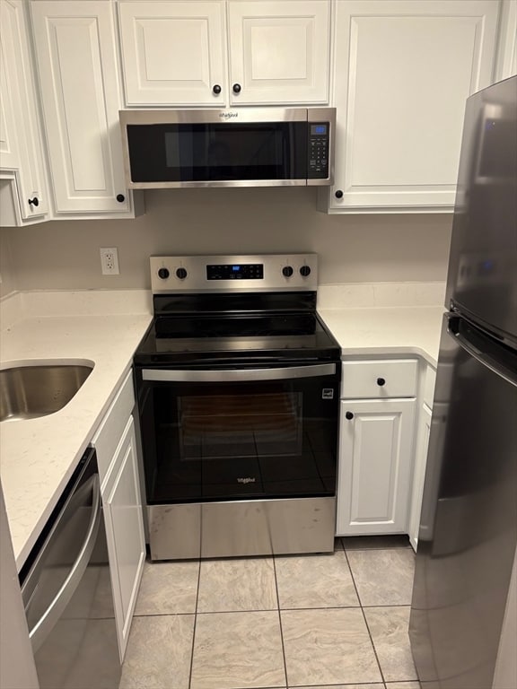
NATICK center! Beautifully maintained 2 bed,2 bath condo in the heart of Natick. Short walk to the Commuter Rail,dining,shopping,coffee shop,farmer's market,and the Town common. Two story unit offering a spacious living/dining area,new 4-piece,quartz/SS kitchen along with a bedroom and full bath on the first level. The second level,accessible both via internal stair as well as via exterior unit door,provides added privacy and features another bedroom and full bath. Great closet space throughout,CENTRAL air,IN-UNIT washer/dryer,and 2 dedicated parking spots (1 garage,1 outdoor.) Excellent commuter location. Available immediately. NO PETS,NO SMOKERS. Excellent credit,First month,Security & 1 month rental fee required. MLS# 73391399
15 Church St is a condo located in Middlesex County and the 01760 ZIP Code.
* Price shown is base rent and may not include non-optional fees and utilities.
Price, availability, fees, and any applicable rent special are subject to change without notice.
* Square footage definitions vary. Displayed square footage is approximate.
Condo Features
Dishwasher
Microwave
Refrigerator
Disposal
- Dishwasher
- Disposal
- Microwave
- Range
- Refrigerator
- Freezer
Fees and Policies
The fees below are based on community-supplied data and may exclude additional fees and utilities.
Contact
- Listed by Arcangelo Mariano | MINQ Property Group LLC
- Phone Number
-
Source
 MLS Property Information Network
The property listing data and information set forth herein were provided to MLS Property Information Network, Inc. from third party sources, including sellers, lessors and public records, and were compiled by MLS Property Information Network, Inc. The property listing data and information are for the personal, non-commercial use of consumers having a good faith interest in purchasing or leasing listed properties of the type displayed to them and may not be used for any purpose other than to identify prospective properties which such consumers may have a good faith interest in purchasing or leasing. MLS Property Information Network, Inc. and its subscribers disclaim any and all representations and warranties as to the accuracy of the property listing data and information set forth herein. All properties are subject to prior sale, change or withdrawal. Copyright © 2025 MLS Property Information Network, Inc. All rights reserved.
Location
Get Directions
Amenities
- Dishwasher
- Disposal
- Microwave
- Range
- Refrigerator
- Freezer
Just west of Boston and East of Worcester sits Metro West, a region that houses a group of towns and cities with significant historical backgrounds. A total of 19 municipalities make up the core of this community, but other municipalities are considered to be a part of the Interstate 495/Metro West Corridor.
Learn more about living in Metro West
Education
| Colleges & Universities | Distance | ||
|---|---|---|---|
| Colleges & Universities | Distance | ||
| Drive: | 7 min | 2.7 mi | |
| Drive: | 9 min | 4.7 mi | |
| Drive: | 11 min | 6.0 mi | |
| Drive: | 19 min | 9.3 mi |
15 Church St Unit 8 is within 7 minutes or 2.7 miles from Wellesley College. It is also near Babson College and Framingham State College.
Transportation options available in Natick include Woodland Station, located 6.8 miles from 15 Church St Unit 8. 15 Church St Unit 8 is near General Edward Lawrence Logan International, located 20.8 miles or 34 minutes away, and Worcester Regional, located 29.9 miles or 51 minutes away.
| Transit / Subway | Distance | ||
|---|---|---|---|
| Transit / Subway | Distance | ||
|
|
Drive: | 13 min | 6.8 mi |
|
|
Drive: | 14 min | 6.9 mi |
|
|
Drive: | 14 min | 7.5 mi |
|
|
Drive: | 16 min | 8.1 mi |
|
|
Drive: | 16 min | 8.3 mi |
| Commuter Rail | Distance | ||
|---|---|---|---|
| Commuter Rail | Distance | ||
|
|
Walk: | 6 min | 0.3 mi |
|
|
Drive: | 5 min | 2.6 mi |
|
|
Drive: | 6 min | 3.1 mi |
|
|
Drive: | 8 min | 3.9 mi |
|
|
Drive: | 9 min | 4.0 mi |
| Airports | Distance | ||
|---|---|---|---|
| Airports | Distance | ||
|
General Edward Lawrence Logan International
|
Drive: | 34 min | 20.8 mi |
|
Worcester Regional
|
Drive: | 51 min | 29.9 mi |
Time and distance from 15 Church St Unit 8.
| Shopping Centers | Distance | ||
|---|---|---|---|
| Shopping Centers | Distance | ||
| Drive: | 4 min | 1.9 mi | |
| Drive: | 3 min | 1.9 mi | |
| Drive: | 4 min | 2.0 mi |
15 Church St Unit 8 has 3 shopping centers within 2.0 miles, which is about a 4-minute drive. The miles and minutes will be for the farthest away property.
| Parks and Recreation | Distance | ||
|---|---|---|---|
| Parks and Recreation | Distance | ||
|
Wellesley College Botanic Gardens
|
Drive: | 4 min | 2.2 mi |
|
Mass Audubon's Broadmoor Wildlife Sanctuary
|
Drive: | 5 min | 2.3 mi |
|
Natick Community Organic Farm
|
Drive: | 5 min | 2.5 mi |
|
Weezie's Garden for Children
|
Drive: | 9 min | 2.9 mi |
|
Elm Bank Reservation
|
Drive: | 9 min | 2.9 mi |
15 Church St Unit 8 has 5 parks within 2.9 miles, including Natick Community Organic Farm, Wellesley College Botanic Gardens, and Mass Audubon's Broadmoor Wildlife Sanctuary.
| Hospitals | Distance | ||
|---|---|---|---|
| Hospitals | Distance | ||
| Drive: | 9 min | 4.3 mi | |
| Drive: | 12 min | 6.6 mi | |
| Drive: | 12 min | 6.6 mi |
15 Church St Unit 8 has 3 hospitals within 6.6 miles, the nearest is MetroWest Medical Center which is 4.3 miles away and a 9 minute drive.
| Military Bases | Distance | ||
|---|---|---|---|
| Military Bases | Distance | ||
| Walk: | 19 min | 1.0 mi | |
| Drive: | 30 min | 16.3 mi |
15 Church St Unit 8 is 1.0 miles from US Military Reservation, and is convenient to other military bases, including Hanscom Air Force Base.
You May Also Like
Similar Rentals Nearby
-
-

-

-

-

-

-

-
1 / 24

-

-

What Are Walk Score®, Transit Score®, and Bike Score® Ratings?
Walk Score® measures the walkability of any address. Transit Score® measures access to public transit. Bike Score® measures the bikeability of any address.
What is a Sound Score Rating?
A Sound Score Rating aggregates noise caused by vehicle traffic, airplane traffic and local sources

15 Church St
Natick, MA 01760