

$950
/ Month
14850 State Hwy 72
Orrum, NC 28369
Favorites
910-738-1466
-
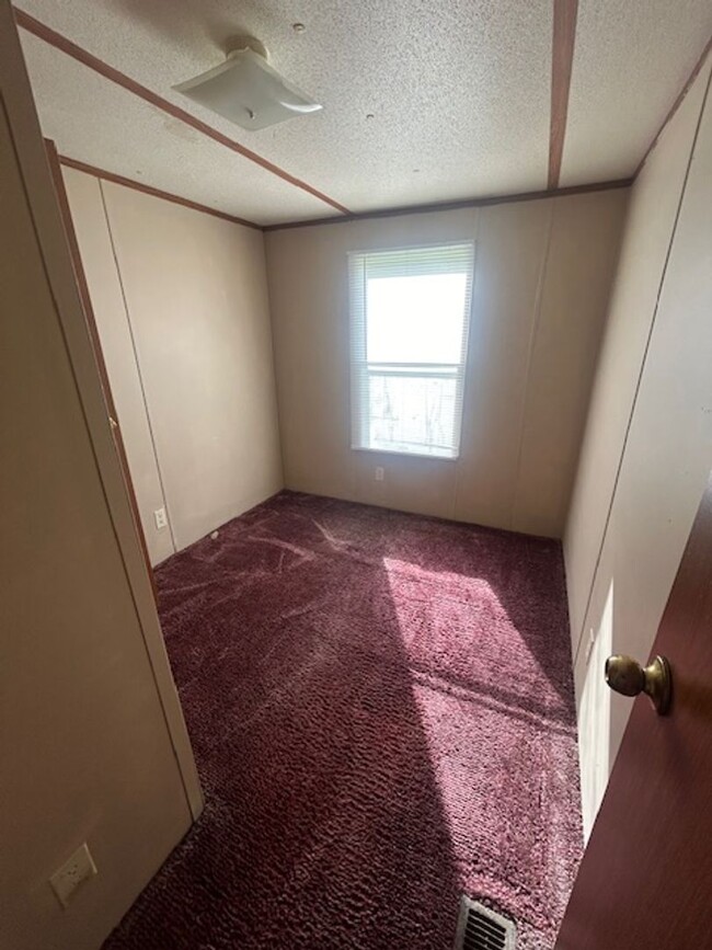
Bedrooms
3
-
Bathrooms
2
-
Square Feet
--
-
Available
Available Now
14850 State Hwy 72

Favorites
About This Home
$950 deposit,
Available Now
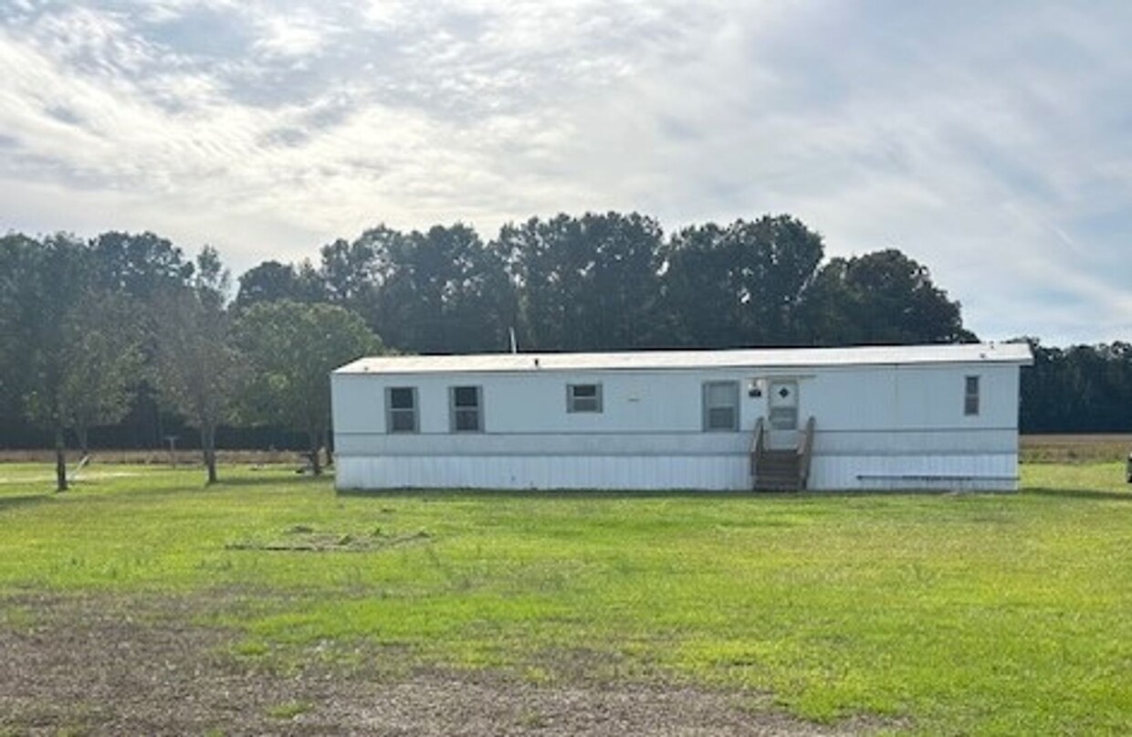
Single wide home with 3 bedroom 2 bath with stove, fridge, w/d hookup and central ac/heat.
14850 State Hwy 72 is a house located in Robeson County and the 28369 ZIP Code. This area is served by the Public School District Of Robeson County attendance zone.
* Price shown is base rent. Excludes user-selected optional fees and variable or usage-based fees and required charges due at or prior to move-in or at move-out. Price, availability, fees, and any applicable rent special are subject to change without notice.
* Square footage definitions vary. Displayed square footage is approximate.
Fees and Policies
The fees listed below are community-provided and may exclude utilities or add-ons. All payments are made directly to the property and are non-refundable unless otherwise specified. Use the Cost Calculator to determine costs based on your needs.
-
One-Time Basics
-
Due at Move-In
-
Security Deposit - RefundableCharged per unit.$950
-
-
Due at Move-In
Property Fee Disclaimer: Based on community-supplied data and independent market research. Subject to change without notice. May exclude fees for mandatory or optional services and usage-based utilities.
House Features
- Range
- Refrigerator
Contact
- Listed by RE/MAX Real Estate Exchange | RE/MAX Real Estate Exchange
- Phone Number
- Contact
Location
Get Directions
Amenities
- Range
- Refrigerator
Education
| Colleges & Universities | Distance | ||
|---|---|---|---|
| Colleges & Universities | Distance | ||
| Drive: | 36 min | 27.7 mi |
14850 State Hwy 72 is within 36 minutes or 27.7 miles from UNC Pembroke.
Schools


Public Elementary & Middle School
Grades K-8
297 Students
Attendance Zone
Public Elementary School
Grades PK-5
442 Students
Attendance Zone
Public High School
Grades 9-12
840 Students
Attendance Zone
Public High School
Grades 9-12
225 Students
Attendance Zone
Private Elementary & Middle School
Grades PK-8
60 Students
Nearby
Private Elementary, Middle & High School
Grades K-12
222 Students
Nearby
School data provided by
 The GreatSchools Rating helps parents compare schools within a state based on a variety of school quality indicators and provides a helpful picture of how effectively each school serves all of its students. Ratings are on a scale of 1 (below average) to 10 (above average) and can include test scores, college readiness, academic progress, advanced courses, equity, discipline and attendance data. We also advise parents to visit schools, consider other information on school performance and programs, and consider family needs as part of the school selection process.
View GreatSchools Rating Methodology
Data provided by GreatSchools.org © 2026. All rights reserved.
View GreatSchools Rating Methodology
Data provided by GreatSchools.org © 2026. All rights reserved.
Getting Around
 What do Walkability, Transit, Drivability, and Bikeability mean?
Walkability measures the walking distance to day-to-day needs.
Transit measures access to public transportation.
Drivability measures congestion, parking availability, and access to major roads.
Bikeability measures the suitability for cycling.
How It Works
What do Walkability, Transit, Drivability, and Bikeability mean?
Walkability measures the walking distance to day-to-day needs.
Transit measures access to public transportation.
Drivability measures congestion, parking availability, and access to major roads.
Bikeability measures the suitability for cycling.
How It Works
Not Walkable
Walkability
0
/ 100
Exceptionally Drivable
Drivability
100
/ 100
Not Bikeable
Bikeability
10
/ 100
Scores provided by
-
Soundscore™
-
/ 100
Traffic
-Airport
-Businesses
-Scores provided by
HowLoud What is a Sound Score Rating? A Sound Score Rating aggregates noise caused by vehicle traffic, airplane traffic and local sources. How It WorksYou May Also Like
Similar Rentals Nearby


What Are Walk Score®, Transit Score®, and Bike Score® Ratings?
Walk Score® measures the walkability of any address. Transit Score® measures access to public transit. Bike Score® measures the bikeability of any address.
What is a Sound Score Rating?
A Sound Score Rating aggregates noise caused by vehicle traffic, airplane traffic and local sources.

14850 State Hwy 72
Orrum, NC 28369