
Monterey Station
180 E Monterey Ave,
Pomona, CA 91767
$1,550 - $2,625
Studio - 2 Beds
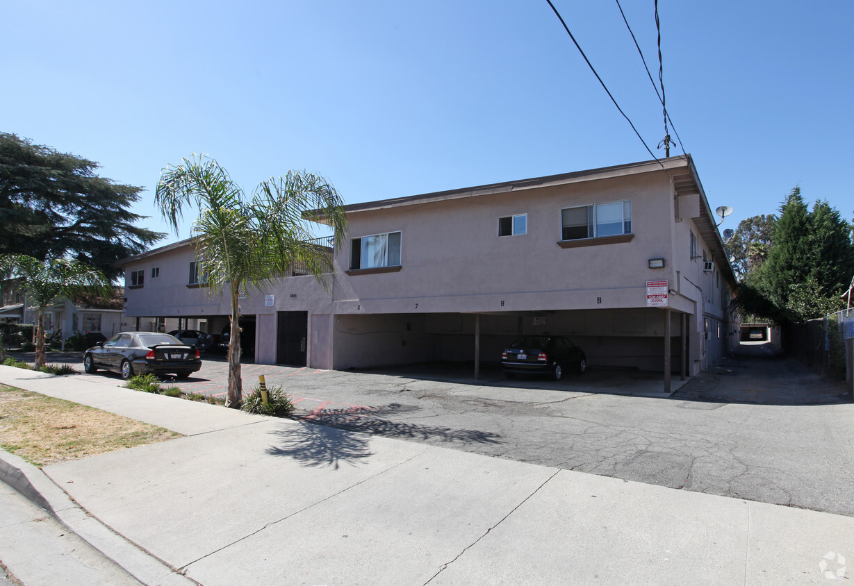
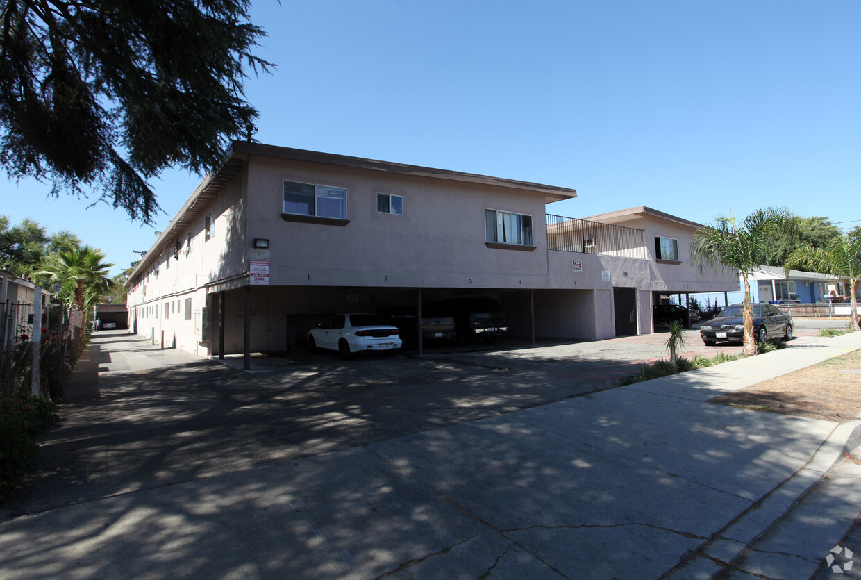

At 1435 Laurel Ave, you've discovered your new place. Located at 1435 Laurel Ave in Pomona, this community is an ideal place to move. The community staff is ready to show you our community. Make a visit to see the current floorplan options. Drop by the leasing office to schedule your tour.
1435 Laurel Ave is an apartment community located in Los Angeles County and the 91768 ZIP Code. This area is served by the Pomona Unified School District attendance zone.
Air Conditioning
Oven
Range
Kitchen
Located in the Pomona Valley, Pomona offers renters a welcoming community with a rich history and convenient amenities. California State Polytechnic University and Western University of Health Sciences anchor the educational landscape, while downtown features the restored Fox Theater and a growing Arts District. Outdoor recreation opportunities abound at Ganesha Park, and the Fairplex hosts the Los Angeles County Fair along with year-round events. Rental options are available in established neighborhoods like Phillips Ranch and the Lincoln Park Historic District.
Situated 30 miles east of Los Angeles, Pomona combines suburban living with easy access to metropolitan areas. The rental market includes a range of housing choices near both university campuses and throughout residential neighborhoods. Tree-lined streets and preserved architecture reflect the city's heritage as a citrus-growing center.
Learn more about living in PomonaCompare neighborhood and city base rent averages by bedroom.
| San Gabriel Valley | Pomona, CA | |
|---|---|---|
| Studio | $1,678 | $1,583 |
| 1 Bedroom | $1,874 | $1,727 |
| 2 Bedrooms | $2,238 | $2,142 |
| 3 Bedrooms | $2,695 | $2,552 |
| Colleges & Universities | Distance | ||
|---|---|---|---|
| Colleges & Universities | Distance | ||
| Drive: | 5 min | 2.2 mi | |
| Drive: | 6 min | 2.3 mi | |
| Drive: | 8 min | 3.4 mi | |
| Drive: | 7 min | 3.5 mi |


Transportation options available in Pomona include Apu / Citrus College Station, located 11.3 miles from 1435 Laurel Ave. 1435 Laurel Ave is near Ontario International, located 12.4 miles or 18 minutes away, and John Wayne/Orange County, located 32.8 miles or 41 minutes away.
| Transit / Subway | Distance | ||
|---|---|---|---|
| Transit / Subway | Distance | ||
| Drive: | 17 min | 11.3 mi | |
| Drive: | 16 min | 11.9 mi |
| Commuter Rail | Distance | ||
|---|---|---|---|
| Commuter Rail | Distance | ||
|
|
Drive: | 4 min | 1.7 mi |
|
|
Drive: | 8 min | 3.3 mi |
|
|
Drive: | 9 min | 5.6 mi |
|
|
Drive: | 12 min | 6.4 mi |
|
|
Drive: | 11 min | 6.7 mi |
| Airports | Distance | ||
|---|---|---|---|
| Airports | Distance | ||
|
Ontario International
|
Drive: | 18 min | 12.4 mi |
|
John Wayne/Orange County
|
Drive: | 41 min | 32.8 mi |
Scores provided by
Traffic
-Airport
-Businesses
-Scores provided by
HowLoud What is a Sound Score Rating? A Sound Score Rating aggregates noise caused by vehicle traffic, airplane traffic and local sources. How It WorksTime and distance from 1435 Laurel Ave.
| Shopping Centers | Distance | ||
|---|---|---|---|
| Shopping Centers | Distance | ||
| Walk: | 16 min | 0.9 mi | |
| Drive: | 6 min | 2.2 mi |
| Parks and Recreation | Distance | ||
|---|---|---|---|
| Parks and Recreation | Distance | ||
|
Frank G. Bonelli Regional Park
|
Drive: | 9 min | 3.9 mi |
|
Millikan Planetarium
|
Drive: | 11 min | 6.0 mi |
|
San Dimas Canyon Nature Center
|
Drive: | 13 min | 6.5 mi |
|
Rancho Santa Ana Botanic Garden
|
Drive: | 11 min | 6.5 mi |
|
Alf Museum of Paleontology
|
Drive: | 14 min | 6.6 mi |
| Hospitals | Distance | ||
|---|---|---|---|
| Hospitals | Distance | ||
| Drive: | 4 min | 1.9 mi | |
| Drive: | 7 min | 3.3 mi | |
| Drive: | 9 min | 6.0 mi |
| Military Bases | Distance | ||
|---|---|---|---|
| Military Bases | Distance | ||
| Drive: | 45 min | 32.6 mi | |
| Drive: | 59 min | 38.4 mi | |
| Drive: | 64 min | 47.4 mi |
Pets Allowed Fitness Center Pool Dishwasher In Unit Washer & Dryer Clubhouse

Pets Allowed Fitness Center Dishwasher Refrigerator Kitchen In Unit Washer & Dryer
Pets Allowed Fitness Center Pool In Unit Washer & Dryer Rooftop Deck
What Are Walk Score®, Transit Score®, and Bike Score® Ratings?
Walk Score® measures the walkability of any address. Transit Score® measures access to public transit. Bike Score® measures the bikeability of any address.
What is a Sound Score Rating?
A Sound Score Rating aggregates noise caused by vehicle traffic, airplane traffic and local sources.

1435 Laurel Ave
Pomona, CA 91768


