
$4,500
/ Month
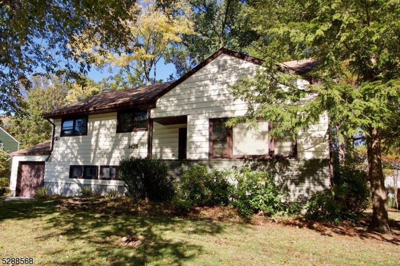
1425 Boynton Ave
Westfield, NJ 07090
Favorites
1425 Boynton Ave

Favorites
Check Back Soon for Upcoming Availability
| Beds | Baths | Average SF |
|---|---|---|
| 4 Bedrooms 4 Bedrooms 4 Br | 2.5 Baths 2.5 Baths 2.5 Ba | 2,255 SF |
Fees and Policies
The fees listed below are community-provided and may exclude utilities or add-ons. All payments are made directly to the property and are non-refundable unless otherwise specified.
- Dogs Allowed
-
Fees not specified
-
Weight limit--
-
Pet Limit--
- Parking
-
Garage--
About This Property
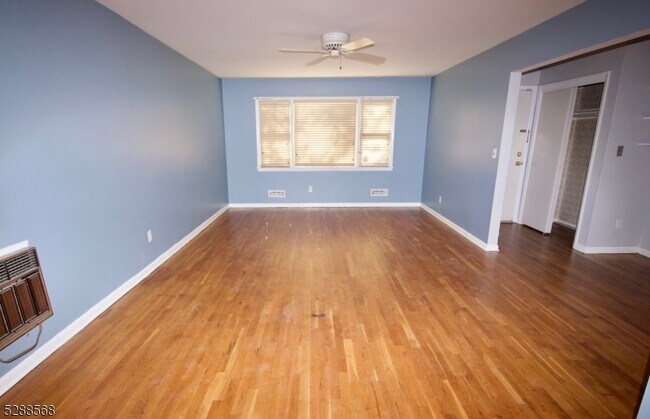
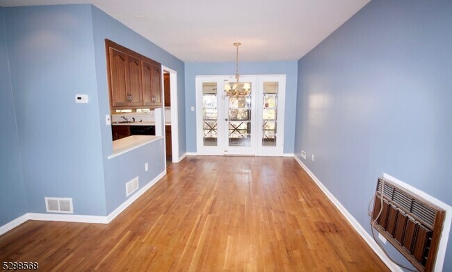
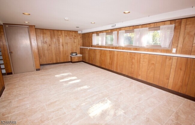
Spacious 4 BR home, quiet area, screenedporch, large rear yard, lot 89x110, .23 acre. Large Family room with New tile floor, recessed lights.First and second floor rooms have hardwood floors, LOTS of storage & FULL LAUNDRY. Greatneighborhood. Large laundry room w/ storage cabinetry, washer,dryer and separate storage roomwith additional cabinetry, entry to garage all on ground level; open floor plan: living room, diningroom, kitchen on first level; 3 bedrooms and 2 full baths on second level, 4th bedroom on third level.Full basement and 1 car garage. Tenant paysrealtor fee of 1 month rent.Tenant pays first $50 of eachrepair. Tenant to provide proof of tenant insurance prior to occupancy. One small pet permitted. No large dogs permitted. Tenant responsible for lawn mowing and snow removal.
1425 Boynton Ave is an apartment community located in Union County and the 07090 ZIP Code.
Features
- Air Conditioning
- Tile Floors
- Porch
1425 Boynton Ave,
Westfield,
NJ
07090
Westfield, New Jersey sits about 20 miles southwest of Manhattan in Union County, offering a self-contained suburban identity with direct rail access to New York City. The town carries a well-established reputation for its walkable downtown, strong civic character, and a cultural scene that includes a community orchestra, live theater, and a summer jazz series that draws crowds each year.
The downtown corridor anchors daily life with a mix of local boutiques, national retailers, coffee shops, and galleries housed in historic storefronts. Kean University lies within roughly nine miles, and Union County College in nearby Cranford adds an educational presence to the broader area. Westfield spans about seven square miles, giving it a compact, approachable scale that makes getting around on foot feel practical rather than aspirational.
Learn more about living in Westfield
Amenities
- Air Conditioning
- Tile Floors
- Porch
Education
| Colleges & Universities | Distance | ||
|---|---|---|---|
| Colleges & Universities | Distance | ||
| Drive: | 11 min | 2.8 mi | |
| Drive: | 17 min | 6.9 mi | |
| Drive: | 17 min | 8.1 mi | |
| Drive: | 16 min | 9.0 mi |
1425 Boynton Ave is within 11 minutes or 2.8 miles from Union County College, Cranford. It is also near Kean University and Union Co. Coll., Plainfield.
Walkability Near 1425 Boynton Ave Westfield, NJ 07090
Getting Around
 What do Walkability, Transit, Drivability, and Bikeability mean?
Walkability measures the walking distance to day-to-day needs.
Transit measures access to public transportation.
Drivability measures congestion, parking availability, and access to major roads.
Bikeability measures the suitability for cycling.
How It Works
What do Walkability, Transit, Drivability, and Bikeability mean?
Walkability measures the walking distance to day-to-day needs.
Transit measures access to public transportation.
Drivability measures congestion, parking availability, and access to major roads.
Bikeability measures the suitability for cycling.
How It Works
Moderately Walkable
Walkability
60
/ 100
Limited Public Transit
Transit
20
/ 100
Moderately Drivable
Drivability
60
/ 100
Fairly Bikeable
Bikeability
50
/ 100
Scores provided by
-
Soundscore™
-
/ 100
Traffic
-Airport
-Businesses
-Scores provided by
HowLoud What is a Sound Score Rating? A Sound Score Rating aggregates noise caused by vehicle traffic, airplane traffic and local sources. How It WorksYou May Also Like
How do I access Social Services in New Jersey?
Statewide service is free, confidential, multilingual and always open. Three easy ways to reach Social Services in NJ: Dial 2-1-1; text your zip code to 898-211; or chat at https://www.nj211.org
Similar Rentals Nearby
-
-
-
-
-
1 / 50

-
-
-
-
-


What Are Walk Score®, Transit Score®, and Bike Score® Ratings?
Walk Score® measures the walkability of any address. Transit Score® measures access to public transit. Bike Score® measures the bikeability of any address.
What is a Sound Score Rating?
A Sound Score Rating aggregates noise caused by vehicle traffic, airplane traffic and local sources.

1425 Boynton Ave
Westfield, NJ 07090