
43 W 125th St
43 W 125th St,
Chicago, IL 60628
$2,095
4 Beds
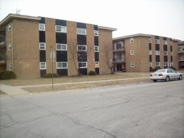
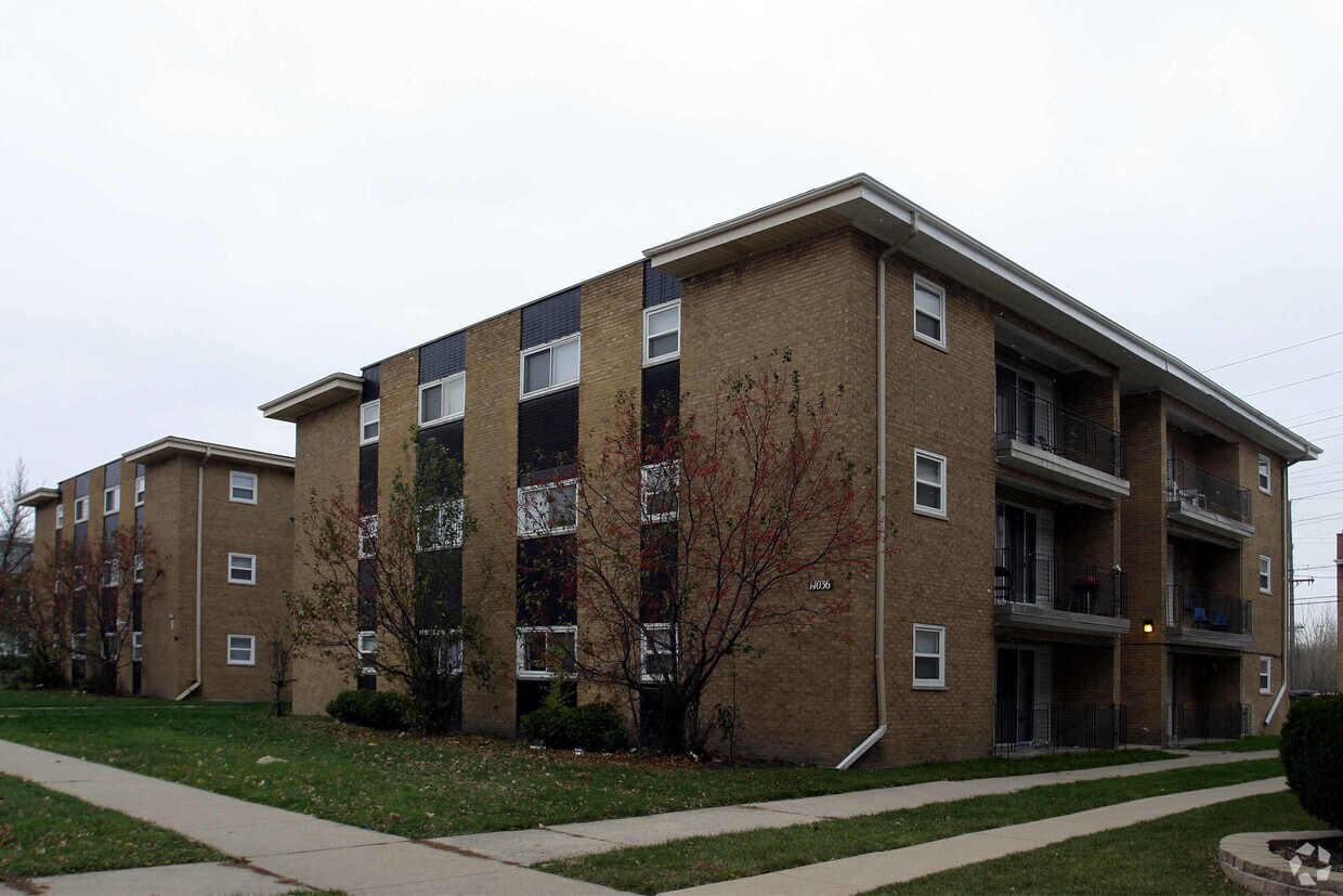
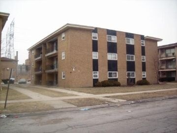
At 14036-14050 S Tracy Ave in Riverdale, IL, experience stylish living. This apartment community is located in Riverdale at 14036-14050 S. Tracy Ave in the 60827 area. Come for a visit to check out the apartment floorplan options. This community offers a selection amenities and features. Some of these include: convenient on-site parking options, smoke free options, and balconies. Your new home awaits you at 14036-14050 S Tracy Ave. Stop by the leasing office to find out current pricing.
14036-14050 S Tracy Ave is an apartment community located in Cook County and the 60827 ZIP Code. This area is served by the Exc Children Have Opportunities attendance zone.
Laundry Facilities
Controlled Access
24 Hour Access
Maintenance on site
Air Conditioning
High Speed Internet Access
Hardwood Floors
Refrigerator
Riverdale is a Cook County village about 20 miles south of Chicago's Loop, sitting along the southern bank of the Little Calumet River and incorporated since 1893. Its history runs deep in manufacturing and industry, and that past shaped a working community that still carries a quieter, more grounded pace than the city to the north. Beaubien Wood Forest Preserve, a 135-acre expanse with old-growth oaks, wetlands, and fishing at Flatfoot Lake, gives the village a natural anchor that contrasts with its industrial roots.
The residential streets are tree-lined and predominantly made up of single-family homes, though renters will also find apartment communities and smaller multi-unit buildings scattered throughout. The housing stock tends toward affordability, making Riverdale one of the more accessible options within the greater Chicago metro.
Learn more about living in Riverdale| Colleges & Universities | Distance | ||
|---|---|---|---|
| Colleges & Universities | Distance | ||
| Drive: | 8 min | 3.3 mi | |
| Drive: | 16 min | 6.9 mi | |
| Drive: | 19 min | 8.5 mi | |
| Drive: | 21 min | 9.6 mi |


Transportation options available in Riverdale include 87Th Street Station, located 7.6 miles from 14036-14050 S Tracy Ave. 14036-14050 S Tracy Ave is near Chicago Midway International, located 17.1 miles or 31 minutes away, and Chicago O'Hare International, located 35.2 miles or 56 minutes away.
| Transit / Subway | Distance | ||
|---|---|---|---|
| Transit / Subway | Distance | ||
|
|
Drive: | 15 min | 7.6 mi |
|
|
Drive: | 17 min | 8.7 mi |
|
|
Drive: | 18 min | 9.6 mi |
|
|
Drive: | 18 min | 9.9 mi |
|
|
Drive: | 22 min | 11.6 mi |
| Commuter Rail | Distance | ||
|---|---|---|---|
| Commuter Rail | Distance | ||
|
|
Walk: | 9 min | 0.5 mi |
|
|
Walk: | 16 min | 0.8 mi |
| Drive: | 5 min | 2.0 mi | |
|
|
Drive: | 7 min | 2.7 mi |
|
|
Drive: | 11 min | 4.1 mi |
| Airports | Distance | ||
|---|---|---|---|
| Airports | Distance | ||
|
Chicago Midway International
|
Drive: | 31 min | 17.1 mi |
|
Chicago O'Hare International
|
Drive: | 56 min | 35.2 mi |
Scores provided by
Traffic
ActiveAirport
CalmBusinesses
ActiveScores provided by
HowLoud What is a Sound Score Rating? A Sound Score Rating aggregates noise caused by vehicle traffic, airplane traffic and local sources. How It WorksTime and distance from 14036-14050 S Tracy Ave.
| Shopping Centers | Distance | ||
|---|---|---|---|
| Shopping Centers | Distance | ||
| Drive: | 6 min | 2.2 mi | |
| Drive: | 6 min | 2.3 mi | |
| Drive: | 6 min | 2.4 mi |
| Parks and Recreation | Distance | ||
|---|---|---|---|
| Parks and Recreation | Distance | ||
|
Calumet Woods
|
Drive: | 8 min | 2.8 mi |
|
West Pullman Park
|
Drive: | 9 min | 3.6 mi |
|
Beaubien Woods
|
Drive: | 11 min | 3.9 mi |
|
Sand Ridge Nature Center
|
Drive: | 12 min | 4.8 mi |
|
Prospect Gardens Park
|
Drive: | 13 min | 6.0 mi |
| Hospitals | Distance | ||
|---|---|---|---|
| Hospitals | Distance | ||
| Drive: | 9 min | 3.9 mi | |
| Drive: | 10 min | 4.8 mi | |
| Drive: | 14 min | 6.9 mi |

What Are Walk Score®, Transit Score®, and Bike Score® Ratings?
Walk Score® measures the walkability of any address. Transit Score® measures access to public transit. Bike Score® measures the bikeability of any address.
What is a Sound Score Rating?
A Sound Score Rating aggregates noise caused by vehicle traffic, airplane traffic and local sources.

14036-14050 S Tracy Ave
Riverdale, IL 60827


