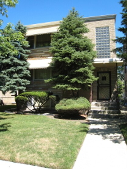
13839 S State St
13839 S State St,
Riverdale,
IL
60827
2 Weeks Ago
Favorites
13839 S State St
Favorites
Check Back Soon for Upcoming Availability
Fees and Policies
Details
Property Information
-
Built in 1962
-
3 units/2 stories
About 13839 S State St Riverdale, IL 60827
Explore your new place at 13839 S State St in Riverdale. The 60827 location has so much to offer its residents. The professional leasing staff is ready and waiting to help you find your perfect fit. Make sure you to check out the current floorplan options. Find your new home at 13839 S State St. Stop by the leasing office to check the current floorplan availability.
13839 S State St is an apartment community located in Cook County and the 60827 ZIP Code. This area is served by the Dolton School District 148 attendance zone.
Location
Get Directions
Situated about 20 miles south of Chicago’s Loop, Riverdale is a Cook County village bordering the southern banks of the Little Calumet River. Numerous forest preserves and wooded areas surround Riverdale, contributing a peaceful atmosphere and beautiful scenery to the community.
Riverdale is predominantly residential, touting a host of quiet neighborhoods with historic homes tucked along tree-lined streets. Riverdale also contains a quaint downtown area, providing residents with several convenient shops and services in well-preserved buildings.
Commuters especially enjoy Riverdale’s accessibility. Quick access to I-57, I-94, and two Metra commuter stations (Ivanhoe and Riverdale) makes getting around from Riverdale simple.
Learn more about living in Riverdale
Education
| Colleges & Universities | Distance | ||
|---|---|---|---|
| Colleges & Universities | Distance | ||
| Drive: | 7 min | 3.0 mi | |
| Drive: | 14 min | 6.2 mi | |
| Drive: | 19 min | 9.4 mi | |
| Drive: | 21 min | 9.7 mi |
13839 S State St is within 7 minutes or 3.0 miles from South Suburban College. It is also near Chicago State University and Saint Xavier University.
Schools


Public Elementary School
Grades K-6
277 Students
Attendance Zone
Public Elementary & Middle School
Grades PK-8
236 Students
Nearby
Public Elementary, Middle & High School
Nearby
Public Middle School
Grades 7-8
131 Students
Attendance Zone
Public High School
Grades 9-12
Nearby
Public High School
Grades 9-12
1,628 Students
Attendance Zone
Private Elementary School
Grades PK-1
Nearby
Private Elementary, Middle & High School
Grades PK-12
Nearby
School data provided by
 The GreatSchools Rating helps parents compare schools within a state based on a variety of school quality indicators and provides a helpful picture of how effectively each school serves all of its students. Ratings are on a scale of 1 (below average) to 10 (above average) and can include test scores, college readiness, academic progress, advanced courses, equity, discipline and attendance data. We also advise parents to visit schools, consider other information on school performance and programs, and consider family needs as part of the school selection process.
View GreatSchools Rating Methodology
Data provided by GreatSchools.org © 2025. All rights reserved.
View GreatSchools Rating Methodology
Data provided by GreatSchools.org © 2025. All rights reserved.
Transportation options available in Riverdale include 87Th Street Station, located 6.9 miles from 13839 S State St. 13839 S State St is near Chicago Midway International, located 17.2 miles or 31 minutes away, and Chicago O'Hare International, located 34.5 miles or 54 minutes away.
| Transit / Subway | Distance | ||
|---|---|---|---|
| Transit / Subway | Distance | ||
|
|
Drive: | 13 min | 6.9 mi |
|
|
Drive: | 15 min | 8.0 mi |
|
|
Drive: | 16 min | 8.9 mi |
|
|
Drive: | 16 min | 9.2 mi |
|
|
Drive: | 20 min | 10.9 mi |
| Commuter Rail | Distance | ||
|---|---|---|---|
| Commuter Rail | Distance | ||
|
|
Walk: | 7 min | 0.4 mi |
|
|
Drive: | 4 min | 1.6 mi |
| Drive: | 5 min | 2.6 mi | |
|
|
Drive: | 6 min | 2.7 mi |
|
|
Drive: | 8 min | 3.4 mi |
| Airports | Distance | ||
|---|---|---|---|
| Airports | Distance | ||
|
Chicago Midway International
|
Drive: | 31 min | 17.2 mi |
|
Chicago O'Hare International
|
Drive: | 54 min | 34.5 mi |
Time and distance from 13839 S State St.
| Shopping Centers | Distance | ||
|---|---|---|---|
| Shopping Centers | Distance | ||
| Drive: | 4 min | 1.7 mi | |
| Drive: | 5 min | 2.3 mi | |
| Drive: | 5 min | 2.3 mi |
13839 S State St has 3 shopping centers within 2.3 miles, which is about a 5-minute drive. The miles and minutes will be for the farthest away property.
| Parks and Recreation | Distance | ||
|---|---|---|---|
| Parks and Recreation | Distance | ||
|
Calumet Woods
|
Drive: | 8 min | 2.9 mi |
|
West Pullman Park
|
Drive: | 6 min | 2.9 mi |
|
Beaubien Woods
|
Drive: | 8 min | 3.2 mi |
|
Sand Ridge Nature Center
|
Drive: | 10 min | 4.4 mi |
|
Camp Shabbona Woods
|
Drive: | 10 min | 5.4 mi |
13839 S State St has 5 parks within 5.4 miles, including Beaubien Woods, Calumet Woods, and West Pullman Park.
| Hospitals | Distance | ||
|---|---|---|---|
| Hospitals | Distance | ||
| Drive: | 8 min | 4.1 mi | |
| Drive: | 10 min | 5.1 mi | |
| Drive: | 13 min | 6.5 mi |
13839 S State St has 3 hospitals within 6.5 miles, the nearest is Roseland Community Hospital which is 4.1 miles away and a 8 minute drive.
You May Also Like
Similar Rentals Nearby


What Are Walk Score®, Transit Score®, and Bike Score® Ratings?
Walk Score® measures the walkability of any address. Transit Score® measures access to public transit. Bike Score® measures the bikeability of any address.
What is a Sound Score Rating?
A Sound Score Rating aggregates noise caused by vehicle traffic, airplane traffic and local sources
Responded To This Review