
$3,250
/ Month
1368 Oakhurst Ave
Los Altos, CA 94024
Today
Favorites
650-520-8784
-
Bedrooms
1
-
Bathrooms
1
-
Square Feet
500 sq ft
-
Available
Available Now
1368 Oakhurst Ave

Favorites
About This Home
$3,250 deposit,
Available Now
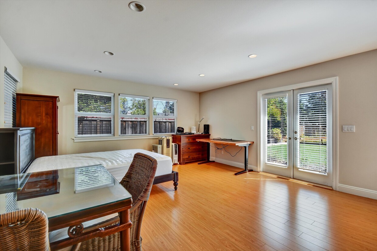
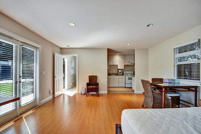
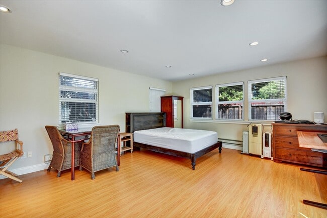
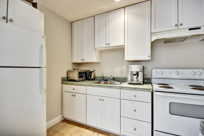
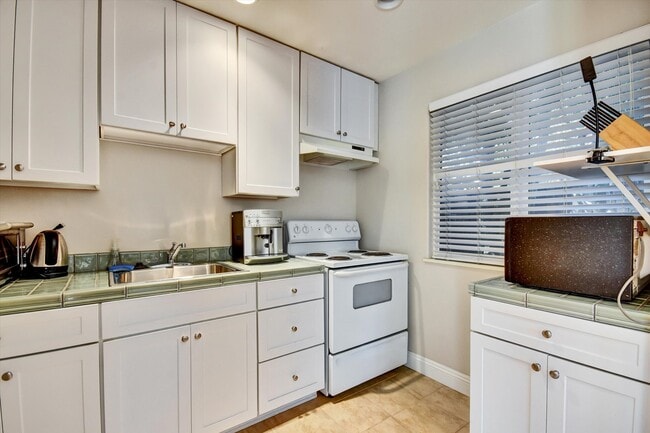
Beautiful ADU for Rent in Los Altos Discover comfort and convenience in this private Accessory Dwelling Unit (ADU) located in the heart of Los Altos. Perfect for those seeking a peaceful neighborhood while staying close to top-rated schools, shops, dining, and major tech employers. Spacious Studio layout with modern finishes Bright open-concept living area with plenty of natural light Updated kitchen Double-pane windows and efficient heating/cooling Private entrance for added privacy Quiet, tree-lined neighborhood, Easy access to 280 and Foothill Expressway Close to downtown Los Altos, parks, and trails Studio is furnished now but it can be rented vacant as well! No smoking | No pets
1368 Oakhurst Ave is a house located in Santa Clara County and the 94024 ZIP Code. This area is served by the Los Altos Elementary attendance zone.
* Price shown is base rent and may not include non-optional fees and utilities. Price, availability, fees, and any applicable rent special are subject to change without notice.
* Square footage definitions vary. Displayed square footage is approximate.
Contact
- Listed by Goodwin Real Estate
- Phone Number
- Contact
Location
Get Directions
Los Altos likes to strike a balance between the urbanized atmosphere of the Bay Area and the more rural environment of the wide-open spaces bordering the city’s southwest side. While it is mainly a residential community, the downtown area surrounding Main Street is a walkable shopping and dining district with tree-lined streets and several public parks nearby. The crime rate is quite low and the local schools are among the highest-performing in the state. Palo Alto is right next door and San Jose just a few minutes down the road, giving Los Altos residents convenient access to Silicon Valley’s greatest amenities.
Learn more about living in Los Altos
Education
| Colleges & Universities | Distance | ||
|---|---|---|---|
| Colleges & Universities | Distance | ||
| Drive: | 8 min | 3.4 mi | |
| Drive: | 10 min | 4.4 mi | |
| Drive: | 14 min | 5.8 mi | |
| Drive: | 17 min | 7.7 mi |
1368 Oakhurst Ave is within 8 minutes or 3.4 miles from Foothill Coll., Los Altos. It is also near De Anza College and Foothill College, Middlefield.
Schools


Public Elementary School
Grades K-5
367 Students
Nearby
Public Elementary School
Grades K-6
332 Students
Attendance Zone
Public Middle School
Grades 7-8
416 Students
Attendance Zone
Public High School
Grades 9-12
2,220 Students
Attendance Zone
Private Elementary & Middle School
Grades PK-8
114 Students
Nearby
Private High School
Grades 9-12
1,776 Students
Nearby
School data provided by
 The GreatSchools Rating helps parents compare schools within a state based on a variety of school quality indicators and provides a helpful picture of how effectively each school serves all of its students. Ratings are on a scale of 1 (below average) to 10 (above average) and can include test scores, college readiness, academic progress, advanced courses, equity, discipline and attendance data. We also advise parents to visit schools, consider other information on school performance and programs, and consider family needs as part of the school selection process.
View GreatSchools Rating Methodology
Data provided by GreatSchools.org © 2025. All rights reserved.
View GreatSchools Rating Methodology
Data provided by GreatSchools.org © 2025. All rights reserved.
Transportation options available in Los Altos include Mountain View Station, located 3.1 miles from 1368 Oakhurst Ave. 1368 Oakhurst Ave is near Norman Y Mineta San Jose International, located 11.3 miles or 19 minutes away, and San Francisco International, located 28.5 miles or 38 minutes away.
| Transit / Subway | Distance | ||
|---|---|---|---|
| Transit / Subway | Distance | ||
| Drive: | 8 min | 3.1 mi | |
|
|
Drive: | 8 min | 3.1 mi |
|
|
Drive: | 9 min | 3.5 mi |
|
|
Drive: | 8 min | 3.8 mi |
|
|
Drive: | 10 min | 4.7 mi |
| Commuter Rail | Distance | ||
|---|---|---|---|
| Commuter Rail | Distance | ||
| Drive: | 8 min | 3.1 mi | |
| Drive: | 9 min | 3.1 mi | |
| Drive: | 10 min | 4.8 mi | |
| Drive: | 12 min | 5.0 mi | |
| Drive: | 15 min | 8.2 mi |
| Airports | Distance | ||
|---|---|---|---|
| Airports | Distance | ||
|
Norman Y Mineta San Jose International
|
Drive: | 19 min | 11.3 mi |
|
San Francisco International
|
Drive: | 38 min | 28.5 mi |
Time and distance from 1368 Oakhurst Ave.
| Shopping Centers | Distance | ||
|---|---|---|---|
| Shopping Centers | Distance | ||
| Walk: | 19 min | 1.0 mi | |
| Drive: | 4 min | 1.3 mi | |
| Drive: | 5 min | 1.8 mi |
1368 Oakhurst Ave has 3 shopping centers within 1.8 miles, which is about a 5-minute walk. The miles and minutes will be for the farthest away property.
| Parks and Recreation | Distance | ||
|---|---|---|---|
| Parks and Recreation | Distance | ||
|
Redwood Grove
|
Drive: | 8 min | 2.8 mi |
|
Foothill College Observatory
|
Drive: | 9 min | 3.6 mi |
|
Rancho San Antonio Open Space Preserve
|
Drive: | 11 min | 3.7 mi |
|
Deer Hollow Farm
|
Drive: | 10 min | 3.8 mi |
|
Rancho San Antonio County Park
|
Drive: | 10 min | 3.9 mi |
1368 Oakhurst Ave has 5 parks within 3.9 miles, including Deer Hollow Farm, Redwood Grove, and Rancho San Antonio County Park.
| Hospitals | Distance | ||
|---|---|---|---|
| Hospitals | Distance | ||
| Drive: | 3 min | 1.2 mi | |
| Drive: | 13 min | 6.3 mi | |
| Drive: | 13 min | 7.0 mi |
1368 Oakhurst Ave has 3 hospitals within 7.0 miles, the nearest is El Camino Hospital which is 1.2 miles away and a 3 minute drive.
| Military Bases | Distance | ||
|---|---|---|---|
| Military Bases | Distance | ||
| Drive: | 13 min | 5.5 mi |
1368 Oakhurst Ave is 5.5 miles and a 13 minute drive from Ames Research Center.
You May Also Like
Similar Rentals Nearby


What Are Walk Score®, Transit Score®, and Bike Score® Ratings?
Walk Score® measures the walkability of any address. Transit Score® measures access to public transit. Bike Score® measures the bikeability of any address.
What is a Sound Score Rating?
A Sound Score Rating aggregates noise caused by vehicle traffic, airplane traffic and local sources

1368 Oakhurst Ave
Los Altos, CA 94024