
$4,000
/ Month
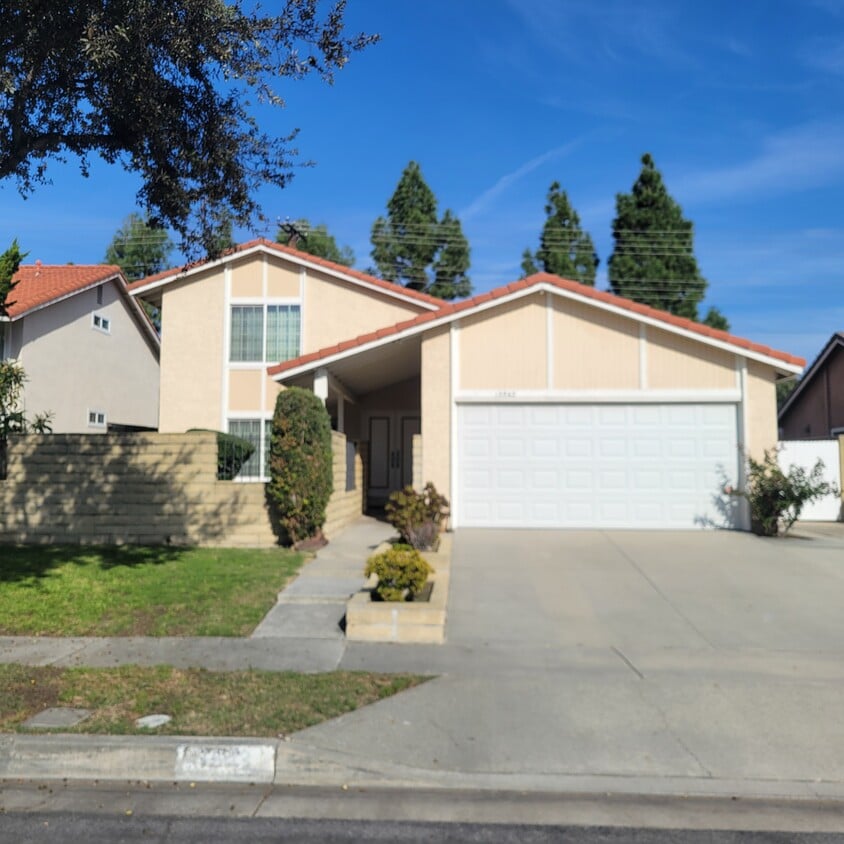
13543 Joaquin Dr
Cerritos, CA 90703
Today
|
Edit
Favorites
714-329-2429
-
Bedrooms
4
-
Bathrooms
2
-
Square Feet
1,650 sq ft
-
Available
Available Now
13543 Joaquin Dr

Favorites
About This Home
$4,000 deposit,
Available Now
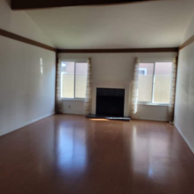
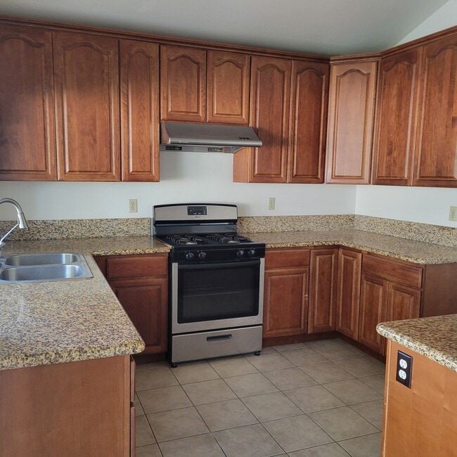
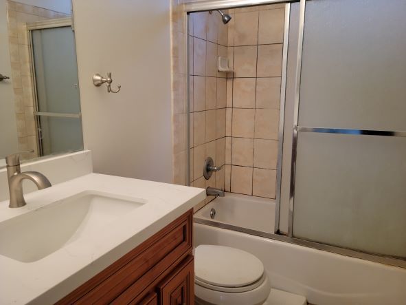
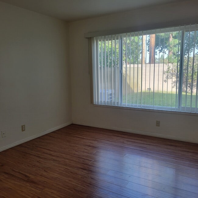
4 Bed 2 Full Baths 2 Car Attached Direct Access from the garage to the Inside. 2 Bed Down stair and 2 Bed Up stair Number 1 School District in Cerritos Gonsalves Elementary Carmenita Jr Cerritos Hi New Central A/C, Wood Floor, High Ceiling, Granite Counter Top, South Face, Good Transportation and shopping. Walking Distance to Elementary and Jr. Hi
13543 Joaquin Dr is a house located in Los Angeles County and the 90703 ZIP Code. This area is served by the ABC Unified attendance zone.
* Price shown is base rent. Excludes user-selected optional fees and variable or usage-based fees and required charges due at or prior to move-in or at move-out. Price, availability, fees, and any applicable rent special are subject to change without notice.
* Square footage definitions vary. Displayed square footage is approximate.
Fees and Policies
The fees below are based on community-supplied data and may exclude additional fees and utilities.
-
One-Time Basics
-
Due at Move-In
-
Security Deposit - RefundableCharged per unit.$4,000
-
-
Due at Move-In
Property Fee Disclaimer: Based on community-supplied data and independent market research. Subject to change without notice. May exclude fees for mandatory or optional services and usage-based utilities.
House Features
- Washer/Dryer
- Washer/Dryer Hookup
- Dishwasher
Contact
- Listed by John Park
- Phone Number
- Contact
Location
Get Directions
Amenities
- Washer/Dryer
- Washer/Dryer Hookup
- Dishwasher
ABC is a lively neighborhood conveniently located 15 miles north of Long Beach and 20 miles south of Los Angeles. The area has a dense population with an abundance of apartments and single-family homes for rent, as well as premier shopping destinations. The Los Cerritos Center, conveniently situated off Interstate 605, attracts shoppers from the surrounding areas. On the other side of town off Highway 91, Cerritos Towne Center provides more retail and dining choices. Quaint boutiques and local eateries are located off Pioneer Boulevard, offering a nice contrast to the large retail centers. More great amenities in town include a few peaceful parks and trails that dot the neighborhood like Liberty Park and Fitness Center.
Learn more about living in ABC
Education
| Colleges & Universities | Distance | ||
|---|---|---|---|
| Colleges & Universities | Distance | ||
| Drive: | 8 min | 3.6 mi | |
| Drive: | 9 min | 4.7 mi | |
| Drive: | 10 min | 5.2 mi | |
| Drive: | 17 min | 9.5 mi |
13543 Joaquin Dr is within 8 minutes or 3.6 miles from Biola University. It is also near Cerritos College and Cypress College.
Schools


Public Elementary School
Grades K-5
435 Students
Nearby
Public Elementary School
Grades K-6
569 Students
Attendance Zone
Public Middle School
Grades 7-8
601 Students
Attendance Zone
Public High School
Grades 9-12
2,242 Students
Attendance Zone
Private Elementary & Middle School
Grades PK-5 & 7
Nearby
Private Elementary, Middle & High School
Grades 1-12
Nearby
School data provided by
 The GreatSchools Rating helps parents compare schools within a state based on a variety of school quality indicators and provides a helpful picture of how effectively each school serves all of its students. Ratings are on a scale of 1 (below average) to 10 (above average) and can include test scores, college readiness, academic progress, advanced courses, equity, discipline and attendance data. We also advise parents to visit schools, consider other information on school performance and programs, and consider family needs as part of the school selection process.
View GreatSchools Rating Methodology
Data provided by GreatSchools.org © 2026. All rights reserved.
View GreatSchools Rating Methodology
Data provided by GreatSchools.org © 2026. All rights reserved.
Transportation options available in Cerritos include Norwalk, located 6.7 miles from 13543 Joaquin Dr. 13543 Joaquin Dr is near Long Beach (Daugherty Field), located 12.6 miles or 20 minutes away, and John Wayne/Orange County, located 21.8 miles or 28 minutes away.
| Transit / Subway | Distance | ||
|---|---|---|---|
| Transit / Subway | Distance | ||
|
|
Drive: | 10 min | 6.7 mi |
|
|
Drive: | 13 min | 7.6 mi |
|
|
Drive: | 18 min | 12.1 mi |
|
|
Drive: | 21 min | 14.4 mi |
|
|
Drive: | 23 min | 15.3 mi |
| Commuter Rail | Distance | ||
|---|---|---|---|
| Commuter Rail | Distance | ||
|
|
Drive: | 8 min | 3.7 mi |
|
|
Drive: | 8 min | 4.3 mi |
|
|
Drive: | 15 min | 9.2 mi |
|
|
Drive: | 15 min | 10.4 mi |
|
|
Drive: | 17 min | 11.7 mi |
| Airports | Distance | ||
|---|---|---|---|
| Airports | Distance | ||
|
Long Beach (Daugherty Field)
|
Drive: | 20 min | 12.6 mi |
|
John Wayne/Orange County
|
Drive: | 28 min | 21.8 mi |
Time and distance from 13543 Joaquin Dr.
| Shopping Centers | Distance | ||
|---|---|---|---|
| Shopping Centers | Distance | ||
| Drive: | 5 min | 2.0 mi | |
| Drive: | 4 min | 2.1 mi | |
| Drive: | 6 min | 2.2 mi |
13543 Joaquin Dr has 3 shopping centers within 2.2 miles, which is about a 6-minute drive. The miles and minutes will be for the farthest away property.
| Parks and Recreation | Distance | ||
|---|---|---|---|
| Parks and Recreation | Distance | ||
|
Children's Museum at La Habra
|
Drive: | 15 min | 8.3 mi |
|
La Habra Historical Museum
|
Drive: | 14 min | 8.5 mi |
|
El Dorado Nature Center
|
Drive: | 15 min | 8.9 mi |
|
El Dorado East Regional Park
|
Drive: | 18 min | 10.0 mi |
|
Earl Burns Miller Japanese Garden
|
Drive: | 20 min | 11.8 mi |
13543 Joaquin Dr has 5 parks within 11.8 miles, including El Dorado Nature Center, El Dorado East Regional Park, and Children's Museum at La Habra.
| Hospitals | Distance | ||
|---|---|---|---|
| Hospitals | Distance | ||
| Drive: | 4 min | 2.6 mi | |
| Drive: | 9 min | 4.8 mi | |
| Drive: | 10 min | 5.4 mi |
13543 Joaquin Dr has 3 hospitals within 5.4 miles, the nearest is La Palma Intercommunity Hospital which is 2.6 miles away and a 4 minute drive.
| Military Bases | Distance | ||
|---|---|---|---|
| Military Bases | Distance | ||
| Drive: | 14 min | 7.7 mi | |
| Drive: | 35 min | 22.5 mi |
13543 Joaquin Dr is 7.7 miles from Los Alamitos Army Airfield, and is convenient to other military bases, including Long Beach Naval Station.
You May Also Like
Similar Rentals Nearby


What Are Walk Score®, Transit Score®, and Bike Score® Ratings?
Walk Score® measures the walkability of any address. Transit Score® measures access to public transit. Bike Score® measures the bikeability of any address.
What is a Sound Score Rating?
A Sound Score Rating aggregates noise caused by vehicle traffic, airplane traffic and local sources

13543 Joaquin Dr
Cerritos, CA 90703