1336-1338 Mountain Ave

1336-1338 Mountain Ave, Purling, NY 12470

2 Weeks Ago
Share Listing
Favorites
1336-1338 Mountain Ave
Share Listing
Favorites

About 1336-1338 Mountain Ave Purling, NY 12470

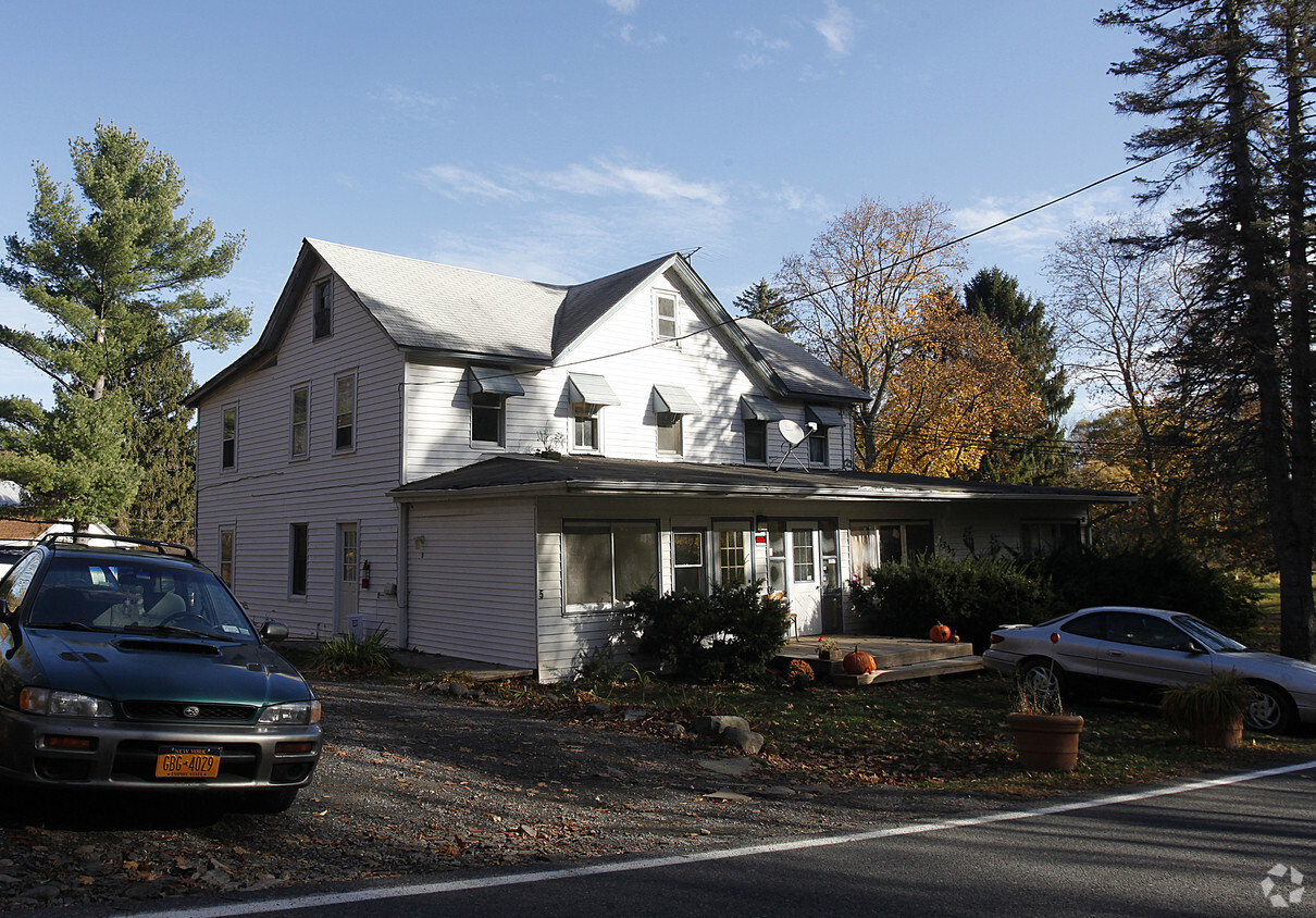
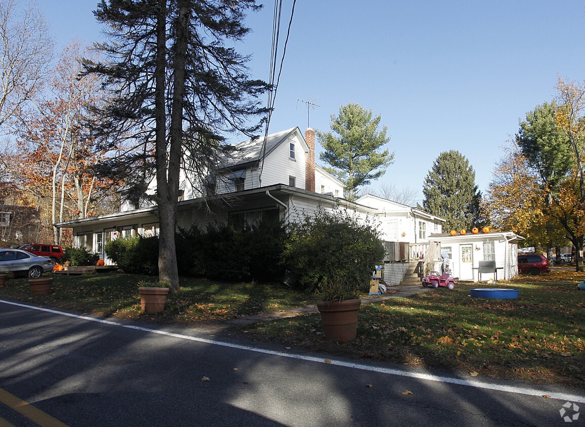
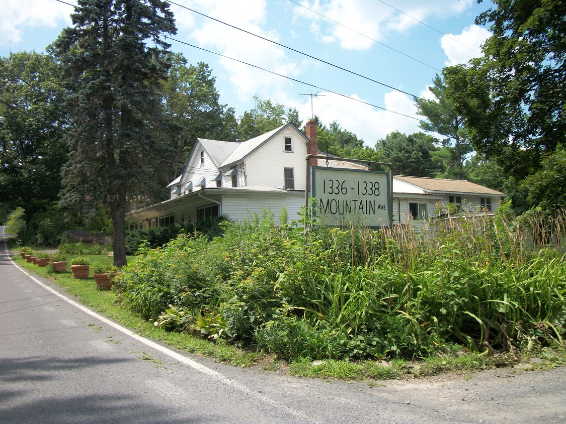
1336-1338 Mountain Ave in Purling, NY is ready to be your home. This community can be found in Purling on Mountain Ave. Here at this community, the professional leasing staff will be ready to help you find your perfect new home. Make sure you to see the current floorplan options. Stop by to check the current floorplan availability.

1336-1338 Mountain Ave is an apartment community located in Greene County and the 12470 ZIP Code. This area is served by the Cairo-Durham Central School District attendance zone.

Location
1336-1338 Mountain Ave, Purling,
NY 12470
Get Directions
Education
Colleges & Universities Distance
Drive: 49 min 29.1 mi
Drive: 60 min 41.8 mi
Drive: 61 min 41.8 mi
Drive: 62 min 43.5 mi
1336-1338 Mountain Ave is within 49 minutes or 29.1 miles from Bard College. It is also near The Sage Colleges, Albany and Albany Law School.
Schools
Public Elementary School
Grades PK-5
174 Students
Nearby
Public Elementary School
Grades K-5
432 Students
Attendance Zone
Public Middle School
Grades 6-8
272 Students
Attendance Zone
Public High School
Grades 9-12
332 Students
Attendance Zone
Private Elementary & Middle School
Grades K-8
Nearby
Private Elementary, Middle & High School
Grades K-12
39 Students
Nearby
Private Elementary & Middle School
Grades PK-8
97 Students
Nearby
Transportation

1336-1338 Mountain Ave is near Albany International, located 53.1 miles or 75 minutes away.

Commuter Rail Distance
Drive: 31 min 17.4 mi
Rhinecliff Amtrak Station
Drive: 60 min 32.6 mi
Drive: 59 min 42.4 mi
Airports Distance
Airports Distance
Albany International
Drive: 75 min 53.1 mi

Walkability Near 1336-1338 Mountain Ave Purling, NY 12470

Getting Around
Not Walkable
Walkability
10 / 100
Minimal Public Transit
Transit
0 / 100
Exceptionally Drivable
Drivability
100 / 100
Somewhat Bikeable
Bikeability
20 / 100

Scores provided by

What do Walkability, Transit, Drivability, and Bikeability mean? Walkability measures the walking distance to day-to-day needs. Transit measures access to public transportation. Drivability measures congestion, parking availability, and access to major roads. Bikeability measures the suitability for cycling. How It Works
-
Soundscore
- / 100

Traffic

-

Airport

-

Businesses

-

Scores provided by

HowLoud What is a Sound Score Rating? A Sound Score Rating aggregates noise caused by vehicle traffic, airplane traffic and local sources. How It Works
Points of Interest

Time and distance from 1336-1338 Mountain Ave.

Shopping Centers Distance
Drive: 24 min 13.1 mi
Drive: 25 min 13.5 mi
Drive: 25 min 13.7 mi
1336-1338 Mountain Ave has 3 shopping centers within 13.7 miles, which is about a 25-minute drive. The miles and minutes will be for the farthest away property.
Parks and Recreation Distance
Ramshorn-Livingston Sanctuary
Drive: 24 min 13.3 mi
Mountain Top Arboretum
Drive: 40 min 18.2 mi
Hunter Mountain Ski Area
Drive: 35 min 21.3 mi
1336-1338 Mountain Ave has 3 parks within 21.3 miles, including Ramshorn-Livingston Sanctuary, Mountain Top Arboretum, and Hunter Mountain Ski Area.
Military Bases Distance
Drive: 110 min 73.9 mi
Drive: 114 min 86.5 mi
Drive: 126 min 86.5 mi
1336-1338 Mountain Ave has 3 military bases within 86.5 miles, the nearest is West Point Military Reserve which is 73.9 miles away and a 110 minute drive.

Explore Similar Rentals Nearby