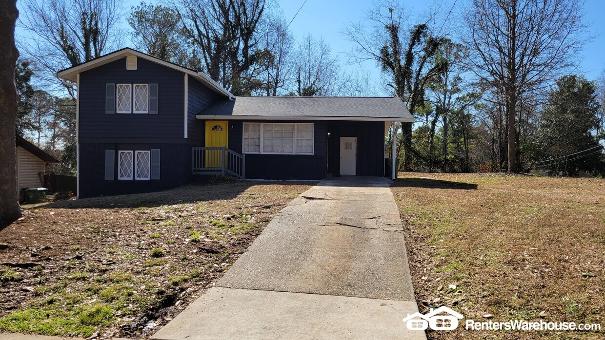
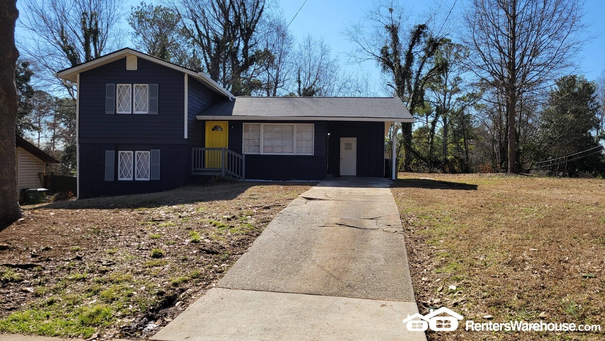
131 Oak Dr SW
Atlanta, GA 30354
-
Bedrooms
3
-
Bathrooms
2
-
Square Feet
1,848 sq ft
-
Available
Available Now
Highlight
- Pets Allowed

About This Home
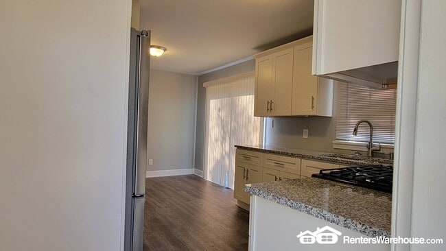
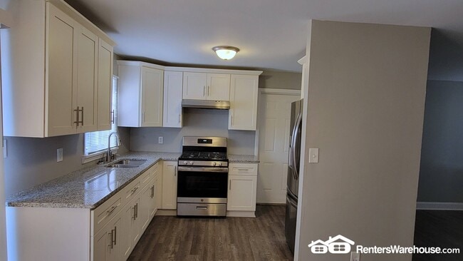
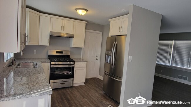
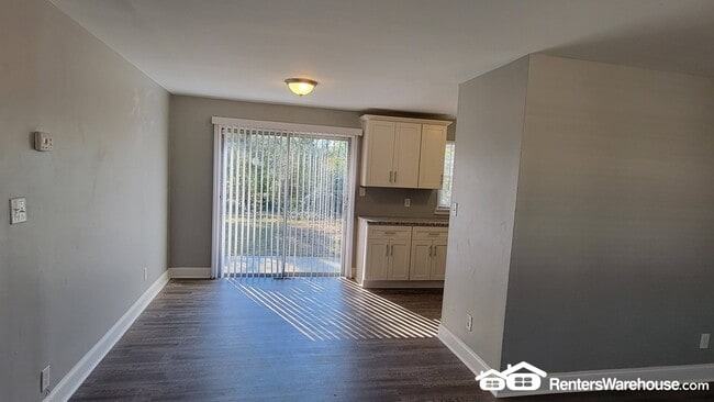
Completely renovated 3 Bedroom, 2 Bath home. Beautiful hardwood floors throughout! Spacious living area. Eat-In Open Kitchen w/ granite counters and stainless steel appliances. One Bedroom w/ 1 full bath on the main level . 2 bedrooms w/ 1 full bath on the upper level. Minutes to I-75/85 Access, Hartsfield-Jackson Airport, and Convenient to Shops and Restaurants. Please call today to schedule a viewing. . Agent: Arvis Sullivan
131 Oak Dr SW is a house located in Fulton County and the 30354 ZIP Code. This area is served by the Atlanta Public Schools attendance zone.
House Features
- Refrigerator
Fees and Policies
The fees below are based on community-supplied data and may exclude additional fees and utilities.
- Dogs Allowed
-
Fees not specified
- Cats Allowed
-
Fees not specified
Contact
- Phone Number
- Website View Property Website
- Contact
-
Source

- Refrigerator
Southeast Atlanta is just one of the many major neighborhoods within the sprawling Atlanta metropolitan area. This area stretches along the east side of I-75, up from Mountain View to Ormewood Park. The neighborhood boasts a diverse mix of residents and offers a variety of rentals, from single-family homes to charming apartment complexes.
Faithful to Atlanta’s reputation as a “city within a forest,” Southeast Atlanta encompasses a large number of parks and green spaces along with its tree-lined streets. Lake Charlotte Nature Preserve and South Bend Park are all popular gathering spots for a breath of fresh air. There are local watering holes and soul food restaurants that serve the area, and the Starlight Drive-In Theatre lies on the neighborhood’s east border.
With I-75 and Moreland Ave. nearby, getting into the heart of the city or other popular areas like East Atlanta is simple.
Learn more about living in Southeast Atlanta| Colleges & Universities | Distance | ||
|---|---|---|---|
| Colleges & Universities | Distance | ||
| Drive: | 8 min | 3.9 mi | |
| Drive: | 12 min | 4.6 mi | |
| Drive: | 13 min | 6.5 mi | |
| Drive: | 15 min | 7.9 mi |


View GreatSchools Rating Methodology
Data provided by GreatSchools.org © 2025. All rights reserved.
Transportation options available in Atlanta include East Point, located 4.4 miles from 131 Oak Dr SW. 131 Oak Dr SW is near Hartsfield - Jackson Atlanta International, located 3.6 miles or 9 minutes away.
| Transit / Subway | Distance | ||
|---|---|---|---|
| Transit / Subway | Distance | ||
|
|
Drive: | 10 min | 4.4 mi |
|
|
Drive: | 10 min | 4.7 mi |
|
|
Drive: | 11 min | 5.2 mi |
|
|
Drive: | 10 min | 5.5 mi |
|
|
Drive: | 15 min | 6.7 mi |
| Commuter Rail | Distance | ||
|---|---|---|---|
| Commuter Rail | Distance | ||
|
|
Drive: | 18 min | 10.6 mi |
| Airports | Distance | ||
|---|---|---|---|
| Airports | Distance | ||
|
Hartsfield - Jackson Atlanta International
|
Drive: | 9 min | 3.6 mi |
Time and distance from 131 Oak Dr SW.
| Shopping Centers | Distance | ||
|---|---|---|---|
| Shopping Centers | Distance | ||
| Walk: | 20 min | 1.0 mi | |
| Drive: | 3 min | 1.3 mi | |
| Drive: | 4 min | 1.5 mi |
| Parks and Recreation | Distance | ||
|---|---|---|---|
| Parks and Recreation | Distance | ||
|
The Georgia Capitol Museum
|
Drive: | 11 min | 6.3 mi |
|
Park Pride
|
Drive: | 12 min | 6.4 mi |
|
Zoo Atlanta
|
Drive: | 13 min | 6.5 mi |
|
West Atlanta Watershed Alliance (WAWA)
|
Drive: | 15 min | 7.0 mi |
|
Trees Atlanta
|
Drive: | 14 min | 7.9 mi |
| Hospitals | Distance | ||
|---|---|---|---|
| Hospitals | Distance | ||
| Drive: | 12 min | 6.7 mi | |
| Drive: | 12 min | 7.6 mi | |
| Drive: | 13 min | 7.7 mi |
| Military Bases | Distance | ||
|---|---|---|---|
| Military Bases | Distance | ||
| Drive: | 11 min | 4.9 mi | |
| Drive: | 17 min | 7.3 mi |
131 Oak Dr SW Photos
Nearby Apartments
Within 50 Miles of 131 Oak Dr SW Atlanta, GA 30354
-
801 North Central
801 N Central Ave
Atlanta, GA 30354
3-4 Br $3,080-$3,580 1.4 mi
-
South Pine
4300 Longleaf Ln
Union City, GA 30291
3 Br $2,399-$3,263 11.0 mi
-
Generation Avondale East
3960 Redan Rd
Stone Mountain, GA 30083
3 Br $2,960-$3,180 11.4 mi
-
Tessa Jodeco Townhomes
2153 Jodeco Rd
McDonough, GA 30253
3-4 Br $2,599-$3,050 16.5 mi
-
Jodeco Landing Rental Homes
150 Purple Finch Pl
Mcdonough, GA 30253
3-4 Br $2,295-$2,900 16.7 mi
-
The Rosemoor
250 Foster Dr
Mcdonough, GA 30253
3 Br $2,849-$3,099 17.6 mi
What Are Walk Score®, Transit Score®, and Bike Score® Ratings?
Walk Score® measures the walkability of any address. Transit Score® measures access to public transit. Bike Score® measures the bikeability of any address.
What is a Sound Score Rating?
A Sound Score Rating aggregates noise caused by vehicle traffic, airplane traffic and local sources
131 Oak Dr SW
Atlanta, GA 30354