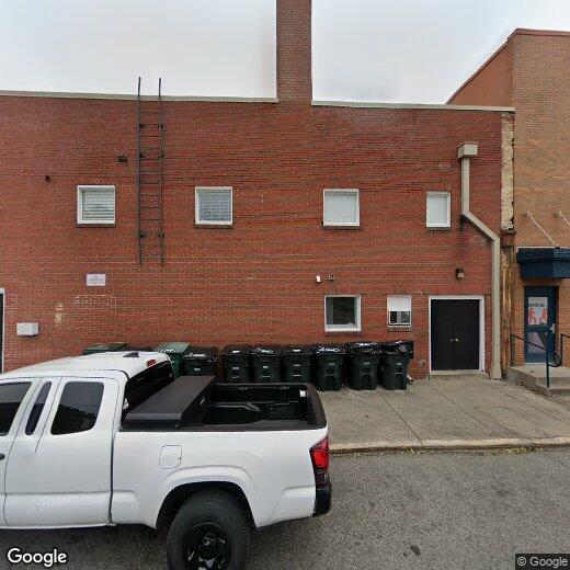
131 E Chestnut St
131 E Chestnut St
Jeffersonville, IN 47130
2 Weeks Ago
|
Edit
Favorites
131 E Chestnut St
Favorites
Check Back Soon for Upcoming Availability
| Beds | Baths | Average SF |
|---|---|---|
| 3 Bedrooms 3 Bedrooms 3 Br | 1.5 Baths 1.5 Baths 1.5 Ba | — |
131 E Chestnut St,
Jeffersonville,
IN
47130
Jeffersonville is located on the banks of the Ohio River and offers a unique blend of small-town charm and city amenities. Jeffersonville boasts a range of residential areas, from historic neighborhoods with picturesque homes to modern apartment complexes. Popular areas for renters include downtown Jeffersonville and the nearby Bridgepointe neighborhood, offering convenient access to shops, restaurants, and the scenic Big Four Bridge, a pedestrian bridge connecting Indiana to Louisville, Kentucky.
Living expenses in Jeffersonville are generally affordable, with reasonable rent prices compared to nearby cities. On average, you can expect to pay around $900 to $1,200 per month for a one-bedroom apartment, but prices may vary depending on location and amenities. The city is also home to several major employers, including Amazon, which has a fulfillment center here, as well as the River Ridge Commerce Center, providing job opportunities for residents.
Learn more about living in Jeffersonville
Education
| Colleges & Universities | Distance | ||
|---|---|---|---|
| Colleges & Universities | Distance | ||
| Walk: | 13 min | 0.7 mi | |
| Drive: | 6 min | 2.5 mi | |
| Drive: | 7 min | 3.4 mi | |
| Drive: | 6 min | 3.7 mi |
131 E Chestnut St is within 13 minutes or 0.7 mile from Indiana Univ. SE, Grad Ctr. It is also near Jefferson Comm. & Tech., DC and Univ. of Louisville, Health.
Walkability Near 131 E Chestnut St Jeffersonville, IN 47130
Getting Around
 What do Walkability, Transit, Drivability, and Bikeability mean?
Walkability measures the walking distance to day-to-day needs.
Transit measures access to public transportation.
Drivability measures congestion, parking availability, and access to major roads.
Bikeability measures the suitability for cycling.
How It Works
What do Walkability, Transit, Drivability, and Bikeability mean?
Walkability measures the walking distance to day-to-day needs.
Transit measures access to public transportation.
Drivability measures congestion, parking availability, and access to major roads.
Bikeability measures the suitability for cycling.
How It Works
Moderately Walkable
Walkability
70
/ 100
Limited Public Transit
Transit
30
/ 100
Very Drivable
Drivability
80
/ 100
Moderately Bikeable
Bikeability
60
/ 100
Scores provided by
-
Soundscore™
-
/ 100
Traffic
-Airport
-Businesses
-Scores provided by
HowLoud What is a Sound Score Rating? A Sound Score Rating aggregates noise caused by vehicle traffic, airplane traffic and local sources. How It WorksYou May Also Like
Similar Rentals Nearby


What Are Walk Score®, Transit Score®, and Bike Score® Ratings?
Walk Score® measures the walkability of any address. Transit Score® measures access to public transit. Bike Score® measures the bikeability of any address.
What is a Sound Score Rating?
A Sound Score Rating aggregates noise caused by vehicle traffic, airplane traffic and local sources.

131 E Chestnut St
Jeffersonville, IN 47130