
$4,650 / Month
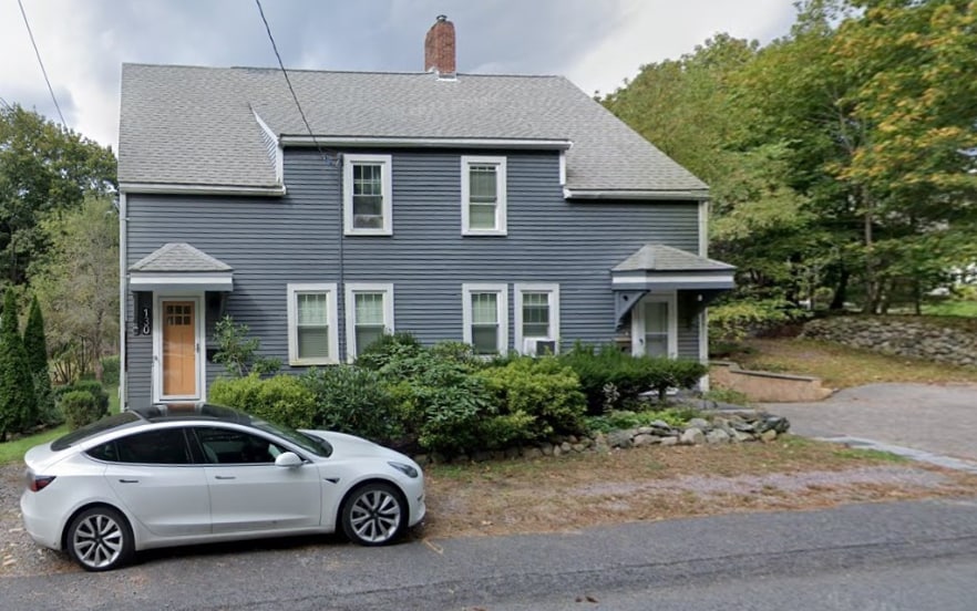
130 Viles St
Weston, MA 02493
1 Day Ago
Favorites
-
Bedrooms
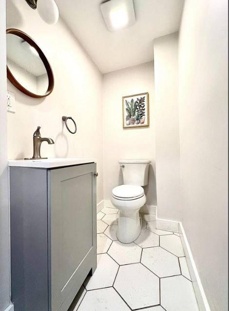
3
-
Bathrooms
2.5
-
Square Feet
1,850 sq ft
-
Available
Available Now
Highlights
- Pets Allowed
- Attic
130 Viles St

Favorites
About This Home
12 Month Lease
,
Available Now
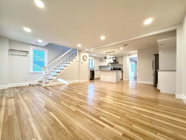
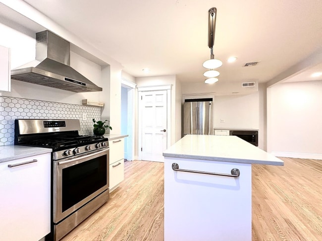
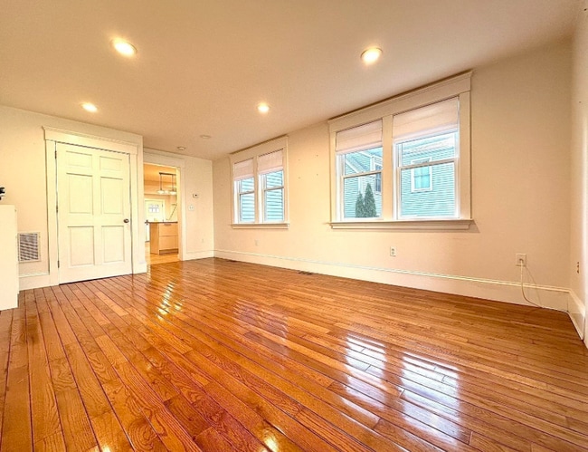
This elegantly remodeled, Attached single-family home spans three floors of comfortable living space. The second floor boasts two bedrooms, each with an en-suite bathroom, offering privacy and convenience. The third floor features a versatile finished attic, perfect for a playroom or home office. The open-concept first floor includes a stunning kitchen equipped with quartz countertops and premium appliances. Additionally, there's a spacious bedroom on the first floor, ideally suited for elderly occupants. Located in a prime area, this home is just a short walk from the town's train station, offering unparalleled value and accessibility.
130 Viles St is a townhome located in Middlesex County and the 02493 ZIP Code. This area is served by the Weston attendance zone.
* Price shown is base rent and may not include non-optional fees and utilities.
Price, availability, fees, and any applicable rent special are subject to change without notice.
* Square footage definitions vary. Displayed square footage is approximate.
Townhome Features
- Washer/Dryer
- Kitchen
- Quartz Countertops
- Office
- Attic
Fees and Policies
The fees below are based on community-supplied data and may exclude additional fees and utilities.
- Dogs Allowed
-
Fees not specified
- Cats Allowed
-
Fees not specified
Contact
- Contact
Location
Get Directions
Just west of Boston and East of Worcester sits Metro West, a region that houses a group of towns and cities with significant historical backgrounds. A total of 19 municipalities make up the core of this community, but other municipalities are considered to be a part of the Interstate 495/Metro West Corridor.
Learn more about living in Metro West
Education
| Colleges & Universities | Distance | ||
|---|---|---|---|
| Colleges & Universities | Distance | ||
| Drive: | 9 min | 3.7 mi | |
| Drive: | 10 min | 4.7 mi | |
| Drive: | 18 min | 9.3 mi | |
| Drive: | 19 min | 9.8 mi |
130 Viles St is within 9 minutes or 3.7 miles from Brandeis University. It is also near Bentley University and Babson College.
Schools


Public Elementary School
Grades PK-3
331 Students
Attendance Zone
Public Elementary School
Grades 4-5
266 Students
Attendance Zone
Public Middle School
Grades 6-8
444 Students
Attendance Zone
Public High School
Grades 9-12
639 Students
Attendance Zone
Private Elementary, Middle & High School
Grades 3-12
107 Students
Nearby
Private Elementary, Middle & High School
Grades 3-12
73 Students
Nearby
Private Elementary & Middle School
Grades PK-8
320 Students
Nearby
Private High School
Grades 9-12
329 Students
Nearby
School data provided by
 The GreatSchools Rating helps parents compare schools within a state based on a variety of school quality indicators and provides a helpful picture of how effectively each school serves all of its students. Ratings are on a scale of 1 (below average) to 10 (above average) and can include test scores, college readiness, academic progress, advanced courses, equity, discipline and attendance data. We also advise parents to visit schools, consider other information on school performance and programs, and consider family needs as part of the school selection process.
View GreatSchools Rating Methodology
View GreatSchools Rating Methodology
Transportation options available in Weston include Riverside, located 5.9 miles from 130 Viles St. 130 Viles St is near General Edward Lawrence Logan International, located 17.0 miles or 30 minutes away, and Worcester Regional, located 41.8 miles or 60 minutes away.
| Transit / Subway | Distance | ||
|---|---|---|---|
| Transit / Subway | Distance | ||
| Drive: | 11 min | 5.9 mi | |
|
|
Drive: | 11 min | 6.4 mi |
|
|
Drive: | 12 min | 7.1 mi |
| Drive: | 15 min | 8.7 mi | |
| Drive: | 15 min | 8.9 mi |
| Commuter Rail | Distance | ||
|---|---|---|---|
| Commuter Rail | Distance | ||
|
|
Walk: | 14 min | 0.8 mi |
| Drive: | 2 min | 1.4 mi | |
| Drive: | 6 min | 3.3 mi | |
| Drive: | 6 min | 3.3 mi | |
| Drive: | 7 min | 3.7 mi |
| Airports | Distance | ||
|---|---|---|---|
| Airports | Distance | ||
|
General Edward Lawrence Logan International
|
Drive: | 30 min | 17.0 mi |
|
Worcester Regional
|
Drive: | 60 min | 41.8 mi |
Time and distance from 130 Viles St.
| Shopping Centers | Distance | ||
|---|---|---|---|
| Shopping Centers | Distance | ||
| Drive: | 5 min | 2.2 mi | |
| Drive: | 4 min | 2.3 mi | |
| Drive: | 7 min | 2.8 mi |
130 Viles St has 3 shopping centers within 2.8 miles, which is about a 7-minute drive. The miles and minutes will be for the farthest away property.
| Parks and Recreation | Distance | ||
|---|---|---|---|
| Parks and Recreation | Distance | ||
|
Land's Sake Farm
|
Drive: | 5 min | 2.6 mi |
|
Mass Audubon's Drumlin Farm Wildlife Sanctuary
|
Drive: | 5 min | 3.1 mi |
|
Codman Community Farms
|
Drive: | 6 min | 3.2 mi |
|
Hazel Brook Conservation Area
|
Drive: | 11 min | 5.1 mi |
|
Upper Mill Brook Conservation Area
|
Drive: | 11 min | 5.7 mi |
130 Viles St has 5 parks within 5.7 miles, including Land's Sake Farm, Mass Audubon's Drumlin Farm Wildlife Sanctuary, and Codman Community Farms.
| Hospitals | Distance | ||
|---|---|---|---|
| Hospitals | Distance | ||
| Drive: | 6 min | 3.0 mi | |
| Drive: | 10 min | 5.8 mi | |
| Drive: | 10 min | 6.1 mi |
130 Viles St has 3 hospitals within 6.1 miles, the nearest is Walden Behavioral Care which is 3.0 miles away and a 6 minute drive.
| Military Bases | Distance | ||
|---|---|---|---|
| Military Bases | Distance | ||
| Drive: | 17 min | 8.5 mi | |
| Drive: | 18 min | 10.1 mi |
130 Viles St is 8.5 miles from Hanscom Air Force Base, and is convenient to other military bases, including US Military Reservation.
Amenities
- Washer/Dryer
- Kitchen
- Quartz Countertops
- Office
- Attic
130 Viles St Photos
What Are Walk Score®, Transit Score®, and Bike Score® Ratings?
Walk Score® measures the walkability of any address. Transit Score® measures access to public transit. Bike Score® measures the bikeability of any address.
What is a Sound Score Rating?
A Sound Score Rating aggregates noise caused by vehicle traffic, airplane traffic and local sources
130 Viles St
Weston, MA 02493