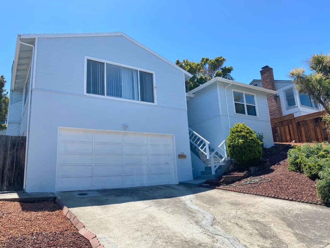
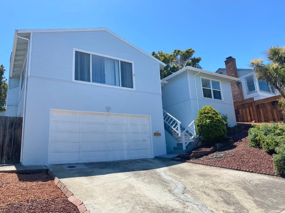
129 42nd Ave
San Mateo, CA 94403
Check Back Soon for Upcoming Availability
| Beds | Baths | Average SF |
|---|---|---|
| 3 Bedrooms 3 Bedrooms 3 Br | 2.5 Baths 2.5 Baths 2.5 Ba | 1,640 SF |
About This Property
Welcome to 129 42nd Ave, a charming property with views of the Bay. This well-maintained home features three bedrooms and two half baths, spacious living areas, modern amenities, and a prime location. The lovely kitchen boasts newer appliances and a breakfast nook with access to the backyard patio. Downstairs, you'll find two extra rooms, perfect for use as a family room, bedroom, or gym. Suitable for families and professionals alike, this property offers easy access to top-rated schools, shopping centers, dining options, and transportation hubs. Enjoy the best of San Mateo living in this comfortable and convenient home. Contact us today for more details and to schedule a viewing. Gardener included
129 42nd Ave is a house located in San Mateo County and the 94403 ZIP Code. This area is served by the San Mateo-Foster City School District attendance zone.
Located about halfway between San Francisco and San Jose, Sugarloaf is a peaceful, suburban neighborhood in San Mateo. Sugarloaf is predominantly residential, touting an array of single-family houses and apartment buildings atop scenic hillsides. However, Sugarloaf also provides plenty of shopping opportunities, from the extensive retail offerings of the Hillsdale Shopping Center to the unique finds in local shops along 37th Avenue.
Sugarloaf residents enjoy ample outdoor activities at the sprawling Laurelwood Park in addition to quick commutes for those working at the San Mateo Medical Center and the College of San Mateo. Convenience to El Camino Real, J. Arthur Younger Freeway, the Hillsdale CalTrain Station, and San Francisco International Airport makes getting around from Sugarloaf a breeze.
Learn more about living in SugarloafBelow are rent ranges for similar nearby apartments
| Colleges & Universities | Distance | ||
|---|---|---|---|
| Colleges & Universities | Distance | ||
| Drive: | 7 min | 3.4 mi | |
| Drive: | 18 min | 10.0 mi | |
| Drive: | 19 min | 12.1 mi | |
| Drive: | 26 min | 15.6 mi |
The GreatSchools Rating helps parents compare schools within a state based on a variety of school quality indicators and provides a helpful picture of how effectively each school serves all of its students. Ratings are on a scale of 1 (below average) to 10 (above average) and can include test scores, college readiness, academic progress, advanced courses, equity, discipline and attendance data. We also advise parents to visit schools, consider other information on school performance and programs, and consider family needs as part of the school selection process.
View GreatSchools Rating Methodology
Data provided by GreatSchools.org © 2026. All rights reserved.
Transportation options available in San Mateo include Millbrae (Caltrain Transfer Platform), located 9.4 miles from 129 42nd Ave. 129 42nd Ave is near San Francisco International, located 10.4 miles or 16 minutes away, and Metro Oakland International, located 26.1 miles or 35 minutes away.
| Transit / Subway | Distance | ||
|---|---|---|---|
| Transit / Subway | Distance | ||
|
|
Drive: | 15 min | 9.4 mi |
|
|
Drive: | 15 min | 10.1 mi |
| Drive: | 16 min | 10.1 mi | |
| Drive: | 16 min | 10.3 mi | |
|
|
Drive: | 16 min | 10.4 mi |
| Commuter Rail | Distance | ||
|---|---|---|---|
| Commuter Rail | Distance | ||
| Drive: | 3 min | 1.4 mi | |
| Drive: | 4 min | 1.5 mi | |
| Drive: | 6 min | 2.3 mi | |
| Drive: | 6 min | 2.4 mi | |
| Drive: | 6 min | 2.6 mi |
| Airports | Distance | ||
|---|---|---|---|
| Airports | Distance | ||
|
San Francisco International
|
Drive: | 16 min | 10.4 mi |
|
Metro Oakland International
|
Drive: | 35 min | 26.1 mi |
Time and distance from 129 42nd Ave.
| Shopping Centers | Distance | ||
|---|---|---|---|
| Shopping Centers | Distance | ||
| Walk: | 2 min | 0.1 mi | |
| Walk: | 5 min | 0.3 mi | |
| Walk: | 12 min | 0.7 mi |
| Parks and Recreation | Distance | ||
|---|---|---|---|
| Parks and Recreation | Distance | ||
|
San Mateo Arboretum
|
Drive: | 7 min | 3.0 mi |
|
Japanese Tea Garden (San Mateo)
|
Drive: | 8 min | 3.4 mi |
|
Shoreline Parks
|
Drive: | 9 min | 5.0 mi |
|
Crystal Springs Trail
|
Drive: | 12 min | 6.9 mi |
|
Pulgas Ridge Open Space Preserve
|
Drive: | 16 min | 9.7 mi |
| Hospitals | Distance | ||
|---|---|---|---|
| Hospitals | Distance | ||
| Walk: | 8 min | 0.4 mi | |
| Drive: | 12 min | 5.1 mi | |
| Drive: | 9 min | 5.3 mi |
| Military Bases | Distance | ||
|---|---|---|---|
| Military Bases | Distance | ||
| Drive: | 26 min | 17.5 mi |
You May Also Like
Similar Rentals Nearby
-
3 Beds$4,858+4 Beds$4,888+Total Monthly PriceTotal Monthly Price NewPrices include base rent and required monthly fees of $22. Variable costs based on usage may apply.Base Rent:3 Beds$4,836+4 Beds$4,866+Specials
-
-
-
-
-
-
-
-
-
What Are Walk Score®, Transit Score®, and Bike Score® Ratings?
Walk Score® measures the walkability of any address. Transit Score® measures access to public transit. Bike Score® measures the bikeability of any address.
What is a Sound Score Rating?
A Sound Score Rating aggregates noise caused by vehicle traffic, airplane traffic and local sources.