
Blue Station
2130 122nd St,
Blue Island, IL 60406
$800 - $1,575
Studio - 3 Beds
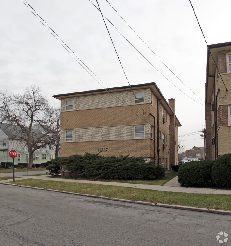
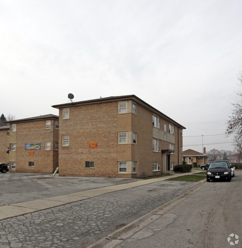

Meet your new home at 12837-12845 S Hoyne Ave in Blue Island, IL. Situated in Blue Island's 60406 Zip code, moving here gives you a variety of nearby attractions to take part in. Be sure to come for a visit to check out the apartment floorplan options. The team of leasing professionals is ready and waiting for you to visit. Stop by the leasing office to schedule your tour.
12837-12845 S Hoyne Ave is an apartment community located in Cook County and the 60406 ZIP Code. This area is served by the Cook County School District 130 attendance zone.
Blue Island earned its name from the blue haze that once drifted over a glacial ridge rising above the surrounding prairie, and that sense of standing apart from the crowd still holds today. Located about 15 miles south of the Chicago Loop in Cook County, this small city covers roughly five square miles and carries a distinctly grounded character. It grew as a commercial and industrial hub in the 19th and 20th centuries, with railroads and brick making shaping much of its early identity. Moraine Valley Community College anchors the area educationally and draws a steady stream of students and staff. The "Uptown" corridor along Western Avenue and Main Street remains the social and retail heart of the city, lined with local businesses and neighborhood taverns.
The housing stock reflects the city's working-class roots, offering a range of single-family rentals, two-flats, and smaller apartment communities.
Learn more about living in Blue Island| Colleges & Universities | Distance | ||
|---|---|---|---|
| Colleges & Universities | Distance | ||
| Drive: | 14 min | 6.1 mi | |
| Drive: | 15 min | 7.1 mi | |
| Drive: | 15 min | 7.2 mi | |
| Drive: | 17 min | 9.5 mi |


Transportation options available in Blue Island include 87Th Street Station, located 7.1 miles from 12837-12845 S Hoyne Ave. 12837-12845 S Hoyne Ave is near Chicago Midway International, located 13.6 miles or 24 minutes away, and Chicago O'Hare International, located 35.6 miles or 50 minutes away.
| Transit / Subway | Distance | ||
|---|---|---|---|
| Transit / Subway | Distance | ||
|
|
Drive: | 11 min | 7.1 mi |
|
|
Drive: | 14 min | 8.2 mi |
|
|
Drive: | 15 min | 9.0 mi |
|
|
Drive: | 17 min | 9.0 mi |
|
|
Drive: | 14 min | 9.4 mi |
| Commuter Rail | Distance | ||
|---|---|---|---|
| Commuter Rail | Distance | ||
|
|
Walk: | 5 min | 0.3 mi |
|
|
Walk: | 10 min | 0.6 mi |
|
|
Walk: | 14 min | 0.8 mi |
|
|
Drive: | 3 min | 1.2 mi |
|
|
Drive: | 3 min | 1.4 mi |
| Airports | Distance | ||
|---|---|---|---|
| Airports | Distance | ||
|
Chicago Midway International
|
Drive: | 24 min | 13.6 mi |
|
Chicago O'Hare International
|
Drive: | 50 min | 35.6 mi |
Scores provided by
Traffic
-Airport
-Businesses
-Scores provided by
HowLoud What is a Sound Score Rating? A Sound Score Rating aggregates noise caused by vehicle traffic, airplane traffic and local sources. How It WorksTime and distance from 12837-12845 S Hoyne Ave.
| Shopping Centers | Distance | ||
|---|---|---|---|
| Shopping Centers | Distance | ||
| Drive: | 3 min | 1.3 mi | |
| Drive: | 3 min | 1.5 mi |
| Parks and Recreation | Distance | ||
|---|---|---|---|
| Parks and Recreation | Distance | ||
|
Calumet Woods
|
Drive: | 7 min | 2.5 mi |
|
West Pullman Park
|
Drive: | 7 min | 3.2 mi |
|
Prospect Gardens Park
|
Drive: | 7 min | 3.3 mi |
|
Munroe Park
|
Drive: | 8 min | 3.8 mi |
|
Mt. Greenwood Park
|
Drive: | 9 min | 4.6 mi |
| Hospitals | Distance | ||
|---|---|---|---|
| Hospitals | Distance | ||
| Drive: | 9 min | 4.6 mi | |
| Drive: | 10 min | 4.7 mi | |
| Drive: | 10 min | 5.4 mi |
| Military Bases | Distance | ||
|---|---|---|---|
| Military Bases | Distance | ||
| Drive: | 52 min | 35.7 mi | |
| Drive: | 63 min | 40.7 mi | |
| Drive: | 58 min | 42.1 mi |
What Are Walk Score®, Transit Score®, and Bike Score® Ratings?
Walk Score® measures the walkability of any address. Transit Score® measures access to public transit. Bike Score® measures the bikeability of any address.
What is a Sound Score Rating?
A Sound Score Rating aggregates noise caused by vehicle traffic, airplane traffic and local sources.


