
Royal Oaks Apartments
7475 Glenmont Dr,
North Royalton, OH 44133
$1,289 - $1,572
1-2 Beds
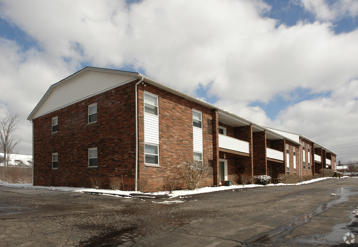
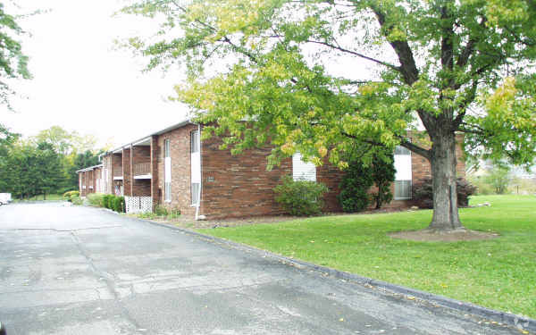
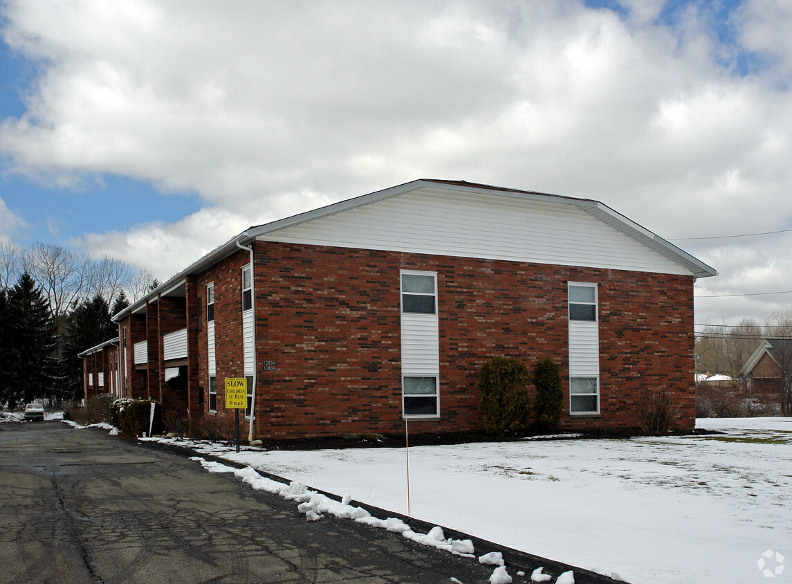

Discover your new place at 12834-12836 State Rd. The address for this community is on 12834-12836 State Rd. in North Royalton. The professional leasing team is ready to help you find your perfect floorplan. Come by to view the available floorplans. It's all waiting for you at 12834-12836 State Rd. Contact or drop by to schedule a tour.
12834-12836 State Rd is an apartment community located in Cuyahoga County and the 44133 ZIP Code. This area is served by the North Royalton City School District attendance zone.
Loosely defined by some as South Cleveland, this sprawling suburban area encompasses a number of communities in and around Medina and Brunswick, Ohio. This wide-reaching area lacks the sheer urban sprawl of Cleveland, instead offering a laid-back, affordable community for renters looking to be close to the city but want a bit more space or a touch of peace and quiet.
You’ll find affordable apartment communities with plenty of amenities, a wide variety of single-family homes, townhomes, condos, and more in South Cleveland. Its location outside of Downtown Cleveland means there’s a pastoral atmosphere and plenty of green spaces to appreciate as well. U.S. Highway 42 and Interstate 71 serve as the major thoroughfares and arteries into the city.
Learn more about living in South ClevelandCompare neighborhood and city base rent averages by bedroom.
| South Cleveland | North Royalton, OH | |
|---|---|---|
| Studio | $1,376 | $899 |
| 1 Bedroom | $1,657 | $1,139 |
| 2 Bedrooms | $1,972 | $1,387 |
| 3 Bedrooms | $2,408 | $2,274 |
| Colleges & Universities | Distance | ||
|---|---|---|---|
| Colleges & Universities | Distance | ||
| Drive: | 12 min | 5.8 mi | |
| Drive: | 16 min | 10.2 mi | |
| Drive: | 19 min | 10.6 mi | |
| Drive: | 25 min | 15.5 mi |


Transportation options available in North Royalton include Brookpark Station, located 13.1 miles from 12834-12836 State Rd. 12834-12836 State Rd is near Cleveland-Hopkins International, located 15.1 miles or 27 minutes away, and Akron-Canton Regional, located 39.5 miles or 53 minutes away.
| Transit / Subway | Distance | ||
|---|---|---|---|
| Transit / Subway | Distance | ||
| Drive: | 21 min | 13.1 mi | |
| Drive: | 22 min | 13.3 mi | |
| Drive: | 22 min | 14.8 mi |
| Commuter Rail | Distance | ||
|---|---|---|---|
| Commuter Rail | Distance | ||
| Drive: | 15 min | 8.0 mi | |
| Drive: | 18 min | 8.6 mi | |
| Drive: | 20 min | 10.2 mi | |
|
Boston Mill
|
Drive: | 23 min | 12.5 mi |
| Drive: | 23 min | 14.0 mi |
| Airports | Distance | ||
|---|---|---|---|
| Airports | Distance | ||
|
Cleveland-Hopkins International
|
Drive: | 27 min | 15.1 mi |
|
Akron-Canton Regional
|
Drive: | 53 min | 39.5 mi |
Scores provided by
Traffic
BusyAirport
CalmBusinesses
CalmScores provided by
HowLoud What is a Sound Score Rating? A Sound Score Rating aggregates noise caused by vehicle traffic, airplane traffic and local sources. How It WorksTime and distance from 12834-12836 State Rd.
| Shopping Centers | Distance | ||
|---|---|---|---|
| Shopping Centers | Distance | ||
| Walk: | 3 min | 0.2 mi | |
| Walk: | 11 min | 0.6 mi | |
| Walk: | 17 min | 0.9 mi |
| Parks and Recreation | Distance | ||
|---|---|---|---|
| Parks and Recreation | Distance | ||
|
Mill Stream Run Reservation
|
Drive: | 8 min | 4.5 mi |
|
West Creek Reservation
|
Drive: | 16 min | 6.7 mi |
|
Brecksville Nature Center
|
Drive: | 12 min | 6.9 mi |
|
Gardenview Horticultural Park
|
Drive: | 16 min | 7.7 mi |
|
Big Creek Reservation
|
Drive: | 16 min | 8.4 mi |
| Hospitals | Distance | ||
|---|---|---|---|
| Hospitals | Distance | ||
| Drive: | 9 min | 5.2 mi | |
| Drive: | 16 min | 9.9 mi | |
| Drive: | 23 min | 11.7 mi |
| Military Bases | Distance | ||
|---|---|---|---|
| Military Bases | Distance | ||
| Drive: | 81 min | 66.2 mi | |
| Drive: | 107 min | 82.1 mi |
Pets Allowed Fitness Center Pool Kitchen In Unit Washer & Dryer Clubhouse Maintenance on site
What Are Walk Score®, Transit Score®, and Bike Score® Ratings?
Walk Score® measures the walkability of any address. Transit Score® measures access to public transit. Bike Score® measures the bikeability of any address.
What is a Sound Score Rating?
A Sound Score Rating aggregates noise caused by vehicle traffic, airplane traffic and local sources.


