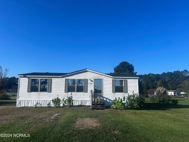
1280 Taylor Rd
Chocowinity, NC 27817
-
Bedrooms
3
-
Bathrooms
2
-
Square Feet
--
-
Available
Available Now

About This Home
Property Id: 1639945 3 Bed/2 Bath home in the country on over 1/2 acre lot. Enjoy all your favorite outdoor actives or just rest and relax in this peaceful country setting.
1280 Taylor Rd is a house located in Beaufort County and the 27817 ZIP Code. This area is served by the Beaufort County School District attendance zone.
Fees and Policies
The fees listed below are community-provided and may exclude utilities or add-ons. All payments are made directly to the property and are non-refundable unless otherwise specified. Use the Cost Calculator to determine costs based on your needs.
-
One-Time Basics
-
Due at Move-In
-
Security Deposit - RefundableCharged per unit.$1,300
-
-
Due at Move-In
Property Fee Disclaimer: Based on community-supplied data and independent market research. Subject to change without notice. May exclude fees for mandatory or optional services and usage-based utilities.
Details
Utilities Included
-
Sewer
House Features
- Oven
- Refrigerator
- Vinyl Flooring
- Lawn
Contact
- Phone Number
- Contact
-
Source

- Oven
- Refrigerator
- Vinyl Flooring
- Lawn
| Colleges & Universities | Distance | ||
|---|---|---|---|
| Colleges & Universities | Distance | ||
| Drive: | 30 min | 17.2 mi | |
| Drive: | 36 min | 19.7 mi | |
| Drive: | 37 min | 20.5 mi |


View GreatSchools Rating Methodology
Data provided by GreatSchools.org © 2026. All rights reserved.
Scores provided by
Traffic
-Airport
-Businesses
-Scores provided by
HowLoud What is a Sound Score Rating? A Sound Score Rating aggregates noise caused by vehicle traffic, airplane traffic and local sources. How It Works1280 Taylor Rd Photos
Nearby Apartments
Within 50 Miles of 1280 Taylor Rd Chocowinity, NC 27817
-
4500 Sandstone Dr
Greenville, NC 27858
$2,595
4 Br 11.1 mi
-
1815 Fox Den Way
Greenville, NC 27858
$1,895
3 Br 12.6 mi
-
1000 W Wright Rd
Greenville, NC 27858
$1,400
4 Br 13.9 mi
-
407 Biltmore St
Greenville, NC 27858
$1,500
3 Br 15.0 mi
-
5583 Core Point Rd
Blounts Creek, NC 27814
$1,700
4 Br 15.6 mi
-
3536 Lena Ln
Greenville, NC 27834
$2,250
4 Br 16.8 mi
What Are Walk Score®, Transit Score®, and Bike Score® Ratings?
Walk Score® measures the walkability of any address. Transit Score® measures access to public transit. Bike Score® measures the bikeability of any address.
What is a Sound Score Rating?
A Sound Score Rating aggregates noise caused by vehicle traffic, airplane traffic and local sources.

1280 Taylor Rd
Chocowinity, NC 27817