$3,695
/ Month
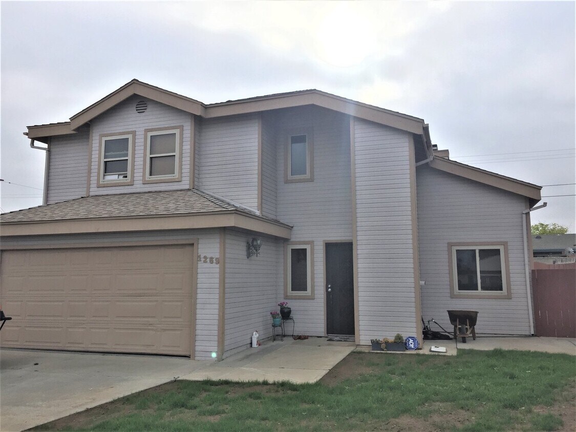
1269 15th St
San Diego, CA 92154
2 Weeks Ago
|
Edit
Favorites
-
Bedrooms
3
-
Bathrooms
2.5
-
Square Feet
1,800 sq ft
1269 15th St

Favorites
About This Home
$3,600 deposit
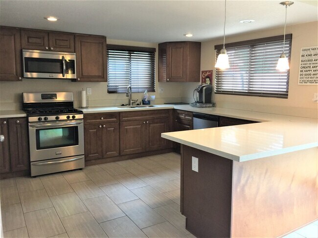
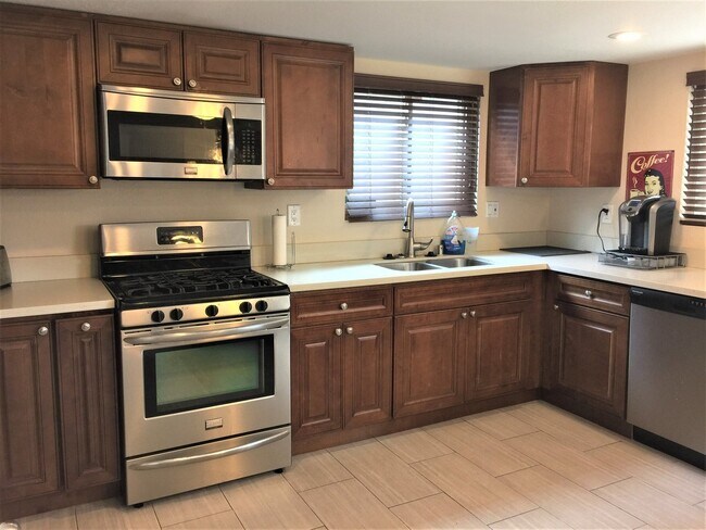
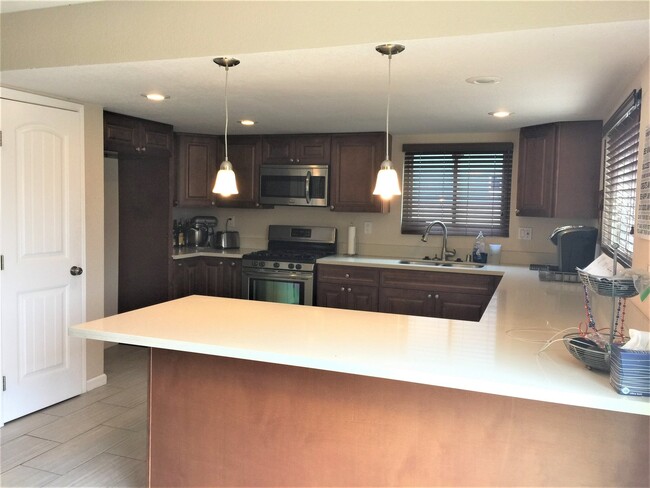
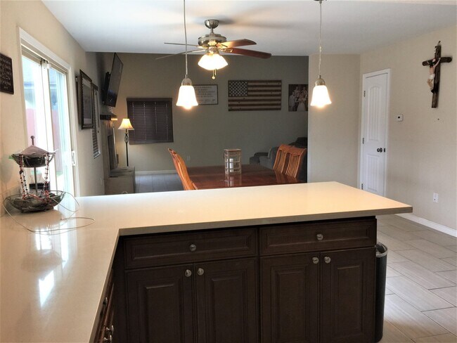
This beautiful three bedroom and two and a half bath home has all upgraded kitchen cabinets, counters, appliances, bathroom cabinets, tile, fixtures, and lighting. The home has newer upgraded tile flooring, fireplace, and beautiful vaulted ceilings. This home has solar panels for little electricity bills!! The backyard is perfect for entertaining with plenty of room to play! Beach life! So close to the beach, the Naval Base, shopping, freeways.This is a must see home for your list! All applicants must complete a PetScreening profile, even if the household does not have a pet/animal. Please see the link below or contact the office. Utopia Management x1193 DRE 01197438
1269 15th St is a house located in San Diego County and the 92154 ZIP Code. This area is served by the Sweetwater Union High attendance zone.
* Price shown is base rent. Excludes user-selected optional fees and variable or usage-based fees and required charges due at or prior to move-in or at move-out. Price, availability, fees, and any applicable rent special are subject to change without notice.
* Square footage definitions vary. Displayed square footage is approximate.
House Features
- Dishwasher
Contact
- Listed by Utopia Management Inc. | Utopia Management Inc.
Location
Get Directions
Amenities
- Dishwasher
Adjacent to the Bay and about 13 miles south of Downtown San Diego, Egger Highlands was named after the Eggers, a family who donated plots of land to build the neighborhood Catholic church. The South Bay Recreation Center pays tribute to Robert Egger, Sr. and provides activities for kids of all ages. Locals who want to spend some time in the California sun should head over to nearby Imperial Beach for a day of swimming, surfing, and beachcombing.
Egger Highlands has the vibe of a laid-back beach town, and has vibrant single-family homes and townhouses for rent. Palm Avenue serves as the busiest street in the neighborhood and has a plethora of restaurants and amenities. Casual dining options include fast and friendly NY Pizzeria to the popular Thai restaurant, Noodles Noodles.
Learn more about living in Egger Highlands
Education
| Colleges & Universities | Distance | ||
|---|---|---|---|
| Colleges & Universities | Distance | ||
| Drive: | 21 min | 11.0 mi | |
| Drive: | 16 min | 12.4 mi | |
| Drive: | 17 min | 12.8 mi | |
| Drive: | 17 min | 13.6 mi |
1269 15th St is within 21 minutes or 11.0 miles from Southwestern Coll, Chula Vista. It is also near San Diego City College and Thomas Jefferson School of Law.
Schools


Public Elementary School
Grades K-6
546 Students
Nearby
Public Elementary School
Grades K-6
384 Students
Attendance Zone
Public Middle School
Grades 7-8
552 Students
Attendance Zone
Public High School
Grades 9-12
1,376 Students
Attendance Zone
Private Elementary & Middle School
Grades K-8
182 Students
Nearby
Private Elementary, Middle & High School
Grades K-12
Nearby
School data provided by
 The GreatSchools Rating helps parents compare schools within a state based on a variety of school quality indicators and provides a helpful picture of how effectively each school serves all of its students. Ratings are on a scale of 1 (below average) to 10 (above average) and can include test scores, college readiness, academic progress, advanced courses, equity, discipline and attendance data. We also advise parents to visit schools, consider other information on school performance and programs, and consider family needs as part of the school selection process.
View GreatSchools Rating Methodology
Data provided by GreatSchools.org © 2025. All rights reserved.
View GreatSchools Rating Methodology
Data provided by GreatSchools.org © 2025. All rights reserved.
Transportation options available in San Diego include Palm Avenue, located 1.9 miles from 1269 15th St. 1269 15th St is near San Diego International, located 16.1 miles or 22 minutes away.
| Transit / Subway | Distance | ||
|---|---|---|---|
| Transit / Subway | Distance | ||
|
|
Drive: | 5 min | 1.9 mi |
|
|
Drive: | 6 min | 2.9 mi |
|
|
Drive: | 7 min | 3.3 mi |
|
|
Drive: | 8 min | 4.0 mi |
|
|
Drive: | 9 min | 4.9 mi |
| Commuter Rail | Distance | ||
|---|---|---|---|
| Commuter Rail | Distance | ||
|
|
Drive: | 19 min | 13.5 mi |
|
|
Drive: | 21 min | 16.7 mi |
|
|
Drive: | 35 min | 28.3 mi |
|
|
Drive: | 44 min | 35.4 mi |
|
|
Drive: | 48 min | 39.1 mi |
| Airports | Distance | ||
|---|---|---|---|
| Airports | Distance | ||
|
San Diego International
|
Drive: | 22 min | 16.1 mi |
Time and distance from 1269 15th St.
| Shopping Centers | Distance | ||
|---|---|---|---|
| Shopping Centers | Distance | ||
| Walk: | 9 min | 0.5 mi | |
| Walk: | 13 min | 0.7 mi | |
| Walk: | 15 min | 0.8 mi |
1269 15th St has 3 shopping centers within 0.8 mile, which is about a 15-minute walk. The miles and minutes will be for the farthest away property.
| Parks and Recreation | Distance | ||
|---|---|---|---|
| Parks and Recreation | Distance | ||
|
Tijuana Slough National Wildlife Refuge
|
Drive: | 4 min | 1.7 mi |
|
Tijuana River National Estuarine Research Reserve
|
Drive: | 4 min | 1.7 mi |
|
Otay Valley Regional Park
|
Drive: | 6 min | 2.9 mi |
|
Tijuana River Valley Regional Park
|
Drive: | 10 min | 4.0 mi |
|
Border Field State Park
|
Drive: | 15 min | 5.4 mi |
1269 15th St has 5 parks within 5.4 miles, including Tijuana Slough National Wildlife Refuge, Tijuana River National Estuarine Research Reserve, and Tijuana River Valley Regional Park.
| Hospitals | Distance | ||
|---|---|---|---|
| Hospitals | Distance | ||
| Drive: | 14 min | 7.4 mi | |
| Drive: | 15 min | 10.6 mi | |
| Drive: | 18 min | 11.1 mi |
1269 15th St has 3 hospitals within 11.1 miles, the nearest is Sharp Chula Vista Medical Center which is 7.4 miles away and a 14 minute drive.
| Military Bases | Distance | ||
|---|---|---|---|
| Military Bases | Distance | ||
| Drive: | 12 min | 8.1 mi | |
| Drive: | 14 min | 9.8 mi |
1269 15th St is 8.1 miles from San Diego Naval Air Station, and is convenient to other military bases, including US Naval Amphibious Base.
You May Also Like
Similar Rentals Nearby


What Are Walk Score®, Transit Score®, and Bike Score® Ratings?
Walk Score® measures the walkability of any address. Transit Score® measures access to public transit. Bike Score® measures the bikeability of any address.
What is a Sound Score Rating?
A Sound Score Rating aggregates noise caused by vehicle traffic, airplane traffic and local sources

1269 15th St
San Diego, CA 92154