

$3,100
/ Month
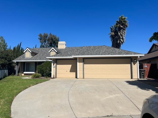
1258 La Paz Ct
Soledad, CA 93960
Favorites
1258 La Paz Ct

Favorites
Check Back Soon for Upcoming Availability
| Beds | Baths | Average SF |
|---|---|---|
| 4 Bedrooms 4 Bedrooms 4 Br | 2 Baths 2 Baths 2 Ba | 1,679 SF |
Fees and Policies
The fees listed below are community-provided and may exclude utilities or add-ons. All payments are made directly to the property and are non-refundable unless otherwise specified.
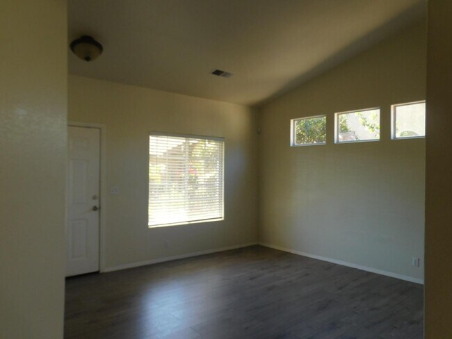
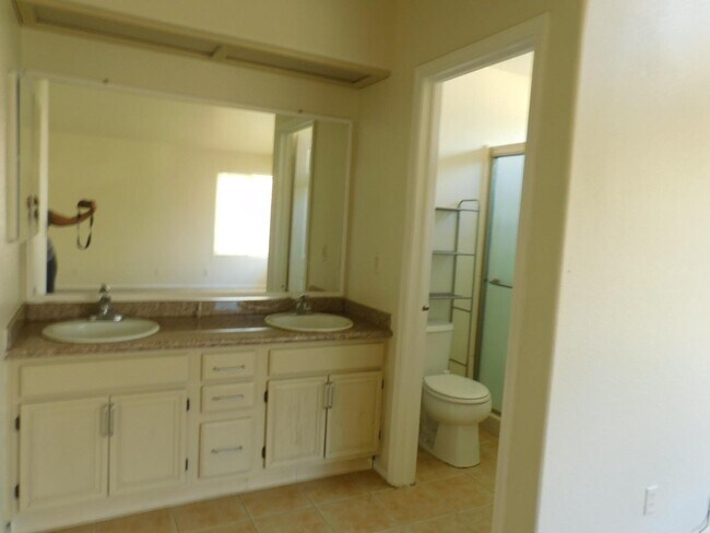
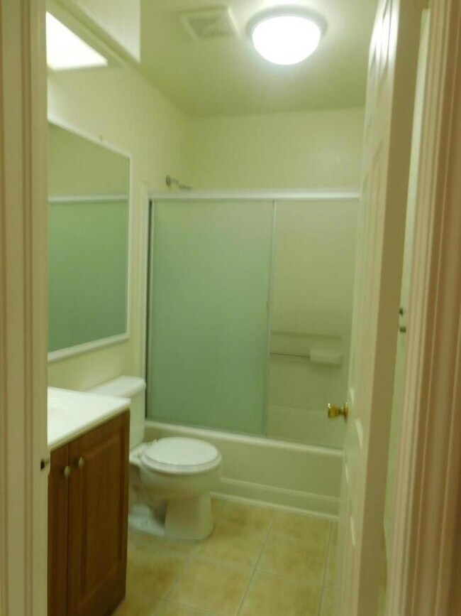
About This Property
Executive home on a cul de sac lot. La Cuesta Views home is four bedroom and two full baths. Three car garage. Great area right across the street from Rose Ferrero School. Move in condition. Laminate floors, indoor washroom, work bench in garage. Nice neighborhood. No Pets please.
1258 La Paz Ct is a house located in Monterey County and the 93960 ZIP Code. This area is served by the Soledad Unified School District attendance zone.
House Features
- Fireplace
1258 La Paz Ct,
Soledad,
CA
93960
Amenities
- Fireplace
Education
| Colleges & Universities | Distance | ||
|---|---|---|---|
| Colleges & Universities | Distance | ||
| Drive: | 38 min | 28.3 mi | |
| Drive: | 52 min | 37.2 mi | |
| Drive: | 58 min | 44.7 mi | |
| Drive: | 68 min | 54.1 mi |
1258 La Paz Ct is within 38 minutes or 28.3 miles from Hartnell College. It is also near Cal State Monterey Bay and Naval Postgraduate School.
Schools


Public Elementary School
Grades K-5
530 Students
Attendance Zone
Public Middle School
Grades 6-8
754 Students
Attendance Zone
Public High School
Grades 9-12
1,546 Students
Attendance Zone
Private Elementary & Middle School
Grades PK-8
396 Students
Nearby
Private Elementary, Middle & High School
Grades K-12
Nearby
School data provided by
 The GreatSchools Rating helps parents compare schools within a state based on a variety of school quality indicators and provides a helpful picture of how effectively each school serves all of its students. Ratings are on a scale of 1 (below average) to 10 (above average) and can include test scores, college readiness, academic progress, advanced courses, equity, discipline and attendance data. We also advise parents to visit schools, consider other information on school performance and programs, and consider family needs as part of the school selection process.
View GreatSchools Rating Methodology
Data provided by GreatSchools.org © 2026. All rights reserved.
View GreatSchools Rating Methodology
Data provided by GreatSchools.org © 2026. All rights reserved.
Walkability Near 1258 La Paz Ct Soledad, CA 93960
Getting Around
 What do Walkability, Transit, Drivability, and Bikeability mean?
Walkability measures the walking distance to day-to-day needs.
Transit measures access to public transportation.
Drivability measures congestion, parking availability, and access to major roads.
Bikeability measures the suitability for cycling.
How It Works
What do Walkability, Transit, Drivability, and Bikeability mean?
Walkability measures the walking distance to day-to-day needs.
Transit measures access to public transportation.
Drivability measures congestion, parking availability, and access to major roads.
Bikeability measures the suitability for cycling.
How It Works
Somewhat Walkable
Walkability
30
/ 100
Minimal Public Transit
Transit
0
/ 100
Exceptionally Drivable
Drivability
100
/ 100
Fairly Bikeable
Bikeability
40
/ 100
Scores provided by
-
Soundscore™
-
/ 100
Traffic
-Airport
-Businesses
-Scores provided by
HowLoud What is a Sound Score Rating? A Sound Score Rating aggregates noise caused by vehicle traffic, airplane traffic and local sources. How It WorksSimilar Rentals Nearby


What Are Walk Score®, Transit Score®, and Bike Score® Ratings?
Walk Score® measures the walkability of any address. Transit Score® measures access to public transit. Bike Score® measures the bikeability of any address.
What is a Sound Score Rating?
A Sound Score Rating aggregates noise caused by vehicle traffic, airplane traffic and local sources.

1258 La Paz Ct
Soledad, CA 93960