

$2,600
/ Month
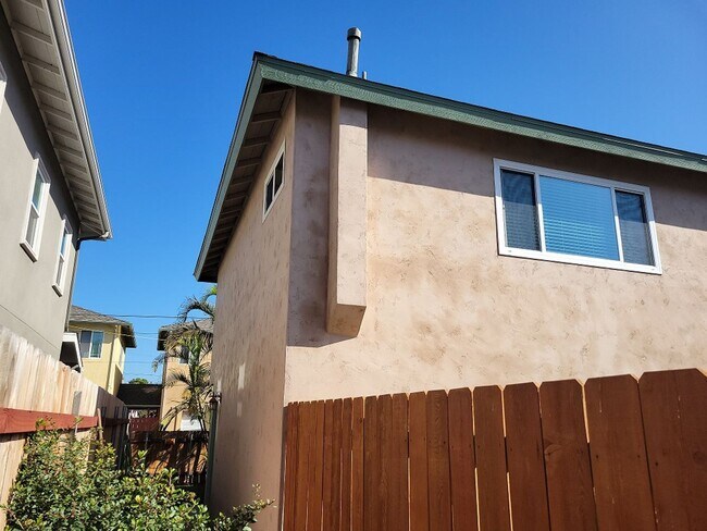
1255 12th St
Imperial Beach, CA 91932
2 Weeks Ago
|
Edit
Favorites
1255 12th St

Favorites
Check Back Soon for Upcoming Availability
| Beds | Baths | Average SF |
|---|---|---|
| 2 Bedrooms 2 Bedrooms 2 Br | 1 Bath 1 Bath 1 Ba | 1,200 SF |
About This Property
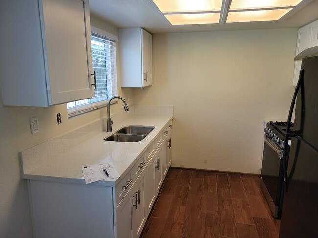
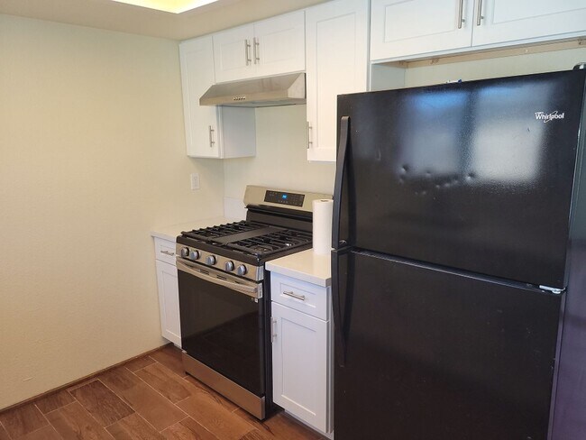
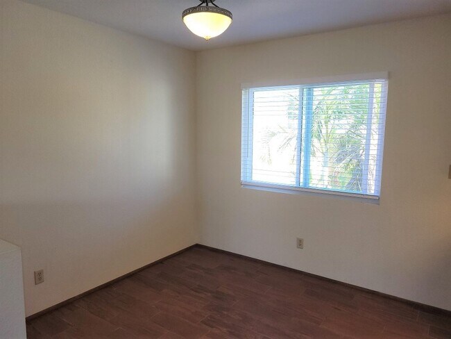
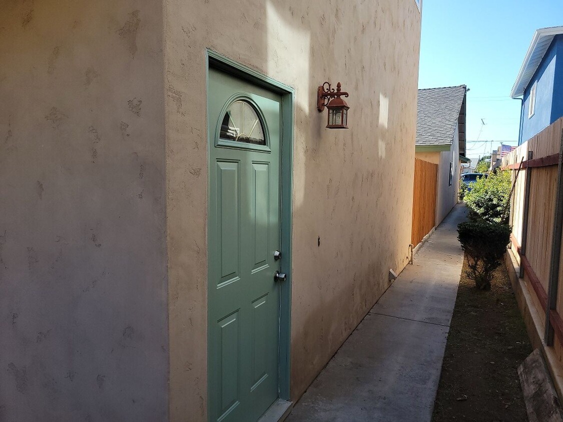
Remodeled 2 bedroom, 1 bath, with 2 car attached garage. This is an upstairs unit built above the garage. It is approximately 1200 sq ft and has remodeled kitchen, bath, new carpet, fresh paint, and is very spacious for its size. It is ready for occupancy. Minimum 1 year lease, no pets allowed. Owner provides all appliances but does not maintain the washer or dryer. Available Now, Deposit same as rent, No Pets, min credit score 640
1255 12th St is a house located in San Diego County and the 91932 ZIP Code. This area is served by the Sweetwater Union High attendance zone.
Location
Get Directions
Situated along the Pacific Ocean between San Diego Bay National Wildlife Refuge and Border Field State Park, Imperial Beach is a tropical oasis just 14 miles south of San Diego. The city hugs the coast to the US-Mexico border and is just five miles northwest of Tijuana, Mexico. Imperial Beach offers four miles of beaches and is connected to Coronado by the popular Silver Strand.
For beautiful ocean views, head to Imperial Beach Pier. While you’re there, have dinner at the popular Tin Fish. Head to Dunes Park and enjoy swimming, surfing, and beach volleyball. If you’re considering an Imperial Beach apartment, you’ll enjoy more than sand, sun, and surf – this city is filled with top-rated restaurants, from IB Street Tacos to Aroma Thai; amazing wildlife at parks like the Tijuana Slough National Wildlife Refuge; and terrific shopping along Palm Avenue.
Learn more about living in Imperial Beach
Education
| Colleges & Universities | Distance | ||
|---|---|---|---|
| Colleges & Universities | Distance | ||
| Drive: | 21 min | 11.3 mi | |
| Drive: | 17 min | 12.8 mi | |
| Drive: | 18 min | 13.2 mi | |
| Drive: | 18 min | 13.9 mi |
1255 12th St is within 21 minutes or 11.3 miles from Southwestern Coll, Chula Vista. It is also near San Diego City College and Calif. Western School of Law.
Schools


Public Elementary School
Grades K-6
546 Students
Nearby
Public Elementary School
Grades K-6
387 Students
Attendance Zone
Public Middle School
Grades 7-8
552 Students
Attendance Zone
Public High School
Grades 9-12
1,376 Students
Attendance Zone
Private Elementary & Middle School
Grades K-8
182 Students
Nearby
Private Elementary, Middle & High School
Grades K-12
Nearby
Private Elementary, Middle & High School
Grades 1-12
Nearby
School data provided by
 The GreatSchools Rating helps parents compare schools within a state based on a variety of school quality indicators and provides a helpful picture of how effectively each school serves all of its students. Ratings are on a scale of 1 (below average) to 10 (above average) and can include test scores, college readiness, academic progress, advanced courses, equity, discipline and attendance data. We also advise parents to visit schools, consider other information on school performance and programs, and consider family needs as part of the school selection process.
View GreatSchools Rating Methodology
Data provided by GreatSchools.org © 2025. All rights reserved.
View GreatSchools Rating Methodology
Data provided by GreatSchools.org © 2025. All rights reserved.
Transportation options available in Imperial Beach include Palm Avenue, located 2.2 miles from 1255 12th St. 1255 12th St is near San Diego International, located 16.4 miles or 23 minutes away.
| Transit / Subway | Distance | ||
|---|---|---|---|
| Transit / Subway | Distance | ||
|
|
Drive: | 5 min | 2.2 mi |
|
|
Drive: | 7 min | 3.3 mi |
|
|
Drive: | 8 min | 3.7 mi |
|
|
Drive: | 9 min | 4.4 mi |
|
|
Drive: | 9 min | 5.3 mi |
| Commuter Rail | Distance | ||
|---|---|---|---|
| Commuter Rail | Distance | ||
|
|
Drive: | 20 min | 13.9 mi |
|
|
Drive: | 22 min | 17.0 mi |
|
|
Drive: | 36 min | 28.6 mi |
|
|
Drive: | 45 min | 35.8 mi |
|
|
Drive: | 48 min | 39.4 mi |
| Airports | Distance | ||
|---|---|---|---|
| Airports | Distance | ||
|
San Diego International
|
Drive: | 23 min | 16.4 mi |
Time and distance from 1255 12th St.
| Shopping Centers | Distance | ||
|---|---|---|---|
| Shopping Centers | Distance | ||
| Walk: | 5 min | 0.3 mi | |
| Walk: | 14 min | 0.7 mi | |
| Drive: | 3 min | 1.2 mi |
1255 12th St has 3 shopping centers within 1.2 miles, which is about a 3-minute drive. The miles and minutes will be for the farthest away property.
| Parks and Recreation | Distance | ||
|---|---|---|---|
| Parks and Recreation | Distance | ||
|
Tijuana Slough National Wildlife Refuge
|
Drive: | 4 min | 1.4 mi |
|
Tijuana River National Estuarine Research Reserve
|
Drive: | 4 min | 1.4 mi |
|
Otay Valley Regional Park
|
Drive: | 7 min | 3.2 mi |
|
Tijuana River Valley Regional Park
|
Drive: | 11 min | 4.3 mi |
|
Border Field State Park
|
Drive: | 16 min | 5.8 mi |
1255 12th St has 5 parks within 5.8 miles, including Tijuana Slough National Wildlife Refuge, Tijuana River National Estuarine Research Reserve, and Tijuana River Valley Regional Park.
| Hospitals | Distance | ||
|---|---|---|---|
| Hospitals | Distance | ||
| Drive: | 15 min | 7.8 mi | |
| Drive: | 17 min | 10.7 mi | |
| Drive: | 16 min | 10.9 mi |
1255 12th St has 3 hospitals within 10.9 miles, the nearest is Sharp Chula Vista Medical Center which is 7.8 miles away and a 15 minute drive.
| Military Bases | Distance | ||
|---|---|---|---|
| Military Bases | Distance | ||
| Drive: | 13 min | 8.4 mi | |
| Drive: | 14 min | 9.4 mi |
1255 12th St is 8.4 miles from San Diego Naval Air Station, and is convenient to other military bases, including US Naval Amphibious Base.
You May Also Like
Similar Rentals Nearby


What Are Walk Score®, Transit Score®, and Bike Score® Ratings?
Walk Score® measures the walkability of any address. Transit Score® measures access to public transit. Bike Score® measures the bikeability of any address.
What is a Sound Score Rating?
A Sound Score Rating aggregates noise caused by vehicle traffic, airplane traffic and local sources
1255 12th St
Imperial Beach, CA 91932