

$6,900
/ Month
1251 Bryant St
Palo Alto, CA 94301
2 Weeks Ago
Favorites
1251 Bryant St

Favorites
Check Back Soon for Upcoming Availability
| Beds | Baths | Average SF |
|---|---|---|
| 3 Bedrooms 3 Bedrooms 3 Br | 3 Baths 3 Baths 3 Ba | 1,500 SF |
Fees and Policies
The fees below are based on community-supplied data and may exclude additional fees and utilities.
- Parking
-
Garage--
About This Property
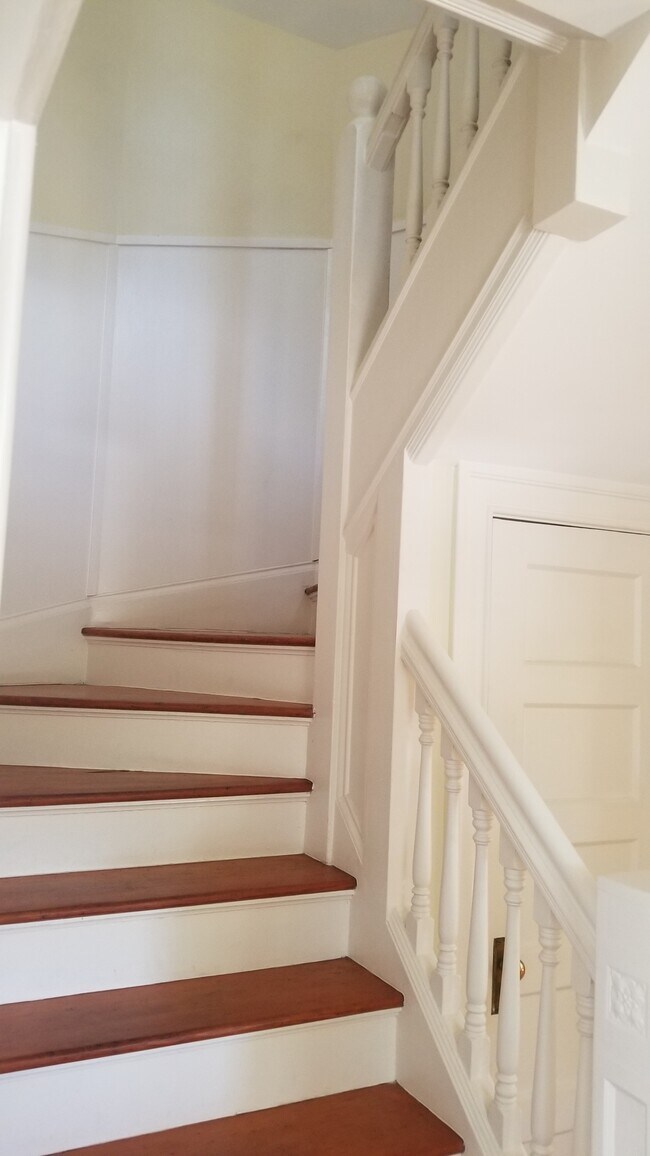
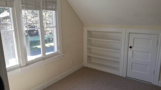
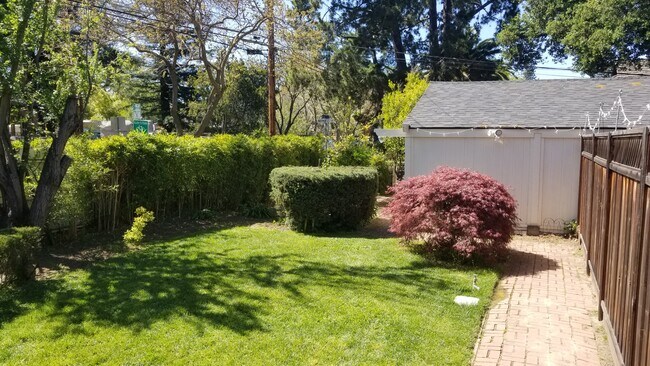
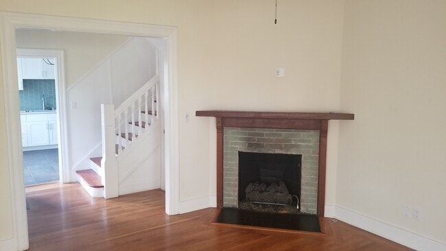
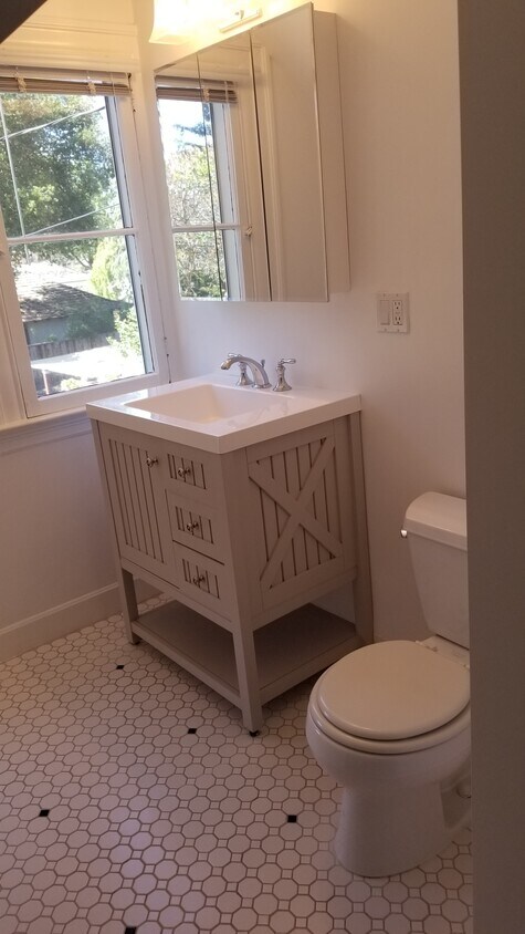
This Professorville duplex is located minutes from University ave, Town & Country, and Stanford. Please contact us with any questions. Thank you. • 3 bedroom 3 bathroom • Hardwood floors • Updated Kitchen • Updated Bathrooms • Large Backyard • Gas Fireplace • 2 spaces in detached garage + storage • Walking distance to University, Stanford, Town and Country, Whole Foods, Castilleja, Paly • 1 year lease minimum • Security - one months rent • Yard service included in rent
1251 Bryant St is a townhome located in Santa Clara County and the 94301 ZIP Code.
Townhome Features
Washer/Dryer
Dishwasher
Hardwood Floors
Fireplace
- Washer/Dryer
- Fireplace
- Dishwasher
- Hardwood Floors
- Storage Space
- Yard
- Garden
Location
Get Directions
An outgoing vibe emanates from the Downtown North neighborhood. Downtown North provides an energy like no other in Palo Alto. Still, locals enjoy being part of a tight-knit community focused on safety, communication and most importantly: fun.
Palo Alto has one of the best public school systems in California, houses Stanford University, and has some of the most delicious dining and exciting shopping opportunities in the Bay Area. The placement of the city provides convenience for commuters to San Jose 24 miles to the Southeast or San Francisco 32 miles to the Northwest.
Learn more about living in Downtown Palo AltoBelow are rent ranges for similar nearby apartments
| Beds | Average Size | Lowest | Typical | Premium |
|---|---|---|---|---|
| Studio Studio Studio | 485 Sq Ft | $1,950 | $2,890 | $3,830 |
| 1 Bed 1 Bed 1 Bed | 653-656 Sq Ft | $2,560 | $3,715 | $5,400 |
| 2 Beds 2 Beds 2 Beds | 1003 Sq Ft | $3,688 | $5,402 | $12,560 |
| 3 Beds 3 Beds 3 Beds | 1756 Sq Ft | $5,100 | $7,642 | $10,500 |
| 4 Beds 4 Beds 4 Beds | 4111 Sq Ft | $9,000 | $22,000 | $35,000 |
Amenities
- Washer/Dryer
- Fireplace
- Dishwasher
- Hardwood Floors
- Storage Space
- Yard
- Garden
Education
| Colleges & Universities | Distance | ||
|---|---|---|---|
| Colleges & Universities | Distance | ||
| Drive: | 6 min | 2.0 mi | |
| Drive: | 8 min | 3.1 mi | |
| Drive: | 11 min | 4.1 mi | |
| Drive: | 16 min | 8.5 mi |
1251 Bryant St is within 6 minutes or 2.0 miles from Stanford University. It is also near Menlo College and Foothill College, Middlefield.
Transportation options available in Palo Alto include Mountain View Station, located 5.6 miles from 1251 Bryant St. 1251 Bryant St is near Norman Y Mineta San Jose International, located 14.7 miles or 23 minutes away, and San Francisco International, located 20.8 miles or 30 minutes away.
| Transit / Subway | Distance | ||
|---|---|---|---|
| Transit / Subway | Distance | ||
| Drive: | 12 min | 5.6 mi | |
|
|
Drive: | 12 min | 5.6 mi |
| Drive: | 12 min | 7.2 mi | |
|
|
Drive: | 13 min | 7.3 mi |
|
|
Drive: | 14 min | 7.8 mi |
| Commuter Rail | Distance | ||
|---|---|---|---|
| Commuter Rail | Distance | ||
| Walk: | 17 min | 0.9 mi | |
| Drive: | 3 min | 1.4 mi | |
| Drive: | 5 min | 2.0 mi | |
| Drive: | 6 min | 2.5 mi | |
| Drive: | 10 min | 4.2 mi |
| Airports | Distance | ||
|---|---|---|---|
| Airports | Distance | ||
|
Norman Y Mineta San Jose International
|
Drive: | 23 min | 14.7 mi |
|
San Francisco International
|
Drive: | 30 min | 20.8 mi |
Time and distance from 1251 Bryant St.
| Shopping Centers | Distance | ||
|---|---|---|---|
| Shopping Centers | Distance | ||
| Walk: | 9 min | 0.5 mi | |
| Drive: | 4 min | 1.3 mi | |
| Drive: | 4 min | 1.4 mi |
1251 Bryant St has 3 shopping centers within 1.4 miles, which is about a 4-minute walk. The miles and minutes will be for the farthest away property.
| Parks and Recreation | Distance | ||
|---|---|---|---|
| Parks and Recreation | Distance | ||
|
Gamble Garden
|
Walk: | 4 min | 0.2 mi |
|
Junior Museum and Zoo
|
Walk: | 11 min | 0.6 mi |
|
Rinconada Park
|
Walk: | 14 min | 0.7 mi |
|
Hopkins Creekside Park
|
Drive: | 5 min | 1.7 mi |
|
El Palo Alto Park
|
Drive: | 7 min | 2.3 mi |
1251 Bryant St has 5 parks within 2.3 miles, including Gamble Garden, Junior Museum and Zoo, and Rinconada Park.
| Hospitals | Distance | ||
|---|---|---|---|
| Hospitals | Distance | ||
| Drive: | 4 min | 1.6 mi | |
| Drive: | 6 min | 2.1 mi | |
| Drive: | 13 min | 7.2 mi |
1251 Bryant St has 3 hospitals within 7.2 miles, the nearest is Lucile Salter Packard Children's Hospital at Stanford which is 1.6 miles away and a 4 minute drive.
| Military Bases | Distance | ||
|---|---|---|---|
| Military Bases | Distance | ||
| Drive: | 16 min | 7.6 mi |
1251 Bryant St is 7.6 miles and a 16 minute drive from Ames Research Center.
You May Also Like
Similar Rentals Nearby


What Are Walk Score®, Transit Score®, and Bike Score® Ratings?
Walk Score® measures the walkability of any address. Transit Score® measures access to public transit. Bike Score® measures the bikeability of any address.
What is a Sound Score Rating?
A Sound Score Rating aggregates noise caused by vehicle traffic, airplane traffic and local sources
1251 Bryant St
Palo Alto, CA 94301