

$1,825
/ Month
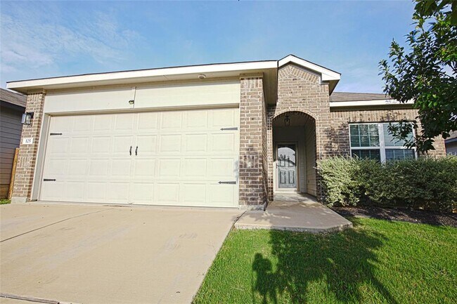
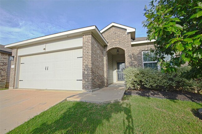
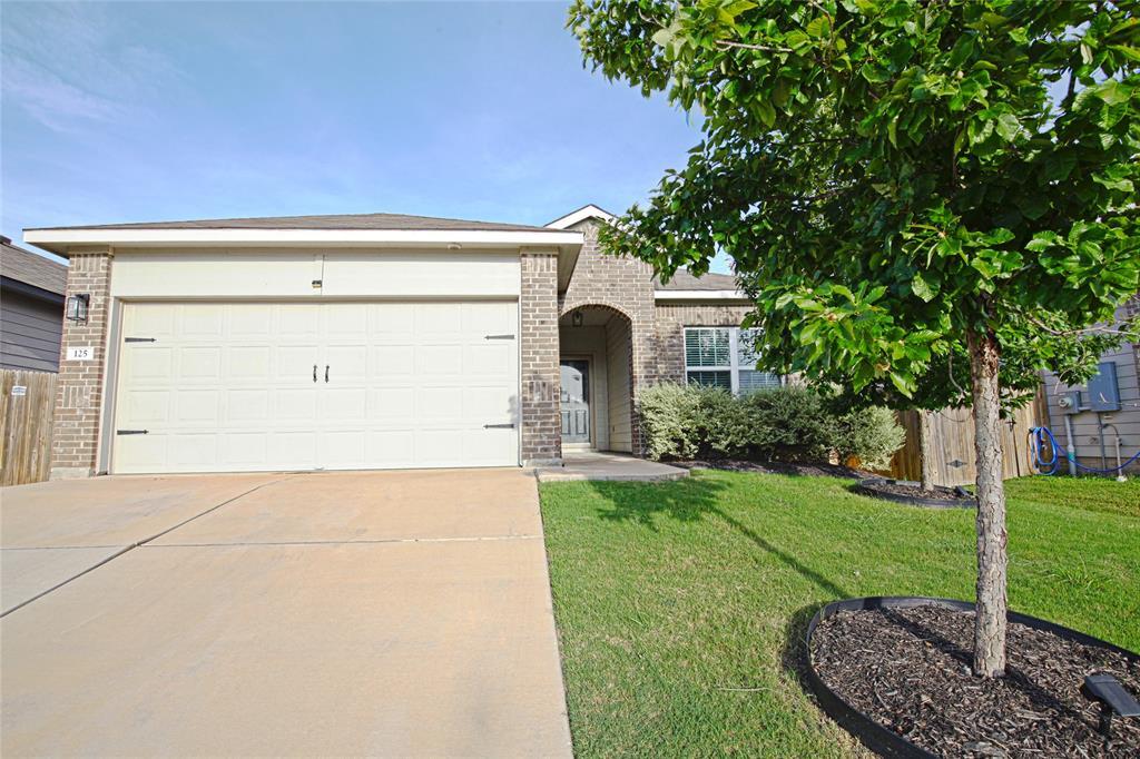
125 Presidential Path
Liberty Hill, TX 78642
Today
Favorites
512-422-8093
-
Bedrooms
3
-
Bathrooms
2
-
Square Feet
1,395 sq ft
-
Available
Available Oct 24
Highlights
- Granite Countertops
- Community Pool
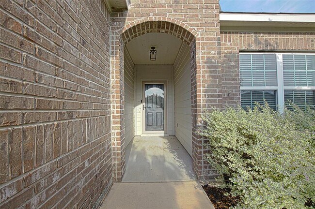
- Covered Patio or Porch
- 2 Car Attached Garage
- Interior Lot
- Community Playground
125 Presidential Path

Favorites
About This Home
Available Oct 24
This lovely one story home is located in the community of Liberty Parke. This home offers a great layout with 3 bedrooms and 2 bathrooms, lots of natural light, stainless steel appliances, upgraded features throughout. This community has resort style amenities which include a pool, playground, dog park and trails. Schedule your tour today!
125 Presidential Path is a house located in Williamson County and the 78642 ZIP Code. This area is served by the Liberty Hill Independent attendance zone.
* Price shown is base rent. Excludes user-selected optional fees and variable or usage-based fees and required charges due at or prior to move-in or at move-out. Price, availability, fees, and any applicable rent special are subject to change without notice.
* Square footage definitions vary. Displayed square footage is approximate.
Home Details
Home Type
Single Family Detached Home
Year Built
Built in 2019 | Under Construction
Accessible Home Design
No Interior Steps
Bedrooms and Bathrooms
3 Main Level Bedrooms
2 Full Bathrooms
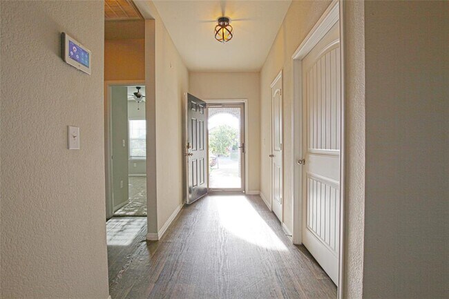
Flooring
Carpet
Vinyl
Home Design
Masonry Siding
Composition Roof
HardiePlank Type
Slab Foundation
Home Security
Fire and Smoke Detector
Interior Spaces
Recessed Lighting
1-Story Property
1,395 Sq Ft Home
Kitchen
Granite Countertops
Electric Cooktop
Free-Standing Range
ENERGY STAR Qualified Appliances
Microwave
Dishwasher
Listing and Financial Details
Security Deposit $1,825
12 Month Lease Term
$65 Application Fee
Assessor Parcel Number 152802020T0040
Tenant pays for all utilities
Lot Details
Interior Lot
West Facing Home
Wood Fence
Level Lot
Lot Dimensions are 50x120
Dense Growth Of Small Trees
Outdoor Features
Covered Patio or Porch
Parking
2 Car Attached Garage
Front Facing Garage
Schools
Bill Burden Elementary School
Liberty Hill Intermediate
Liberty Hill High School
Utilities
Central Heating and Cooling System
Vented Exhaust Fan
Community Details
Amenities
Common Area
Community Mailbox
Overview
Property has a Home Owners Association
Built by DR HORTON, AMERICA'S BUILDER
Property managed by AVANTA360
Liberty Parke Subdivision
Pet Policy
Pets allowed on a case-by-case basis
Recreation
Community Pool
Community Playground
Trails
Dog Park
Fees and Policies
The fees below are based on community-supplied data and may exclude additional fees and utilities.
Pet policies are negotiable.
Contact
- Listed by Kirby Taylor | AMG Austin Group, LLC
- Phone Number
- Contact
-
Source
 Austin Board of REALTORS®
The information included in this listing is provided exclusively for consumers’ personal, non-commercial use and may not be used for any purpose other than to identify prospective properties consumers may be interested in purchasing. The information on each listing is furnished by the owner and deemed reliable to the best of his/her knowledge, but should be verified by the purchaser. ABoR, ACTRIS and Estately assume no responsibility for typographical errors, misprints or misinformation. This property listing is offered without respect to any protected classes in accordance with the law. Copyright © 2025.
Location
Get Directions
Amenities
- Dishwasher
- Microwave
- Carpet
- Vinyl Flooring
Formed from remnants of small ranching and farming villages, Liberty Hill has transformed into one of the fastest growing communities in the Austin metro area. Residents are drawn to Liberty Hill for its scenic hill-laden landscape, relaxed atmosphere, excellent schools, and abundant opportunities.
Situated between the North and South Forks of the San Gabriel River, Liberty Hill is convenient to all kinds of outdoor adventure. Nearby parks include Canyonlands National Wildlife Refuge, Southwest Williamson County Regional Park, and Pace Bend Park. Liberty Hill is also just a short drive away from Inner Space Cavern.
Shopping options in Liberty Hill range from local stores in town to national retailers in nearby Lakeline Mall and Round Rock Premium Outlets. Metropolitan delights abound in Austin, which is less than an hour’s drive from Liberty Hill. Quick access to Route 29 makes getting around from Liberty Hill easy.
Learn more about living in Liberty Hill
Education
| Colleges & Universities | Distance | ||
|---|---|---|---|
| Colleges & Universities | Distance | ||
| Drive: | 24 min | 14.8 mi | |
| Drive: | 21 min | 15.4 mi | |
| Drive: | 30 min | 20.8 mi | |
| Drive: | 32 min | 21.2 mi |
125 Presidential Path is within 24 minutes or 14.8 miles from Southwestern University. It is also near Austin C.C., Cypress Creek and Austin C.C., Round Rock Campus.
Schools


Public Elementary School
Grades PK-5
704 Students
Attendance Zone
Public Elementary School
Grades PK-5
808 Students
Nearby
Public Middle School
Grades 6-8
944 Students
Attendance Zone
Public High School
Grades 9-12
2,001 Students
Attendance Zone
Private Elementary, Middle & High School
Grades PK-12
Nearby
School data provided by
 The GreatSchools Rating helps parents compare schools within a state based on a variety of school quality indicators and provides a helpful picture of how effectively each school serves all of its students. Ratings are on a scale of 1 (below average) to 10 (above average) and can include test scores, college readiness, academic progress, advanced courses, equity, discipline and attendance data. We also advise parents to visit schools, consider other information on school performance and programs, and consider family needs as part of the school selection process.
View GreatSchools Rating Methodology
Data provided by GreatSchools.org © 2025. All rights reserved.
View GreatSchools Rating Methodology
Data provided by GreatSchools.org © 2025. All rights reserved.
Transportation options available in Liberty Hill include Leander Station, located 6.5 miles from 125 Presidential Path. 125 Presidential Path is near Robert Gray AAF, located 36.0 miles or 57 minutes away, and Killeen Municipal, located 42.1 miles or 56 minutes away.
| Transit / Subway | Distance | ||
|---|---|---|---|
| Transit / Subway | Distance | ||
| Drive: | 10 min | 6.5 mi |
| Commuter Rail | Distance | ||
|---|---|---|---|
| Commuter Rail | Distance | ||
|
|
Drive: | 41 min | 32.0 mi |
|
|
Drive: | 50 min | 35.1 mi |
| Airports | Distance | ||
|---|---|---|---|
| Airports | Distance | ||
|
Robert Gray AAF
|
Drive: | 57 min | 36.0 mi |
|
Killeen Municipal
|
Drive: | 56 min | 42.1 mi |
Time and distance from 125 Presidential Path.
| Shopping Centers | Distance | ||
|---|---|---|---|
| Shopping Centers | Distance | ||
| Walk: | 17 min | 0.9 mi | |
| Walk: | 19 min | 1.0 mi | |
| Drive: | 4 min | 2.0 mi |
125 Presidential Path has 3 shopping centers within 2.0 miles, which is about a 4-minute walk. The miles and minutes will be for the farthest away property.
| Parks and Recreation | Distance | ||
|---|---|---|---|
| Parks and Recreation | Distance | ||
|
Garey Park
|
Drive: | 23 min | 10.8 mi |
|
Austin Steam Train
|
Drive: | 17 min | 12.0 mi |
125 Presidential Path has 2 parks within 12.0 miles, including Garey Park, and Austin Steam Train.
| Hospitals | Distance | ||
|---|---|---|---|
| Hospitals | Distance | ||
| Drive: | 18 min | 11.9 mi |
125 Presidential Path is 11.9 miles and a 18 minute drive from Cedar Park Regional Medical Center.
| Military Bases | Distance | ||
|---|---|---|---|
| Military Bases | Distance | ||
| Drive: | 63 min | 47.2 mi |
125 Presidential Path is 47.2 miles and a 63 minute drive from Fort Hood.
You May Also Like
Similar Rentals Nearby
-
-
1 / 12

-
-
1 / 32

-
-
-
-
1 / 10

-
-


What Are Walk Score®, Transit Score®, and Bike Score® Ratings?
Walk Score® measures the walkability of any address. Transit Score® measures access to public transit. Bike Score® measures the bikeability of any address.
What is a Sound Score Rating?
A Sound Score Rating aggregates noise caused by vehicle traffic, airplane traffic and local sources
125 Presidential Path
Liberty Hill, TX 78642