$2,600
/ Month
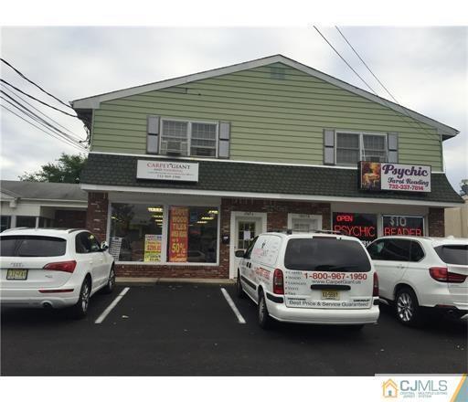
1247 Roosevelt Ave Unit C
Carteret, NJ 07008
Favorites
1247 Roosevelt Ave Unit C

Favorites
Check Back Soon for Upcoming Availability
| Beds | Baths | Average SF |
|---|---|---|
| 5 Bedrooms 5 Bedrooms 5 Br | 2 Baths 2 Baths 2 Ba | — |
Fees and Policies
Details
Lease Options
-
12 Months
About This Property
Conveniently located 2nd level apartment of a mix use property. 5 Bedrooms with 2 additional rooms could be use as an office or playroom 2 full baths. Plenty of parking,Lots of sunlight,great location,near shopping. Great for commuters,bus and train minutes away
1247 Roosevelt Ave is an apartment community located in Middlesex County and the 07008 ZIP Code.
Features
Washer/Dryer
Air Conditioning
Carpet
Dining Room
- Washer/Dryer
- Air Conditioning
- Kitchen
- Carpet
- Vinyl Flooring
- Dining Room
1247 Roosevelt Ave,
Carteret,
NJ
07008
Carteret, a borough in northeastern Middlesex County, sits along the Arthur Kill waterway and bills itself as the "Center of it All," a nod to its central location just 22 miles from Manhattan and 10 miles from Newark. Named after Sir George Carteret, one of the earliest proprietors of the province of New Jersey, the borough has a rich history dating back to its founding in 1906. Renters looking at apartments for rent in Carteret will find a well-connected community with easy access to major employment hubs, green spaces, and everyday conveniences all within a compact five-square-mile area.
Renters in Carteret can choose from a mix of apartments, condos, townhomes, and houses spread across established residential neighborhoods. Washington Avenue features brick-paved sidewalks and locally-owned shops and cafes, while Roosevelt Avenue offers a more contemporary mix of dining and retail.
Learn more about living in Carteret
Amenities
- Washer/Dryer
- Air Conditioning
- Kitchen
- Carpet
- Vinyl Flooring
- Dining Room
Education
| Colleges & Universities | Distance | ||
|---|---|---|---|
| Colleges & Universities | Distance | ||
| Drive: | 13 min | 7.1 mi | |
| Drive: | 17 min | 8.8 mi | |
| Drive: | 21 min | 9.0 mi | |
| Drive: | 18 min | 10.0 mi |
1247 Roosevelt Ave Unit C is within 13 minutes or 7.1 miles from Union County Coll., Elizabeth. It is also near Union County College, Cranford and Kean University.
Transportation options available in Carteret include 8Th Street Light Rail Station, located 11.6 miles from 1247 Roosevelt Ave Unit C. 1247 Roosevelt Ave Unit C is near Newark Liberty International, located 13.2 miles or 21 minutes away, and LaGuardia, located 30.6 miles or 50 minutes away.
| Transit / Subway | Distance | ||
|---|---|---|---|
| Transit / Subway | Distance | ||
| Drive: | 19 min | 11.6 mi | |
|
|
Drive: | 21 min | 12.8 mi |
|
|
Drive: | 20 min | 14.5 mi |
|
|
Drive: | 19 min | 14.5 mi |
| Commuter Rail | Distance | ||
|---|---|---|---|
| Commuter Rail | Distance | ||
|
|
Drive: | 6 min | 2.6 mi |
|
|
Drive: | 7 min | 3.5 mi |
|
|
Drive: | 10 min | 4.3 mi |
|
|
Drive: | 9 min | 4.9 mi |
|
|
Drive: | 19 min | 12.6 mi |
| Airports | Distance | ||
|---|---|---|---|
| Airports | Distance | ||
|
Newark Liberty International
|
Drive: | 21 min | 13.2 mi |
|
LaGuardia
|
Drive: | 50 min | 30.6 mi |
Walkability Near 1247 Roosevelt Ave Carteret, NJ 07008
Getting Around
 What do Walkability, Transit, Drivability, and Bikeability mean?
Walkability measures the walking distance to day-to-day needs.
Transit measures access to public transportation.
Drivability measures congestion, parking availability, and access to major roads.
Bikeability measures the suitability for cycling.
How It Works
What do Walkability, Transit, Drivability, and Bikeability mean?
Walkability measures the walking distance to day-to-day needs.
Transit measures access to public transportation.
Drivability measures congestion, parking availability, and access to major roads.
Bikeability measures the suitability for cycling.
How It Works
Fairly Walkable
Walkability
50
/ 100
Limited Public Transit
Transit
30
/ 100
Exceptionally Drivable
Drivability
100
/ 100
Fairly Bikeable
Bikeability
40
/ 100
Scores provided by
-
Soundscore™
-
/ 100
Traffic
-Airport
-Businesses
-Scores provided by
HowLoud What is a Sound Score Rating? A Sound Score Rating aggregates noise caused by vehicle traffic, airplane traffic and local sources. How It WorksTime and distance from 1247 Roosevelt Ave Unit C.
| Shopping Centers | Distance | ||
|---|---|---|---|
| Shopping Centers | Distance | ||
| Walk: | 15 min | 0.8 mi | |
| Walk: | 18 min | 0.9 mi | |
| Drive: | 8 min | 3.8 mi |
1247 Roosevelt Ave Unit C has 3 shopping centers within 3.8 miles, which is about a 8-minute drive. The miles and minutes will be for the farthest away property.
| Parks and Recreation | Distance | ||
|---|---|---|---|
| Parks and Recreation | Distance | ||
|
Liberty State Park
|
Walk: | 13 min | 0.7 mi |
|
Hawk Rise Sanctuary
|
Drive: | 8 min | 3.5 mi |
|
Merrill Park
|
Drive: | 9 min | 4.4 mi |
|
William T. Davis Wildlife Refuge
|
Drive: | 17 min | 10.2 mi |
|
Clay Pit Ponds State Park Preserve
|
Drive: | 20 min | 12.1 mi |
1247 Roosevelt Ave Unit C has 5 parks within 12.1 miles, including Liberty State Park, Hawk Rise Sanctuary, and Merrill Park.
| Hospitals | Distance | ||
|---|---|---|---|
| Hospitals | Distance | ||
| Drive: | 8 min | 3.6 mi | |
| Drive: | 13 min | 6.9 mi | |
| Drive: | 13 min | 8.4 mi |
1247 Roosevelt Ave Unit C has 3 hospitals within 8.4 miles, the nearest is Robert Wood Johnson University Hospital at Rahway which is 3.6 miles away and a 8 minute drive.
| Military Bases | Distance | ||
|---|---|---|---|
| Military Bases | Distance | ||
| Drive: | 16 min | 6.5 mi | |
| Drive: | 18 min | 7.3 mi | |
| Drive: | 26 min | 14.6 mi |
1247 Roosevelt Ave Unit C has 3 military bases within 14.6 miles, the nearest is Ash Brook Reservation which is 6.5 miles away and a 16 minute drive.
You May Also Like
How do I access Social Services in New Jersey?
Statewide service is free, confidential, multilingual and always open. Three easy ways to reach Social Services in NJ: Dial 2-1-1; text your zip code to 898-211; or chat at https://www.nj211.org
Similar Rentals Nearby
-
-
-
-
-
1 / 50

-
-
-
-
-


What Are Walk Score®, Transit Score®, and Bike Score® Ratings?
Walk Score® measures the walkability of any address. Transit Score® measures access to public transit. Bike Score® measures the bikeability of any address.
What is a Sound Score Rating?
A Sound Score Rating aggregates noise caused by vehicle traffic, airplane traffic and local sources.

1247 Roosevelt Ave
Carteret, NJ 07008