
SoLA
10930 Garfield Ave,
South Gate, CA 90280
1-3 Beds $2,349 - $3,849


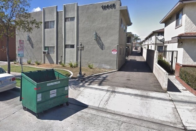
Discover 12445 Paramount Blvd in Downey, CA. You'll find this community in the 90242 area of Downey. The professional leasing team is available to help you find your new home. Your new home awaits you at 12445 Paramount Blvd. Contact us or stop by the leasing office to see available floor plans.
12445 Paramount Blvd is an apartment community located in Los Angeles County and the 90242 ZIP Code. This area is served by the Downey Unified attendance zone.
Downey is a family-friendly metropolis home to Wilderness Park, the city’s premier destination for outdoor recreation, home to a duck pond, paved jogging trails, and scenic picnic spots. Residents also frequent Apollo Park, Furman Park, and the Rio Hondo Golf Club. Downey features top-notch local restaurants and shops like Lock & Key Social Drinkery + Kitchen off Downey Avenue. But don’t forget about Porto’s Bakery and Café, an iconic Cuban establishment since 1960 offering Latin snacks and specialty desserts.
Situated just 13 miles southeast of Los Angeles, Downey offers unbeatable access to everything LA has to offer. And if you plan to commute into LA, Downey is an idyllic suburb for you with easy access to I-5. Apartment rentals in Downey range from affordable to upscale, offering a variety of options for renters. Excellent public schools reside in the Downey Unified School District.
Learn more about living in Downey| Colleges & Universities | Distance | ||
|---|---|---|---|
| Colleges & Universities | Distance | ||
| Drive: | 12 min | 6.2 mi | |
| Drive: | 13 min | 7.6 mi | |
| Drive: | 13 min | 7.6 mi | |
| Drive: | 17 min | 8.7 mi |


Transportation options available in Downey include Lakewood Station, located 1.4 miles from 12445 Paramount Blvd. 12445 Paramount Blvd is near Long Beach (Daugherty Field), located 8.6 miles or 17 minutes away, and Los Angeles International, located 17.1 miles or 23 minutes away.
| Transit / Subway | Distance | ||
|---|---|---|---|
| Transit / Subway | Distance | ||
|
|
Drive: | 2 min | 1.4 mi |
|
|
Drive: | 7 min | 4.3 mi |
|
|
Drive: | 8 min | 4.9 mi |
|
|
Drive: | 11 min | 6.0 mi |
|
|
Drive: | 11 min | 7.9 mi |
| Commuter Rail | Distance | ||
|---|---|---|---|
| Commuter Rail | Distance | ||
|
|
Drive: | 10 min | 5.8 mi |
|
|
Drive: | 11 min | 6.0 mi |
|
|
Drive: | 13 min | 7.3 mi |
|
|
Drive: | 19 min | 11.2 mi |
| Drive: | 22 min | 17.3 mi |
| Airports | Distance | ||
|---|---|---|---|
| Airports | Distance | ||
|
Long Beach (Daugherty Field)
|
Drive: | 17 min | 8.6 mi |
|
Los Angeles International
|
Drive: | 23 min | 17.1 mi |
Time and distance from 12445 Paramount Blvd.
| Shopping Centers | Distance | ||
|---|---|---|---|
| Shopping Centers | Distance | ||
| Walk: | 3 min | 0.2 mi | |
| Walk: | 15 min | 0.8 mi | |
| Walk: | 16 min | 0.8 mi |
| Parks and Recreation | Distance | ||
|---|---|---|---|
| Parks and Recreation | Distance | ||
|
Watts Senior Center & Rose Garden
|
Drive: | 11 min | 6.3 mi |
|
Compton Creek Natural Park at George Washington Elementary
|
Drive: | 11 min | 6.4 mi |
|
Watts Towers-Rodia State Park
|
Drive: | 11 min | 7.0 mi |
|
Augustus Hawkins Natural Park
|
Drive: | 15 min | 8.9 mi |
|
Pio Pico State Historic Park
|
Drive: | 13 min | 9.2 mi |
| Hospitals | Distance | ||
|---|---|---|---|
| Hospitals | Distance | ||
| Drive: | 3 min | 1.7 mi | |
| Drive: | 4 min | 1.8 mi | |
| Drive: | 5 min | 3.3 mi |
| Military Bases | Distance | ||
|---|---|---|---|
| Military Bases | Distance | ||
| Drive: | 20 min | 15.5 mi | |
| Drive: | 24 min | 16.2 mi |

What Are Walk Score®, Transit Score®, and Bike Score® Ratings?
Walk Score® measures the walkability of any address. Transit Score® measures access to public transit. Bike Score® measures the bikeability of any address.
What is a Sound Score Rating?
A Sound Score Rating aggregates noise caused by vehicle traffic, airplane traffic and local sources
12445 Paramount Blvd
Downey, CA 90242


 - Violet on Virgil")


