
$10,500 / Month
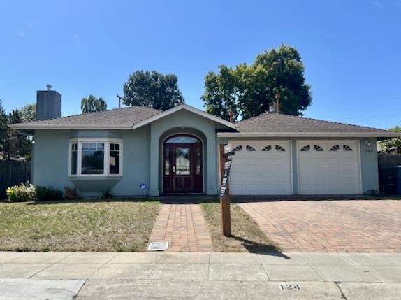
124 Lois Ln
Palo Alto, CA 94303
Today
Favorites
-
Bedrooms
4
-
Bathrooms
2.5
-
Square Feet
2,253 sq ft
-
Available
Available Now
Highlights
- Wood Flooring
- Formal Dining Room
- Open to Family Room
- Tile Flooring
- Forced Air Heating and Cooling System
- Washer and Dryer
124 Lois Ln

Favorites
About This Home
Available Now
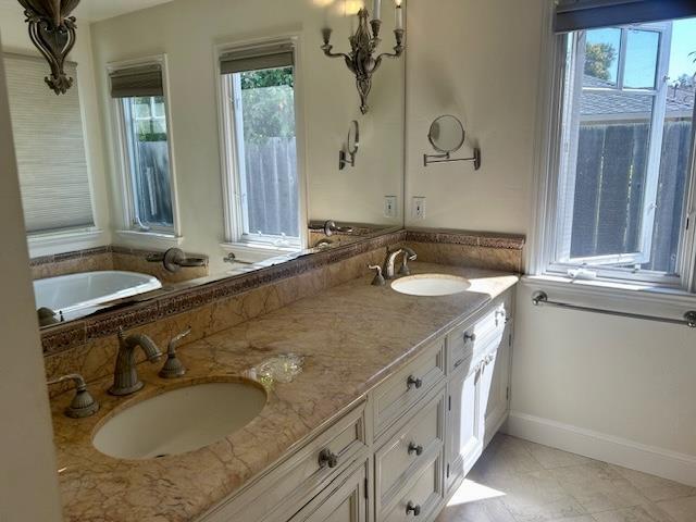
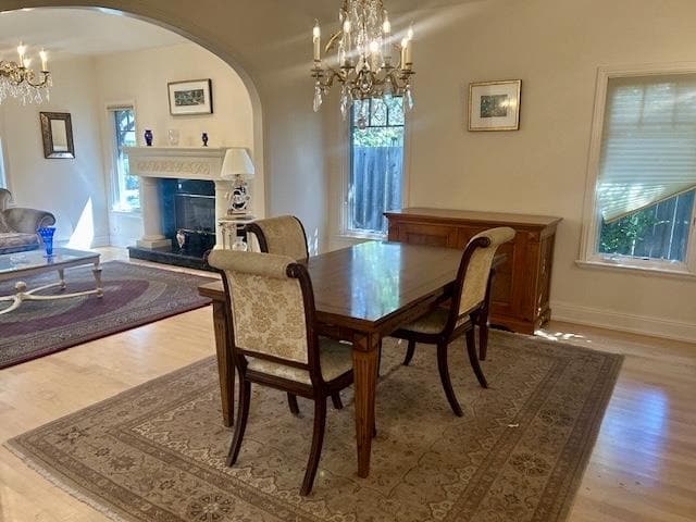
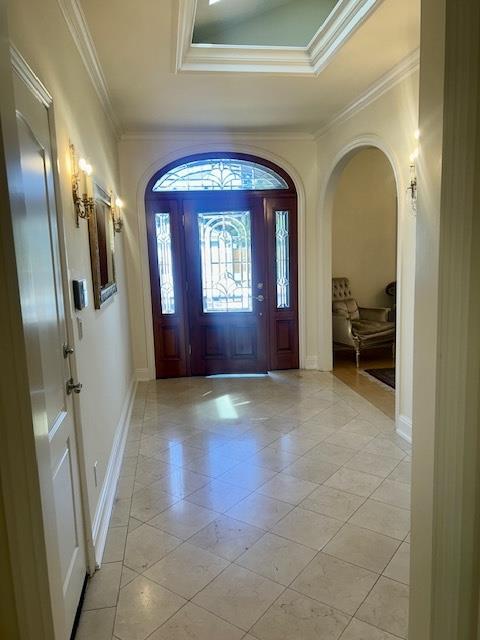
Beautifully updated single-story 4BR/2.5BA home in prime Palo Alto location with top-rated Palo Alto schools. Approx. 2,506 sq ft (per County records) with marble entry, formal living & dining rooms, and open-concept kitchen/family room. Chefs kitchen features custom cabinets, abundant counter space, 4 ovens, 6-burner gas range, grill & oversized fridge. Marble fireplace, solid maple floors (tile in baths), and central A/C. Spacious primary suite with walk-in closet, built-ins & spa-like bath. Large private patio, low-maintenance yard, laundry room, and oversized 2-car garage with storage. Convenient to parks, shopping, dining & major commute routes. Duveneck Elementary, Green Middle & Palo Alto High School (tenant to verify).
124 Lois Ln is a house located in Santa Clara County and the 94303 ZIP Code.
* Price shown is base rent and may not include non-optional fees and utilities.
Price, availability, fees, and any applicable rent special are subject to change without notice.
* Square footage definitions vary. Displayed square footage is approximate.
Home Details
Home Type
Single Family Detached Home
Bedrooms and Bathrooms
2.5 Bathrooms
4 Bedrooms
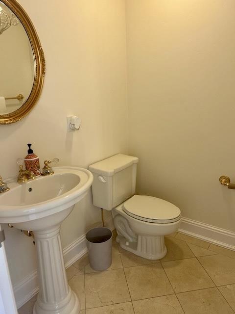
Flooring
Wood
Tile
Interior Spaces
Living Room with Fireplace
Formal Dining Room
2,253 Sq Ft Home
1-Story Property
Kitchen
Open to Family Room
Gas Oven
Microwave
Dishwasher
Laundry
Washer and Dryer
Listing and Financial Details
Security Deposit $10,500
Property Available on 8/1/25
12-Month Minimum Lease Term
Rent includes gardener, laundry facilities
Lot Details
6,900 Sq Ft Lot
Parking
2 Car Garage
Utilities
Forced Air Heating and Cooling System
Community Details
Fees and Policies
The fees below are based on community-supplied data and may exclude additional fees and utilities.
Contact
- Listed by Leannah and Laurel | Christie's International Real Estate Sereno
- Contact
-
Source
 MLSListings Inc.
Copyright © 2025 MLSListings Inc.
Location
Get Directions
Amenities
- Fireplace
Palo Alto is known as the birthplace of Silicon Valley and that unique heritage is proudly on display, with the Computer History Museum just down the street from Google’s world headquarters and countless other tech companies all over town. The restaurant scene rivals that of nearby San Francisco, with many small, independent eateries serving up some of the best food in the Bay Area.
With close proximity to the country’s tech center, it’s no surprise that Palo Alto apartments come with some of the most incredible amenities around. Residents also have access to dozens of options for outdoor recreation, including the gorgeous hiking and biking trails through the surrounding nature preserves, several golf courses, and easy access to San Francisco Bay. Bicycling is a popular mode of transportation around Palo Alto, with many bike-friendly routes around the city.
Palo Alto is famous as the home of Stanford University, and the campus is one of the most dominant landmarks in the area.
Learn more about living in Palo Alto
Education
| Colleges & Universities | Distance | ||
|---|---|---|---|
| Colleges & Universities | Distance | ||
| Drive: | 9 min | 2.8 mi | |
| Drive: | 9 min | 4.0 mi | |
| Drive: | 11 min | 4.1 mi | |
| Drive: | 17 min | 8.8 mi |
124 Lois Ln is within 9 minutes or 2.8 miles from Stanford University. It is also near Foothill College, Middlefield and Menlo College.
Transportation options available in Palo Alto include Bayshore Nasa Station, located 6.3 miles from 124 Lois Ln. 124 Lois Ln is near Norman Y Mineta San Jose International, located 13.9 miles or 20 minutes away, and San Francisco International, located 20.5 miles or 29 minutes away.
| Transit / Subway | Distance | ||
|---|---|---|---|
| Transit / Subway | Distance | ||
| Drive: | 10 min | 6.3 mi | |
|
|
Drive: | 10 min | 6.4 mi |
| Drive: | 10 min | 6.7 mi | |
|
|
Drive: | 10 min | 6.7 mi |
|
|
Drive: | 11 min | 6.9 mi |
| Commuter Rail | Distance | ||
|---|---|---|---|
| Commuter Rail | Distance | ||
| Drive: | 4 min | 1.6 mi | |
| Drive: | 6 min | 2.0 mi | |
| Drive: | 6 min | 2.4 mi | |
| Drive: | 9 min | 3.3 mi | |
| Drive: | 10 min | 4.8 mi |
| Airports | Distance | ||
|---|---|---|---|
| Airports | Distance | ||
|
Norman Y Mineta San Jose International
|
Drive: | 20 min | 13.9 mi |
|
San Francisco International
|
Drive: | 29 min | 20.5 mi |
Time and distance from 124 Lois Ln.
| Shopping Centers | Distance | ||
|---|---|---|---|
| Shopping Centers | Distance | ||
| Walk: | 17 min | 0.9 mi | |
| Drive: | 5 min | 1.5 mi | |
| Drive: | 7 min | 2.1 mi |
124 Lois Ln has 3 shopping centers within 2.1 miles, which is about a 7-minute walk. The miles and minutes will be for the farthest away property.
| Parks and Recreation | Distance | ||
|---|---|---|---|
| Parks and Recreation | Distance | ||
|
Rinconada Park
|
Walk: | 9 min | 0.5 mi |
|
Junior Museum and Zoo
|
Walk: | 12 min | 0.7 mi |
|
Gamble Garden
|
Walk: | 18 min | 0.9 mi |
|
Hopkins Creekside Park
|
Drive: | 6 min | 2.0 mi |
|
The Environmental Volunteers EcoCenter
|
Drive: | 6 min | 2.1 mi |
124 Lois Ln has 5 parks within 2.1 miles, including Rinconada Park, Junior Museum and Zoo, and Gamble Garden.
| Hospitals | Distance | ||
|---|---|---|---|
| Hospitals | Distance | ||
| Drive: | 8 min | 2.6 mi | |
| Drive: | 9 min | 3.1 mi | |
| Drive: | 12 min | 6.9 mi |
124 Lois Ln has 3 hospitals within 6.9 miles, the nearest is Lucile Salter Packard Children's Hospital at Stanford which is 2.6 miles away and a 8 minute drive.
| Military Bases | Distance | ||
|---|---|---|---|
| Military Bases | Distance | ||
| Drive: | 13 min | 6.7 mi |
124 Lois Ln is 6.7 miles and a 13 minute drive from Ames Research Center.
You May Also Like
Similar Rentals Nearby


What Are Walk Score®, Transit Score®, and Bike Score® Ratings?
Walk Score® measures the walkability of any address. Transit Score® measures access to public transit. Bike Score® measures the bikeability of any address.
What is a Sound Score Rating?
A Sound Score Rating aggregates noise caused by vehicle traffic, airplane traffic and local sources

124 Lois Ln
Palo Alto, CA 94303