


$750
/ Month
1233 Zellner Rd
Forsyth, GA 31029
2 Weeks Ago
|
Edit
Favorites
1233 Zellner Rd

Favorites
Check Back Soon for Upcoming Availability
| Beds | Baths | Average SF |
|---|---|---|
| 1 Bedroom 1 Bedroom 1 Br | 1 Bath 1 Bath 1 Ba | 384 SF |
Fees and Policies
The fees listed below are community-provided and may exclude utilities or add-ons. All payments are made directly to the property and are non-refundable unless otherwise specified.
About This Property
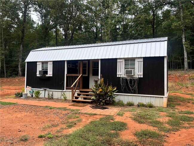
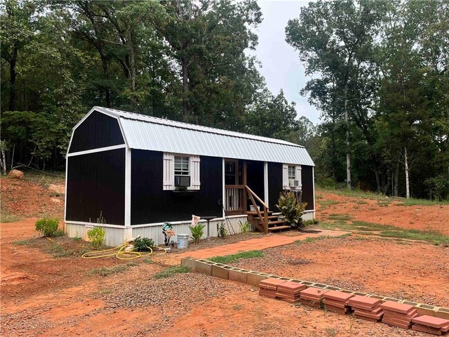
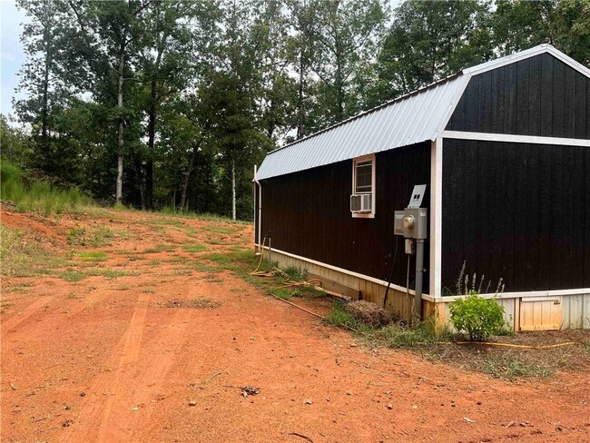
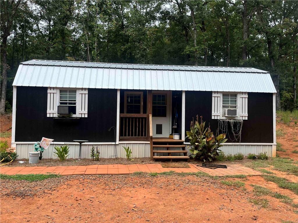
Tiny Home for rent in rural Monroe County sits on approximately 3 wooded acres. Home was recently finished and features a living room with loft above,galley style kitchen,bedroom area,and full bath. There is plenty of storage in the attic and loft area. No pets,or smoking. Home is unfurnished and does not include a laundry hook up. Available October 1st. Now accepting applications. 650 credit score,clean background check,and references required.
1233 Zellner Rd is a house located in Monroe County and the 31029 ZIP Code. This area is served by the Monroe County School District attendance zone.
House Features
- Dishwasher
- Range
- Refrigerator
1233 Zellner Rd,
Forsyth,
GA
31029
Amenities
- Dishwasher
- Range
- Refrigerator
Education
| Colleges & Universities | Distance | ||
|---|---|---|---|
| Colleges & Universities | Distance | ||
| Drive: | 21 min | 9.8 mi | |
| Drive: | 42 min | 29.4 mi | |
| Drive: | 47 min | 33.2 mi |
1233 Zellner Rd is within 21 minutes or 9.8 miles from Gordon College, Barnesville. It is also near Middle Georgia State, Main and Mercer University.
Schools


Public Elementary School
Grades PK-5
732 Students
Attendance Zone
Public High School
Grades 9-12
1,287 Students
Attendance Zone
Private Elementary, Middle & High School
Grades PK-12
454 Students
Nearby
Private Elementary & Middle School
Grades K-8
6 Students
Nearby
School data provided by
 The GreatSchools Rating helps parents compare schools within a state based on a variety of school quality indicators and provides a helpful picture of how effectively each school serves all of its students. Ratings are on a scale of 1 (below average) to 10 (above average) and can include test scores, college readiness, academic progress, advanced courses, equity, discipline and attendance data. We also advise parents to visit schools, consider other information on school performance and programs, and consider family needs as part of the school selection process.
View GreatSchools Rating Methodology
Data provided by GreatSchools.org © 2026. All rights reserved.
View GreatSchools Rating Methodology
Data provided by GreatSchools.org © 2026. All rights reserved.
Walkability Near 1233 Zellner Rd Forsyth, GA 31029
Getting Around
 What do Walkability, Transit, Drivability, and Bikeability mean?
Walkability measures the walking distance to day-to-day needs.
Transit measures access to public transportation.
Drivability measures congestion, parking availability, and access to major roads.
Bikeability measures the suitability for cycling.
How It Works
What do Walkability, Transit, Drivability, and Bikeability mean?
Walkability measures the walking distance to day-to-day needs.
Transit measures access to public transportation.
Drivability measures congestion, parking availability, and access to major roads.
Bikeability measures the suitability for cycling.
How It Works
Not Walkable
Walkability
0
/ 100
Exceptionally Drivable
Drivability
100
/ 100
Somewhat Bikeable
Bikeability
20
/ 100
Scores provided by
-
Soundscore™
-
/ 100
Traffic
-Airport
-Businesses
-Scores provided by
HowLoud What is a Sound Score Rating? A Sound Score Rating aggregates noise caused by vehicle traffic, airplane traffic and local sources. How It WorksYou May Also Like
Similar Rentals Nearby
-
-

-

-
 4 Beds$1,935Total Monthly PriceTotal Monthly Price NewPrices include all required monthly fees.House for Rent
 -
-
 4 Beds$2,265Total Monthly PriceTotal Monthly Price NewPrices include all required monthly fees.House for Rent
 -
 4 Beds$2,370Total Monthly PriceTotal Monthly Price NewPrices include all required monthly fees.House for Rent
 -

-
 3 Beds$1,945Total Monthly PriceTotal Monthly Price NewPrices include all required monthly fees.House for Rent
 -


What Are Walk Score®, Transit Score®, and Bike Score® Ratings?
Walk Score® measures the walkability of any address. Transit Score® measures access to public transit. Bike Score® measures the bikeability of any address.
What is a Sound Score Rating?
A Sound Score Rating aggregates noise caused by vehicle traffic, airplane traffic and local sources.
1233 Zellner Rd
Forsyth, GA 31029