
Trestle
225 W Duarte Rd,
Monrovia, CA 91016
$2,430 - $8,185
Studio - 2 Beds
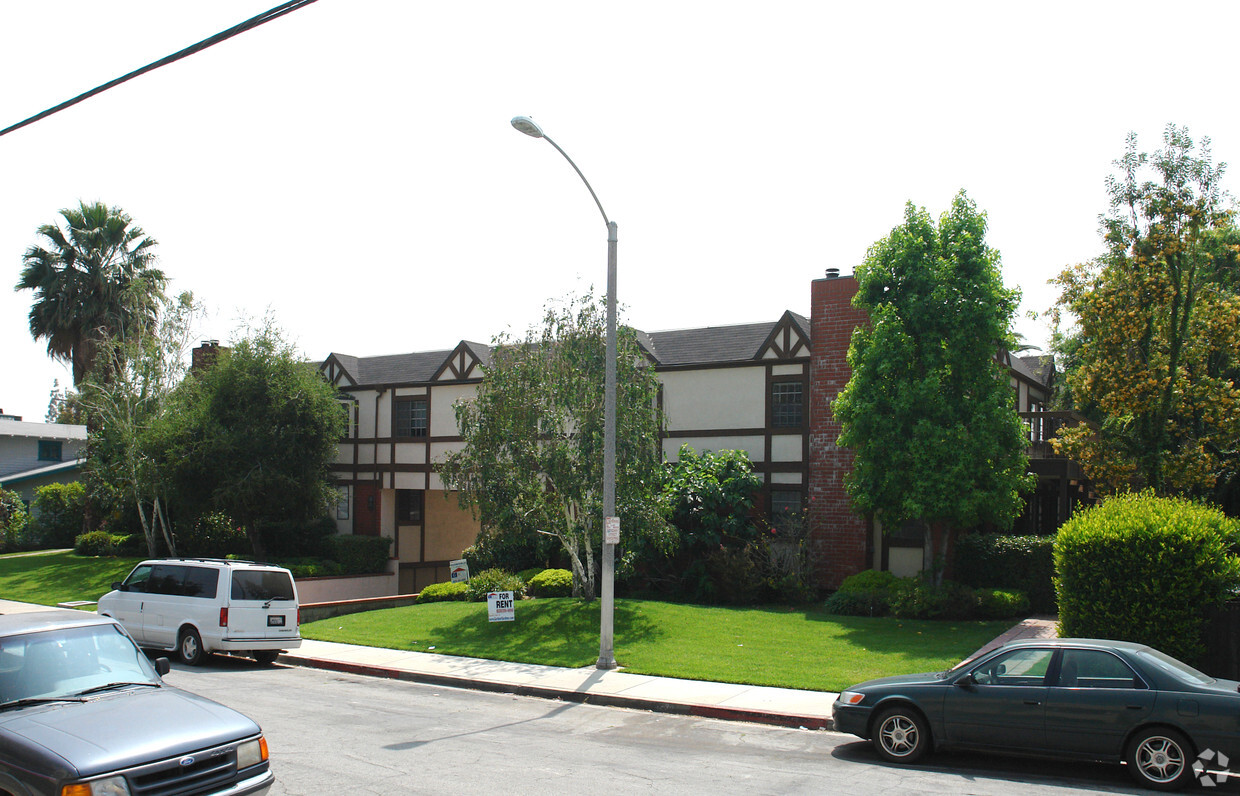
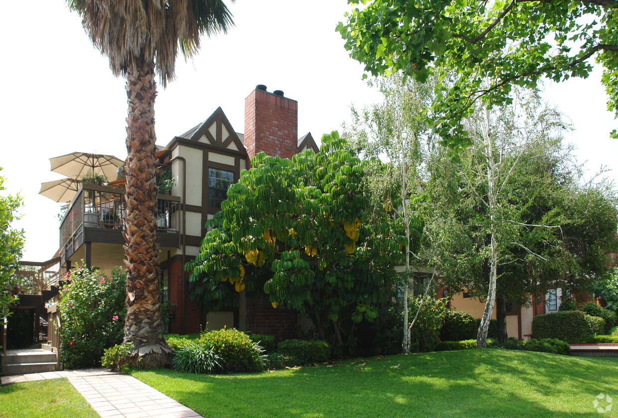
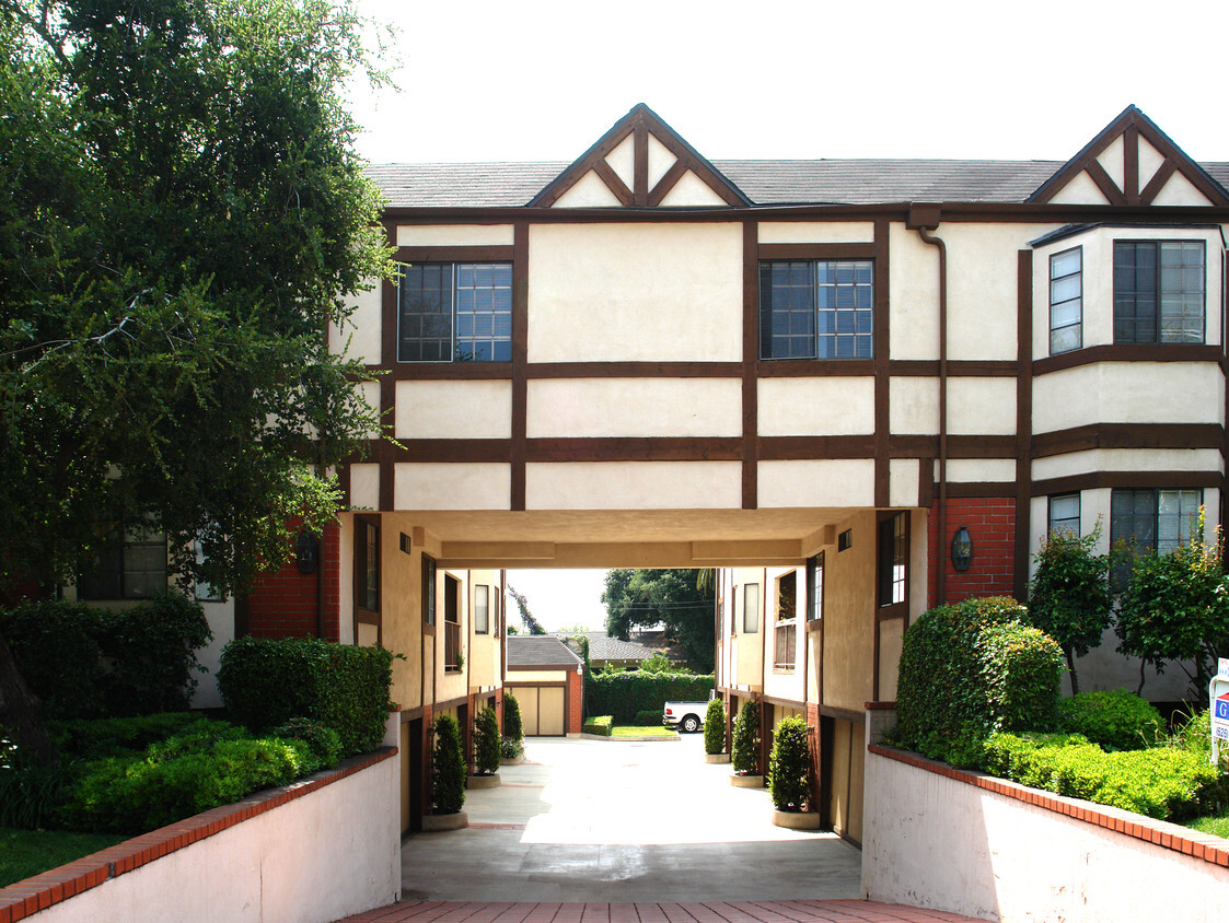

Find your new apartment at 123 S Encinitas Ave. This community is located in the 91016 area of Monrovia. The leasing team is available to help you find the best floor plan for your lifestyle. Contact us today to see available floor plans and find your new place at 123 S Encinitas Ave.
123 S Encinitas Ave is an apartment community located in Los Angeles County and the 91016 ZIP Code. This area is served by the Monrovia Unified attendance zone.
Washer/Dryer
Air Conditioning
Dishwasher
Microwave
The City of Monrovia provides a small-town charm in a big way. Nestled at the foot of the San Gabriel Mountains, the town is approximately 23 miles east of Downtown Los Angeles off Interstate 210. Often attracting movie crews, the homey feel and community kindness score high with those who visit.
This Southern California area is host to a number of street fairs, while lazy mornings give rise to vibrant (and often packed!) farmers markets. The Metro Gold Line allows residents to travel with ease at the community station. Longtime locals love their apartments, but sometimes venture outdoors for camping at Monrovia Canyon State Park. The downtown area consists of delicious gourmet restaurants, eclectic coffeehouses, and a community center near South Myrtle Avenue.
Learn more about living in MonroviaCompare neighborhood and city base rent averages by bedroom.
| San Gabriel Valley | Monrovia, CA | |
|---|---|---|
| Studio | $1,666 | $2,089 |
| 1 Bedroom | $1,875 | $2,459 |
| 2 Bedrooms | $2,221 | $2,699 |
| 3 Bedrooms | $2,680 | $3,419 |
| Colleges & Universities | Distance | ||
|---|---|---|---|
| Colleges & Universities | Distance | ||
| Drive: | 14 min | 8.1 mi | |
| Drive: | 14 min | 8.7 mi | |
| Drive: | 16 min | 8.8 mi | |
| Drive: | 14 min | 9.0 mi |


Transportation options available in Monrovia include Monrovia Station, located 1.6 miles from 123 S Encinitas Ave. 123 S Encinitas Ave is near Bob Hope, located 25.2 miles or 34 minutes away, and Ontario International, located 28.9 miles or 38 minutes away.
| Transit / Subway | Distance | ||
|---|---|---|---|
| Transit / Subway | Distance | ||
| Drive: | 4 min | 1.6 mi | |
| Drive: | 6 min | 2.5 mi | |
| Drive: | 7 min | 3.4 mi | |
|
|
Drive: | 8 min | 4.9 mi |
| Drive: | 9 min | 5.5 mi |
| Commuter Rail | Distance | ||
|---|---|---|---|
| Commuter Rail | Distance | ||
|
|
Drive: | 13 min | 6.5 mi |
|
|
Drive: | 13 min | 6.8 mi |
|
|
Drive: | 15 min | 9.8 mi |
|
|
Drive: | 28 min | 19.4 mi |
| Drive: | 31 min | 22.7 mi |
| Airports | Distance | ||
|---|---|---|---|
| Airports | Distance | ||
|
Bob Hope
|
Drive: | 34 min | 25.2 mi |
|
Ontario International
|
Drive: | 38 min | 28.9 mi |
Time and distance from 123 S Encinitas Ave.
| Shopping Centers | Distance | ||
|---|---|---|---|
| Shopping Centers | Distance | ||
| Walk: | 4 min | 0.2 mi | |
| Walk: | 11 min | 0.6 mi | |
| Drive: | 3 min | 1.2 mi |
| Parks and Recreation | Distance | ||
|---|---|---|---|
| Parks and Recreation | Distance | ||
|
Grassy Hollow Visitor Center
|
Drive: | 5 min | 2.2 mi |
|
Chilao Visitor Center
|
Drive: | 5 min | 2.2 mi |
|
Los Angeles County Arboretum
|
Drive: | 8 min | 3.6 mi |
|
Wilderness Park
|
Drive: | 11 min | 4.0 mi |
|
Santa Fe Dam Recreation Area
|
Drive: | 20 min | 7.8 mi |
| Hospitals | Distance | ||
|---|---|---|---|
| Hospitals | Distance | ||
| Drive: | 7 min | 3.2 mi | |
| Drive: | 11 min | 6.1 mi | |
| Drive: | 15 min | 7.9 mi |
| Military Bases | Distance | ||
|---|---|---|---|
| Military Bases | Distance | ||
| Drive: | 44 min | 34.4 mi | |
| Drive: | 47 min | 38.9 mi |
What Are Walk Score®, Transit Score®, and Bike Score® Ratings?
Walk Score® measures the walkability of any address. Transit Score® measures access to public transit. Bike Score® measures the bikeability of any address.
What is a Sound Score Rating?
A Sound Score Rating aggregates noise caused by vehicle traffic, airplane traffic and local sources

123 S Encinitas Ave
Monrovia, CA 91016


 - Violet on Virgil")

