

$1,895
/ Month
12272 S Fork Little Butte Creek Rd
Eagle Point, OR 97524
2 Weeks Ago
|
Edit
Favorites
12272 S Fork Little Butte Creek Rd

Favorites
Check Back Soon for Upcoming Availability
| Beds | Baths | Average SF |
|---|---|---|
| 3 Bedrooms 3 Bedrooms 3 Br | 2 Baths 2 Baths 2 Ba | 1,296 SF |
About This Property
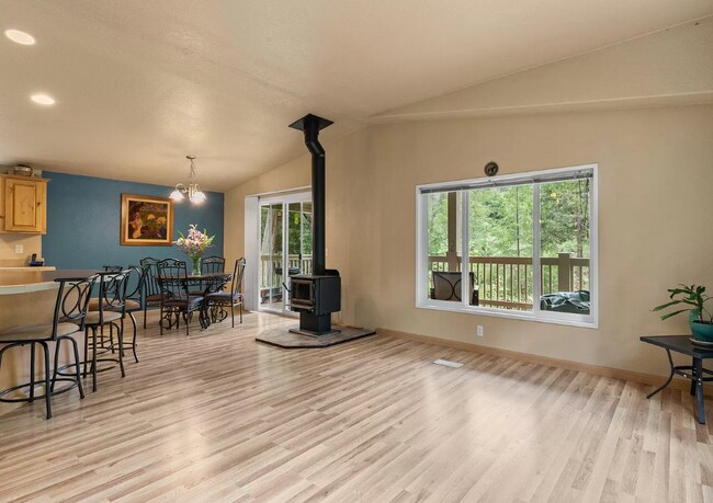
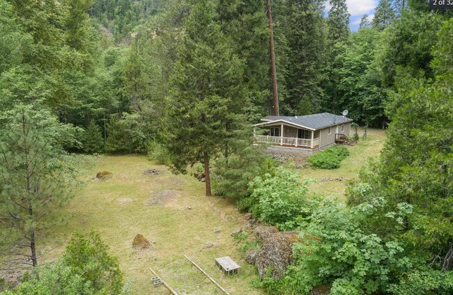
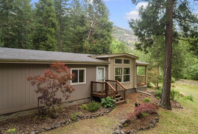
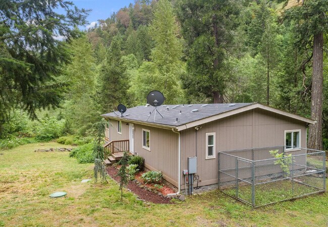
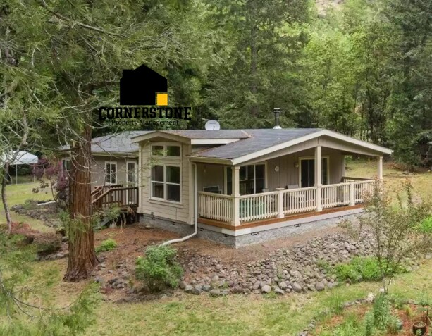
12272 S Fork Little Butte Creek Rd, Eagle Pt, OR 97524 Looking for privacy? Look no further! 2 bed (plus an office) and 2 bath manufactured home. 1296 sq. ft. 2.32 acres on the Little Butte Creek. Beautiful land with deck that overlooks the property. Home comes with refrigerator and washer and dryer hook ups. 2 pets under 75 permitted with $700 Pet deposit per pet. No Smoking Month to Month lease Property is currently for sale as well. Once lease is signed for rental, owner will pull property off the market Available 11.17.2025 Rent: $1,895 Deposit: $2,400 Managed by Cornerstone Property Management
12272 S Fork Little Butte Creek Rd is a house located in Jackson County and the 97524 ZIP Code. This area is served by the Butte Falls School District 91 attendance zone.
12272 S Fork Little Butte Creek Rd,
Eagle Point,
OR
97524
Education
| Colleges & Universities | Distance | ||
|---|---|---|---|
| Colleges & Universities | Distance | ||
| Drive: | 77 min | 45.5 mi |
12272 S Fork Little Butte Creek Rd is within 77 minutes or 45.5 miles from Southern Oregon University.
Schools


Public Elementary, Middle & High School
Grades K-12
196 Students
Nearby
Public Elementary School
Grades K-5
42 Students
Nearby
Private Elementary School
Grades PK-5
32 Students
Nearby
Private Elementary & Middle School
Grades K-8
184 Students
Nearby
Private High School
Grades 9-12
10 Students
Nearby
School data provided by
 The GreatSchools Rating helps parents compare schools within a state based on a variety of school quality indicators and provides a helpful picture of how effectively each school serves all of its students. Ratings are on a scale of 1 (below average) to 10 (above average) and can include test scores, college readiness, academic progress, advanced courses, equity, discipline and attendance data. We also advise parents to visit schools, consider other information on school performance and programs, and consider family needs as part of the school selection process.
View GreatSchools Rating Methodology
Data provided by GreatSchools.org © 2026. All rights reserved.
View GreatSchools Rating Methodology
Data provided by GreatSchools.org © 2026. All rights reserved.
Walkability Near 12272 S Fork Little Butte Creek Rd Eagle Point, OR 97524
Getting Around
 What do Walkability, Transit, Drivability, and Bikeability mean?
Walkability measures the walking distance to day-to-day needs.
Transit measures access to public transportation.
Drivability measures congestion, parking availability, and access to major roads.
Bikeability measures the suitability for cycling.
How It Works
What do Walkability, Transit, Drivability, and Bikeability mean?
Walkability measures the walking distance to day-to-day needs.
Transit measures access to public transportation.
Drivability measures congestion, parking availability, and access to major roads.
Bikeability measures the suitability for cycling.
How It Works
Not Walkable
Walkability
0
/ 100
Exceptionally Drivable
Drivability
100
/ 100
Somewhat Bikeable
Bikeability
20
/ 100
Scores provided by
-
Soundscore™
-
/ 100
Traffic
-Airport
-Businesses
-Scores provided by
HowLoud What is a Sound Score Rating? A Sound Score Rating aggregates noise caused by vehicle traffic, airplane traffic and local sources. How It WorksYou May Also Like
Similar Rentals Nearby


What Are Walk Score®, Transit Score®, and Bike Score® Ratings?
Walk Score® measures the walkability of any address. Transit Score® measures access to public transit. Bike Score® measures the bikeability of any address.
What is a Sound Score Rating?
A Sound Score Rating aggregates noise caused by vehicle traffic, airplane traffic and local sources.
12272 S Fork Little Butte Creek Rd
Eagle Point, OR 97524