
$800
/ Month
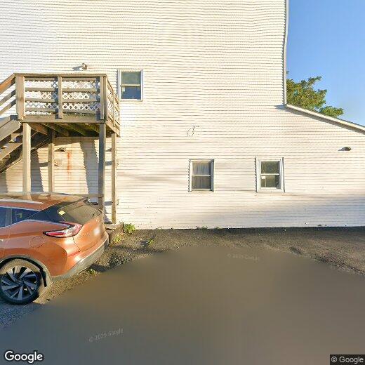
1221 N State St
Syracuse, NY 13208
Favorites
1221 N State St

Favorites
Check Back Soon for Upcoming Availability
| Beds | Baths | Average SF |
|---|---|---|
| 2 Bedrooms 2 Bedrooms 2 Br | 1 Bath 1 Bath 1 Ba | 5,810 SF |
About This Property
Cute 2 bedroom upstairs apartment. No washer dryer hookup. Tenant pays utilities. NO SMOKING!
1221 N State St is an apartment community located in Onondaga County and the 13208 ZIP Code.
1221 N State St,
Syracuse,
NY
13208
Northside is one of the oldest and largest neighborhoods in Syracuse. This sprawling neighborhood has multiple parks and is best known for its incredible collection of international restaurants and grocers, especially in Little Italy Syracuse. Northside is also known for its affordability. The neighborhood has rental options for every budget and style including high-rise apartments, lofts, luxury condos, and single-family houses. Attracting even more renters, Northside is about two miles away from Downtown Syracuse, Syracuse University, and Lakefront, a trendy neighborhood along Onondaga Lake. Residents have access to Interstate 690 and Route 11, so traveling across Syracuse is made easy.
Learn more about living in NorthsideBelow are rent ranges for similar nearby apartments
| Beds | Average Size | Lowest | Typical | Premium |
|---|---|---|---|---|
| Studio Studio Studio | 560-566 Sq Ft | $750 | $1,698 | $3,000 |
| 1 Bed 1 Bed 1 Bed | 750-774 Sq Ft | $825 | $1,678 | $2,900 |
| 2 Beds 2 Beds 2 Beds | 1058-1069 Sq Ft | $1,070 | $2,166 | $3,800 |
| 3 Beds 3 Beds 3 Beds | 1516-1553 Sq Ft | $1,300 | $2,295 | $4,500 |
| 4 Beds 4 Beds 4 Beds | 3117 Sq Ft | $1,997 | $1,998 | $2,000 |
Education
| Colleges & Universities | Distance | ||
|---|---|---|---|
| Colleges & Universities | Distance | ||
| Drive: | 4 min | 2.0 mi | |
| Drive: | 8 min | 3.4 mi | |
| Drive: | 10 min | 5.3 mi | |
| Drive: | 14 min | 6.0 mi |
1221 N State St is within 4 minutes or 2.0 miles from Upstate Medical University. It is also near Syracuse University and Le Moyne College.
Walkability Near 1221 N State St Syracuse, NY 13208
Getting Around
 What do Walkability, Transit, Drivability, and Bikeability mean?
Walkability measures the walking distance to day-to-day needs.
Transit measures access to public transportation.
Drivability measures congestion, parking availability, and access to major roads.
Bikeability measures the suitability for cycling.
How It Works
What do Walkability, Transit, Drivability, and Bikeability mean?
Walkability measures the walking distance to day-to-day needs.
Transit measures access to public transportation.
Drivability measures congestion, parking availability, and access to major roads.
Bikeability measures the suitability for cycling.
How It Works
Moderately Walkable
Walkability
60
/ 100
Limited Public Transit
Transit
30
/ 100
Moderately Drivable
Drivability
70
/ 100
Fairly Bikeable
Bikeability
40
/ 100
Scores provided by
-
Soundscore™
-
/ 100
Traffic
-Airport
-Businesses
-Scores provided by
HowLoud What is a Sound Score Rating? A Sound Score Rating aggregates noise caused by vehicle traffic, airplane traffic and local sources. How It WorksYou May Also Like
Similar Rentals Nearby


What Are Walk Score®, Transit Score®, and Bike Score® Ratings?
Walk Score® measures the walkability of any address. Transit Score® measures access to public transit. Bike Score® measures the bikeability of any address.
What is a Sound Score Rating?
A Sound Score Rating aggregates noise caused by vehicle traffic, airplane traffic and local sources.
1221 N State St
Syracuse, NY 13208