1215 W 10th St
1215 W 10th St,
Cleveland,
OH
44113

Check Back Soon for Upcoming Availability
Fees and Policies
The fees below are based on community-supplied data and may exclude additional fees and utilities.
- Dogs Allowed
-
Fees not specified
- Cats Allowed
-
Fees not specified
- Parking
-
Garage--
Details
Lease Options
-
12 Months
About 1215 W 10th St Cleveland, OH 44113
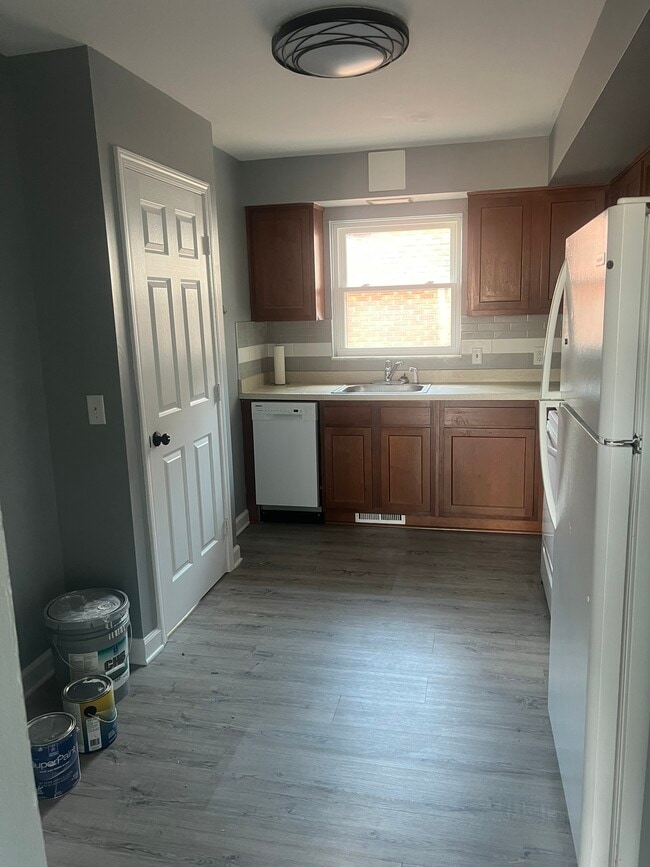
High ceiling, in unit laundry, close to all amenity, located in down town Cleveland
1215 W 10th St is a condo located in Cuyahoga County and the 44113 ZIP Code. This area is served by the Cleveland Metropolitan attendance zone.
Condo Features
- Washer/Dryer
- Wheelchair Accessible (Rooms)
A small urban neighborhood near Cleveland State University in Downtown, Playhouse Square offers in-city living at its finest. Named after a local performing arts center, Playhouse Square features five historic theaters that put on Broadway-style shows, comedy shows, concerts, plays, opera, and more. This iconic and central attraction not only gives the neighborhood its name, but it brings in the majority of residents and visitors—with the help of nearby attractions like the House of Blues and Wolstein Center.
Playhouse Square sits between Superior Avenue and Interstate 90, and is home to an array of local restaurants and bars like Cibreo Italian Kitchen, Cowell & Hubbard, and Hofbräuhaus. A cultural, artistic, and entertainment hub for the city of Cleveland, Playhouse Square is a lively neighborhood ideal for renters interested in big-city living. Playhouse Square is located near Tower City Center, Cleveland Public Square, and JACK Cleveland Casino.
Learn more about living in Playhouse SquareBelow are rent ranges for similar nearby apartments
- Washer/Dryer
- Wheelchair Accessible (Rooms)
| Colleges & Universities | Distance | ||
|---|---|---|---|
| Colleges & Universities | Distance | ||
| Drive: | 6 min | 1.9 mi | |
| Drive: | 6 min | 2.3 mi | |
| Drive: | 14 min | 5.6 mi | |
| Drive: | 14 min | 7.8 mi |
 The GreatSchools Rating helps parents compare schools within a state based on a variety of school quality indicators and provides a helpful picture of how effectively each school serves all of its students. Ratings are on a scale of 1 (below average) to 10 (above average) and can include test scores, college readiness, academic progress, advanced courses, equity, discipline and attendance data. We also advise parents to visit schools, consider other information on school performance and programs, and consider family needs as part of the school selection process.
View GreatSchools Rating Methodology
Data provided by GreatSchools.org © 2025. All rights reserved.
Transportation options available in Cleveland include Flats East Bank Station, located 0.1 mile from 1215 W 10th St. 1215 W 10th St is near Cleveland-Hopkins International, located 14.0 miles or 24 minutes away.
| Transit / Subway | Distance | ||
|---|---|---|---|
| Transit / Subway | Distance | ||
| Walk: | 1 min | 0.1 mi | |
| Walk: | 5 min | 0.3 mi | |
| Walk: | 10 min | 0.6 mi | |
| Walk: | 11 min | 0.6 mi | |
|
|
Walk: | 12 min | 0.7 mi |
| Commuter Rail | Distance | ||
|---|---|---|---|
| Commuter Rail | Distance | ||
|
|
Drive: | 7 min | 2.3 mi |
| Drive: | 19 min | 10.0 mi | |
| Drive: | 21 min | 11.7 mi | |
| Drive: | 29 min | 17.6 mi | |
|
Boston Mill
|
Drive: | 36 min | 22.6 mi |
| Airports | Distance | ||
|---|---|---|---|
| Airports | Distance | ||
|
Cleveland-Hopkins International
|
Drive: | 24 min | 14.0 mi |
Time and distance from 1215 W 10th St.
| Shopping Centers | Distance | ||
|---|---|---|---|
| Shopping Centers | Distance | ||
| Drive: | 3 min | 1.3 mi | |
| Drive: | 5 min | 1.8 mi | |
| Drive: | 6 min | 3.1 mi |
| Parks and Recreation | Distance | ||
|---|---|---|---|
| Parks and Recreation | Distance | ||
|
Great Lakes Science Center
|
Drive: | 4 min | 1.1 mi |
|
Lakefront Reservation and Edgewater Park
|
Drive: | 7 min | 2.7 mi |
|
Ohio & Erie Canal Reservation
|
Drive: | 10 min | 5.3 mi |
|
Cleveland Metroparks Zoo
|
Drive: | 11 min | 5.5 mi |
|
Cleveland Museum of Natural History
|
Drive: | 14 min | 7.5 mi |
| Hospitals | Distance | ||
|---|---|---|---|
| Hospitals | Distance | ||
| Drive: | 3 min | 1.3 mi | |
| Drive: | 5 min | 1.9 mi | |
| Drive: | 8 min | 2.8 mi |
| Military Bases | Distance | ||
|---|---|---|---|
| Military Bases | Distance | ||
| Drive: | 99 min | 82.8 mi | |
| Drive: | 102 min | 83.0 mi |
You May Also Like
Similar Rentals Nearby
What Are Walk Score®, Transit Score®, and Bike Score® Ratings?
Walk Score® measures the walkability of any address. Transit Score® measures access to public transit. Bike Score® measures the bikeability of any address.
What is a Sound Score Rating?
A Sound Score Rating aggregates noise caused by vehicle traffic, airplane traffic and local sources


