
$1,225
/ Month
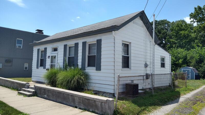
1207 Jefferson Ave
Reading, OH 45215
1 Day Ago
|
Edit
Favorites
513-599-8777
-
Bedrooms
2
-
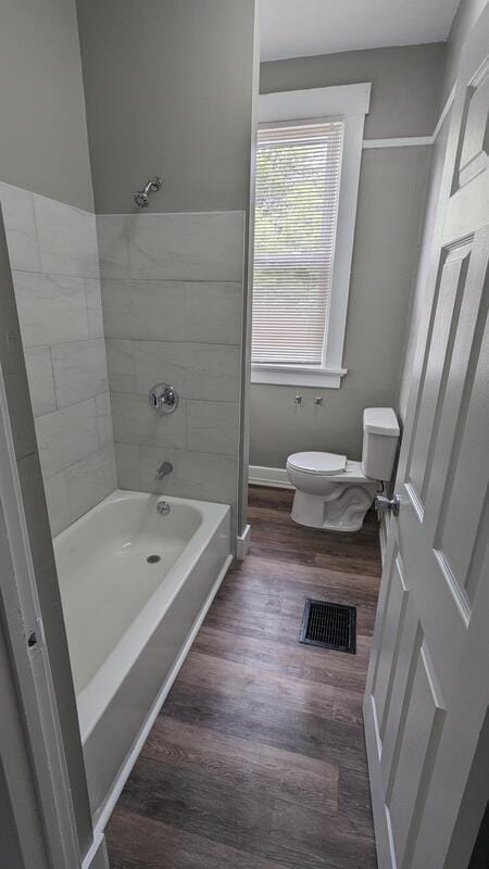
Bathrooms
1
-
Square Feet
900 sq ft
-
Available
Available Now
1207 Jefferson Ave

Favorites
About This Home
$1,225 deposit,
Available Now
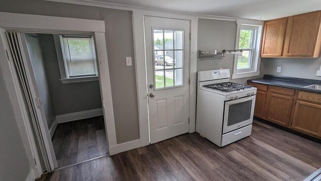
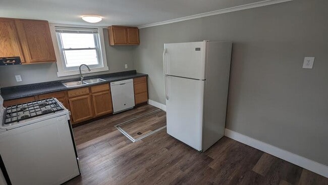
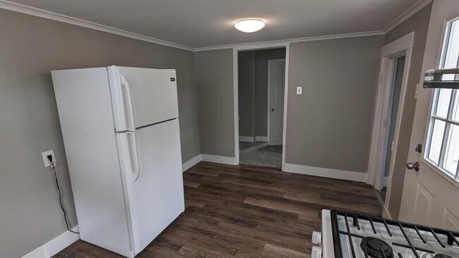
Convenient 2 Bedroom with extra large master. Excellent location in all new K-12 Reading Schools, just a few blocks from the bustling bridal district. New roof, furnace and central air. Kitchen remodeled with dishwasher and disposal. Off street parking for 3. Walk to Quiet Park or Vonderhaars for an ice cream. Easy access to 71, 75 and Ronald Reagan Hwy. Convenient 2 Bedroom with extra large master. Excellent location in all new K-12 Reading Schools, just a few blocks from the bustling bridal district. New roof, furnace and central air. Kitchen remodeled with dishwasher and disposal. Off street parking for 3. Walk to Quiet Park or Vonderhaars for an ice cream. Easy access to 71, 75 and Ronald Reagan Hwy.
1207 Jefferson Ave is a house located in Hamilton County and the 45215 ZIP Code. This area is served by the Reading Community City attendance zone.
* Price shown is base rent. Excludes user-selected optional fees and variable or usage-based fees and required charges due at or prior to move-in or at move-out. Price, availability, fees, and any applicable rent special are subject to change without notice.
* Square footage definitions vary. Displayed square footage is approximate.
Fees and Policies
The fees below are based on community-supplied data and may exclude additional fees and utilities.
-
One-Time Basics
-
Due at Move-In
-
Security Deposit - RefundableCharged per unit.$1,225
-
-
Due at Move-In
-
Street Parking
Property Fee Disclaimer: Based on community-supplied data and independent market research. Subject to change without notice. May exclude fees for mandatory or optional services and usage-based utilities.
House Features
- Dishwasher
- Refrigerator
Contact
- Phone Number
- Contact
Location
Get Directions
Amenities
- Dishwasher
- Refrigerator
Founded in 1794, Reading is a Cincinnati suburb brimming with historic charm. The city is predominantly residential, featuring an array of apartments and single-family homes in old-fashioned buildings along tree-lined streets. Reading’s charming downtown area is centered on the intersection of Benson Street and Reading Road, where residents enjoy a variety of restaurants, boutiques, and specialty shops.
Reading’s small-town atmosphere is complemented by its close proximity to Downtown Cincinnati, which is just 12 miles away. Reading is also convenient to attractions like Hamilton County Fairgrounds, French Park, and the Cincinnati Zoo and Botanical Garden. Recreational destinations such as Sharon Woods, Winton Woods, and Mount Airy Forest are all just a short drive away as well.
Reading is known for being at “The Crossroads of Opportunity,” offering residents direct access to major thoroughfares like I-75, U.S. 42, and Ronald Reagan Cross County Highway.
Learn more about living in Reading
Education
| Colleges & Universities | Distance | ||
|---|---|---|---|
| Colleges & Universities | Distance | ||
| Drive: | 4 min | 2.1 mi | |
| Drive: | 11 min | 4.3 mi | |
| Drive: | 15 min | 7.5 mi | |
| Drive: | 17 min | 8.8 mi |
1207 Jefferson Ave is within 4 minutes or 2.1 miles from Cincinnati State, WDC. It is also near Univ. of Cincinnati, Blue Ash and Xavier University.
Schools


Public Elementary School
Grades 3-5
385 Students
Attendance Zone
Public Elementary School
Grades K-6
232 Students
Nearby
Public Elementary School
Grades PK-2
351 Students
Attendance Zone
Public Middle School
Grades 6-8
421 Students
Attendance Zone
Public Middle & High School
Grades 7-12
716 Students
Attendance Zone
Private Elementary, Middle & High School
Grades PK-12
289 Students
Nearby
Private Elementary & Middle School
Grades K-8
151 Students
Nearby
Private High School
Grades 9-12
709 Students
Nearby
School data provided by
 The GreatSchools Rating helps parents compare schools within a state based on a variety of school quality indicators and provides a helpful picture of how effectively each school serves all of its students. Ratings are on a scale of 1 (below average) to 10 (above average) and can include test scores, college readiness, academic progress, advanced courses, equity, discipline and attendance data. We also advise parents to visit schools, consider other information on school performance and programs, and consider family needs as part of the school selection process.
View GreatSchools Rating Methodology
Data provided by GreatSchools.org © 2025. All rights reserved.
View GreatSchools Rating Methodology
Data provided by GreatSchools.org © 2025. All rights reserved.
Transportation options available in Reading include Brewery District Station, Elm & Henry, located 11.7 miles from 1207 Jefferson Ave. 1207 Jefferson Ave is near Cincinnati/Northern Kentucky International, located 25.6 miles or 43 minutes away.
| Transit / Subway | Distance | ||
|---|---|---|---|
| Transit / Subway | Distance | ||
| Drive: | 19 min | 11.7 mi | |
| Drive: | 19 min | 11.7 mi | |
| Drive: | 19 min | 11.8 mi | |
| Drive: | 19 min | 11.8 mi | |
| Drive: | 20 min | 12.0 mi |
| Commuter Rail | Distance | ||
|---|---|---|---|
| Commuter Rail | Distance | ||
|
|
Drive: | 18 min | 11.6 mi |
| Airports | Distance | ||
|---|---|---|---|
| Airports | Distance | ||
|
Cincinnati/Northern Kentucky International
|
Drive: | 43 min | 25.6 mi |
Time and distance from 1207 Jefferson Ave.
| Shopping Centers | Distance | ||
|---|---|---|---|
| Shopping Centers | Distance | ||
| Drive: | 4 min | 1.5 mi | |
| Drive: | 5 min | 1.7 mi | |
| Drive: | 5 min | 1.8 mi |
1207 Jefferson Ave has 3 shopping centers within 1.8 miles, which is about a 5-minute drive. The miles and minutes will be for the farthest away property.
| Parks and Recreation | Distance | ||
|---|---|---|---|
| Parks and Recreation | Distance | ||
|
Gorman Heritage Farm
|
Drive: | 3 min | 1.9 mi |
|
French Park
|
Drive: | 8 min | 3.0 mi |
|
Glenwood Gardens
|
Drive: | 10 min | 3.8 mi |
|
Caldwell Preserve
|
Drive: | 8 min | 4.3 mi |
|
Sharon Woods
|
Drive: | 8 min | 4.6 mi |
1207 Jefferson Ave has 5 parks within 4.6 miles, including Gorman Heritage Farm, French Park, and Glenwood Gardens.
| Hospitals | Distance | ||
|---|---|---|---|
| Hospitals | Distance | ||
| Drive: | 5 min | 2.7 mi | |
| Drive: | 6 min | 3.5 mi | |
| Drive: | 12 min | 4.5 mi |
1207 Jefferson Ave has 3 hospitals within 4.5 miles, the nearest is Trihealth Evendale Hospital which is 2.7 miles away and a 5 minute drive.
| Military Bases | Distance | ||
|---|---|---|---|
| Military Bases | Distance | ||
| Drive: | 57 min | 43.5 mi | |
| Drive: | 63 min | 48.6 mi | |
| Drive: | 65 min | 51.9 mi |
1207 Jefferson Ave has 3 military bases within 51.9 miles, the nearest is Gentile Air Force Station which is 43.5 miles away and a 57 minute drive.
You May Also Like
Similar Rentals Nearby


What Are Walk Score®, Transit Score®, and Bike Score® Ratings?
Walk Score® measures the walkability of any address. Transit Score® measures access to public transit. Bike Score® measures the bikeability of any address.
What is a Sound Score Rating?
A Sound Score Rating aggregates noise caused by vehicle traffic, airplane traffic and local sources

1207 Jefferson Ave
Reading, OH 45215