
Alivia Apartments
11201 Carmenita Rd,
Santa Fe Springs, CA 90670
$2,635 - $3,695
1-2 Beds


At 12045 Orange St in Norwalk, find your new home. The convenient Orange St. address in the 90650 area of Norwalk is a unique place to move into. Make sure you to check out the apartment floorplan options. At this community, you'll have top amenities and features available to you like smoke free options and high-speed internet access. So get a head start on your move. Contact or stop by the 12045 Orange St leasing office to check the current floorplan availability today.
12045 Orange St is an apartment community located in Los Angeles County and the 90650 ZIP Code. This area is served by the Norwalk-La Mirada Unified School District attendance zone.
Smoke Free
Range
Vinyl Flooring
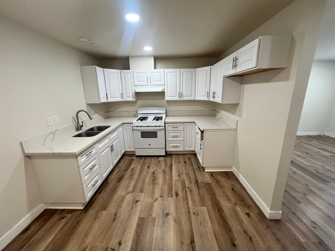
Kitchen
Norwalk sits about 17 miles southeast of Downtown Los Angeles, occupying a compact 10 square miles in the heart of the Gateway Cities corridor. The city carries a distinctly residential character, with tree-lined streets, well-maintained parks, and a settled, grounded atmosphere that sets it apart from the busier metro areas nearby. Incorporated in 1957, Norwalk traces its roots to an 1873 railroad stop, and that sense of established community still comes through today. Access to major freeways including I-5, I-605, and the 91, along with Metro rail connections, keeps the broader Los Angeles region well within reach.
The housing mix here leans toward apartment communities and smaller multi-family buildings, though single-family rentals and townhomes also appear throughout the city's neighborhoods. Renters generally find more space per dollar compared to closer-in Los Angeles submarkets.
Learn more about living in Norwalk| Colleges & Universities | Distance | ||
|---|---|---|---|
| Colleges & Universities | Distance | ||
| Drive: | 7 min | 3.1 mi | |
| Drive: | 8 min | 4.2 mi | |
| Drive: | 15 min | 7.6 mi | |
| Drive: | 14 min | 7.8 mi |


Transportation options available in Norwalk include Norwalk, located 2.5 miles from 12045 Orange St. 12045 Orange St is near Long Beach (Daugherty Field), located 11.7 miles or 20 minutes away, and Los Angeles International, located 22.0 miles or 29 minutes away.
| Transit / Subway | Distance | ||
|---|---|---|---|
| Transit / Subway | Distance | ||
|
|
Drive: | 4 min | 2.5 mi |
|
|
Drive: | 8 min | 4.9 mi |
|
|
Drive: | 16 min | 9.3 mi |
|
|
Drive: | 13 min | 9.4 mi |
|
|
Drive: | 18 min | 11.2 mi |
| Commuter Rail | Distance | ||
|---|---|---|---|
| Commuter Rail | Distance | ||
|
|
Drive: | 5 min | 2.1 mi |
|
|
Drive: | 11 min | 6.3 mi |
|
|
Drive: | 13 min | 8.0 mi |
|
|
Drive: | 15 min | 9.3 mi |
|
|
Drive: | 17 min | 11.4 mi |
| Airports | Distance | ||
|---|---|---|---|
| Airports | Distance | ||
|
Long Beach (Daugherty Field)
|
Drive: | 20 min | 11.7 mi |
|
Los Angeles International
|
Drive: | 29 min | 22.0 mi |
Scores provided by
Traffic
-Airport
-Businesses
-Scores provided by
HowLoud What is a Sound Score Rating? A Sound Score Rating aggregates noise caused by vehicle traffic, airplane traffic and local sources. How It WorksTime and distance from 12045 Orange St.
| Shopping Centers | Distance | ||
|---|---|---|---|
| Shopping Centers | Distance | ||
| Walk: | 2 min | 0.1 mi | |
| Walk: | 9 min | 0.5 mi | |
| Walk: | 10 min | 0.6 mi |
| Parks and Recreation | Distance | ||
|---|---|---|---|
| Parks and Recreation | Distance | ||
|
Pio Pico State Historic Park
|
Drive: | 11 min | 7.5 mi |
|
Children's Museum at La Habra
|
Drive: | 16 min | 9.4 mi |
|
El Dorado Nature Center
|
Drive: | 13 min | 9.6 mi |
|
La Habra Historical Museum
|
Drive: | 16 min | 9.6 mi |
|
El Dorado East Regional Park
|
Drive: | 16 min | 10.4 mi |
| Hospitals | Distance | ||
|---|---|---|---|
| Hospitals | Distance | ||
| Drive: | 4 min | 2.2 mi | |
| Drive: | 6 min | 2.8 mi | |
| Drive: | 7 min | 4.0 mi |
| Military Bases | Distance | ||
|---|---|---|---|
| Military Bases | Distance | ||
| Drive: | 18 min | 10.4 mi | |
| Drive: | 26 min | 20.3 mi | |
| Drive: | 35 min | 21.6 mi |
Pets Allowed Fitness Center Pool In Unit Washer & Dryer Clubhouse Balcony
What Are Walk Score®, Transit Score®, and Bike Score® Ratings?
Walk Score® measures the walkability of any address. Transit Score® measures access to public transit. Bike Score® measures the bikeability of any address.
What is a Sound Score Rating?
A Sound Score Rating aggregates noise caused by vehicle traffic, airplane traffic and local sources.
12045 Orange St
Norwalk, CA 90650


