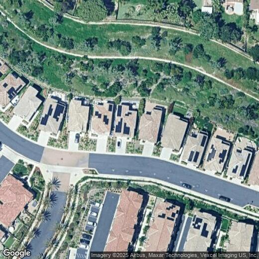
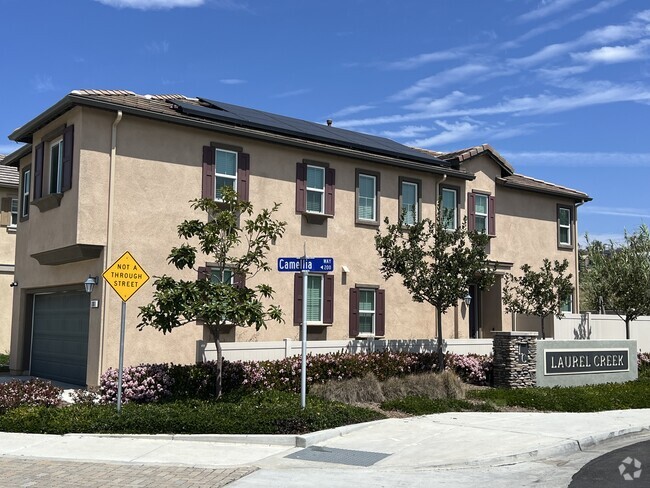
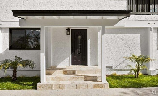
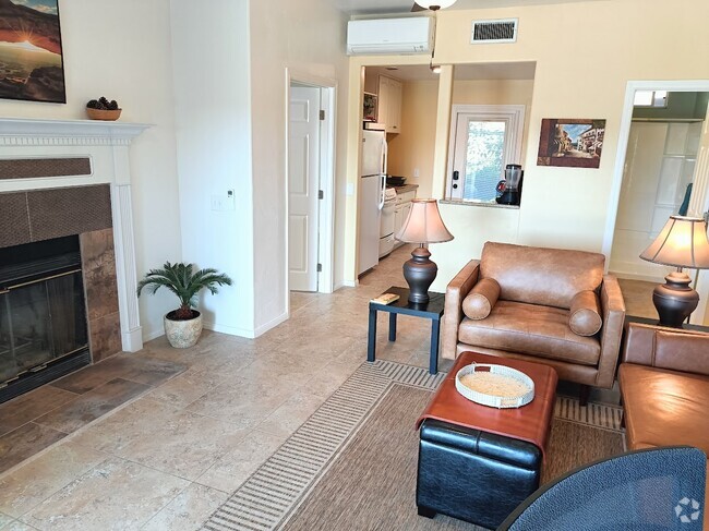
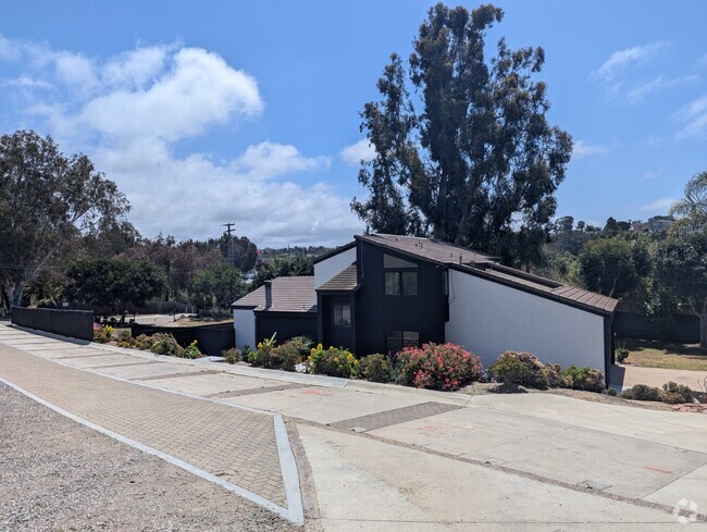
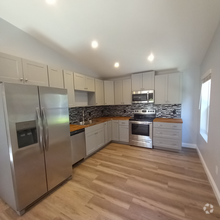
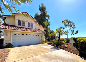
1204 Via Candelas
1204 Via Candelas
Oceanside, CA 92056
2 Weeks Ago
Favorites
1204 Via Candelas

Favorites
Check Back Soon for Upcoming Availability
Location
Get Directions
The coastal town of Oceanside rests about halfway between Anaheim and San Diego. Oceanside, which locals affectionately refer to as O’side, borders the Marine Corps Base Camp Pendelton to the north as well as Carlsbad and Legoland to the south.
The ocean plays a large role in O’side life. Whale watching from a boat, fishing off the Oceanside Pier, and swimming at Harbor Beach are all O’side staples. Surfing is also a major draw, with the California Surf Museum located in town. Should you tire of the ocean, Anza-Borrego Desert State Park is less than a two-hour drive away.
Cultural amenities abound in O’side, with Mission San Luis Rey, Oceanside Museum of Art, and the Star Theatre all within city limits. Hikers take to the trails in Guajome Regional Park and bikers to the San Luis Rey River Trail. Golfers practice their swings at Oceanside and Arrowood Golf Courses.
Learn more about living in Oceanside
Education
| Colleges & Universities | Distance | ||
|---|---|---|---|
| Colleges & Universities | Distance | ||
| Drive: | 6 min | 3.3 mi | |
| Drive: | 17 min | 10.8 mi | |
| Drive: | 20 min | 12.7 mi | |
| Drive: | 19 min | 12.8 mi |
1204 Via Candelas is within 6 minutes or 3.3 miles from MiraCosta College, Oceanside. It is also near Palomar College and USAHS.
Transportation options available in Oceanside include College Boulevard, located 1.1 miles from 1204 Via Candelas. 1204 Via Candelas is near San Diego International, located 40.1 miles or 52 minutes away.
| Transit / Subway | Distance | ||
|---|---|---|---|
| Transit / Subway | Distance | ||
|
|
Drive: | 3 min | 1.1 mi |
|
|
Drive: | 5 min | 2.0 mi |
|
|
Drive: | 6 min | 3.0 mi |
|
|
Drive: | 8 min | 3.4 mi |
|
|
Drive: | 8 min | 4.2 mi |
| Commuter Rail | Distance | ||
|---|---|---|---|
| Commuter Rail | Distance | ||
|
|
Drive: | 14 min | 7.7 mi |
|
|
Drive: | 14 min | 7.9 mi |
|
|
Drive: | 19 min | 11.7 mi |
|
|
Drive: | 24 min | 16.7 mi |
|
|
Drive: | 29 min | 21.2 mi |
| Airports | Distance | ||
|---|---|---|---|
| Airports | Distance | ||
|
San Diego International
|
Drive: | 52 min | 40.1 mi |
Time and distance from 1204 Via Candelas.
| Shopping Centers | Distance | ||
|---|---|---|---|
| Shopping Centers | Distance | ||
| Drive: | 3 min | 1.1 mi | |
| Drive: | 2 min | 1.2 mi | |
| Drive: | 3 min | 1.3 mi |
1204 Via Candelas has 3 shopping centers within 1.3 miles, which is about a 3-minute drive. The miles and minutes will be for the farthest away property.
| Parks and Recreation | Distance | ||
|---|---|---|---|
| Parks and Recreation | Distance | ||
|
Guajome County Park
|
Drive: | 7 min | 3.7 mi |
|
Rancho Guajome Adobe
|
Drive: | 7 min | 4.1 mi |
|
Agua Hedionda Lagoon Discovery Center
|
Drive: | 14 min | 7.1 mi |
|
Buena Vista Audubon Nature Center
|
Drive: | 11 min | 7.2 mi |
|
Carlsbad State Beach
|
Drive: | 13 min | 8.9 mi |
1204 Via Candelas has 5 parks within 8.9 miles, including Guajome County Park, Rancho Guajome Adobe, and Agua Hedionda Lagoon Discovery Center.
| Hospitals | Distance | ||
|---|---|---|---|
| Hospitals | Distance | ||
| Drive: | 6 min | 3.4 mi | |
| Drive: | 19 min | 9.9 mi |
1204 Via Candelas is 3.4 miles from Tri - City Medical Center, and is convenient to other hospitals, including NH Camp Pendleton.
| Military Bases | Distance | ||
|---|---|---|---|
| Military Bases | Distance | ||
| Drive: | 33 min | 20.9 mi | |
| Drive: | 49 min | 32.9 mi |
1204 Via Candelas is 20.9 miles from Marine Corps Base Camp Pendleton, and is convenient to other military bases, including USMC Air Station Miramar.
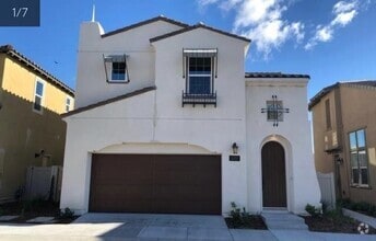
You May Also Like
Similar Rentals Nearby

What Are Walk Score®, Transit Score®, and Bike Score® Ratings?
Walk Score® measures the walkability of any address. Transit Score® measures access to public transit. Bike Score® measures the bikeability of any address.
What is a Sound Score Rating?
A Sound Score Rating aggregates noise caused by vehicle traffic, airplane traffic and local sources