

$2,900 / Month
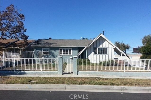
1203 Lindengrove Ave
Rowland Heights, CA 91748
2 Weeks Ago
Favorites
1203 Lindengrove Ave

Favorites
Check Back Soon for Upcoming Availability
| Beds | Baths | Average SF |
|---|---|---|
| 3 Bedrooms 3 Bedrooms 3 Br | 2 Baths 2 Baths 2 Ba | 1,677 SF |
Fees and Policies
The fees below are based on community-supplied data and may exclude additional fees and utilities.
- Parking
-
Garage--
-
Other--
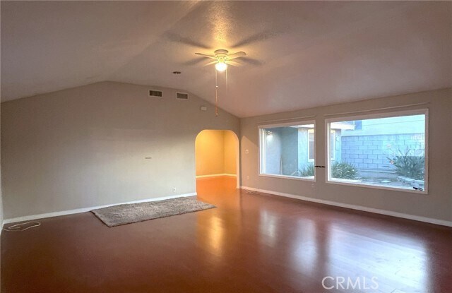
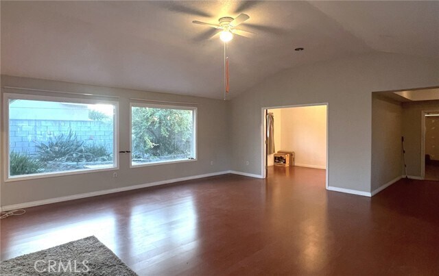
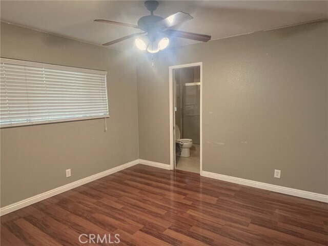
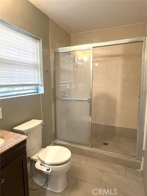
About This Property
California Ranch house located on a quiet street in the city of Rowland Heights. The property is clean and move in ready. The property is conveniently located within walking distance to supermarkets and restaurants. Close and easy access to 60 Freeway.
1203 Lindengrove Ave is a house located in Los Angeles County and the 91748 ZIP Code. This area is served by the Rowland Unified attendance zone.
House Features
Air Conditioning
Washer/Dryer Hookup
Heating
Range
- Washer/Dryer Hookup
- Air Conditioning
- Heating
- Range
- Dining Room
- Views
Location
Get Directions
Located approximately 20 miles east of Los Angeles, Rowland is a small neighborhood in the City of Industry. This prosperous community sits at the south end of the San Gabriel Valley and offers a central location for commuters. With easy access to shopping and major roadways, Rowland serves its residents with plenty of convenience, while its parks and wilderness areas let you stay connected to California’s natural beauty. Residents enjoy the abundant entertainment options, including retailers, movie theaters, fitness centers, department stores, and restaurants, as well as outdoor options like Peter F. Schabarum Regional Park, a 575-acre park with tennis courts and beautiful nature trails.
Learn more about living in RowlandBelow are rent ranges for similar nearby apartments
| Beds | Average Size | Lowest | Typical | Premium |
|---|---|---|---|---|
| Studio Studio Studio | 527 Sq Ft | $1,829 | $1,938 | $2,026 |
| 1 Bed 1 Bed 1 Bed | 692 Sq Ft | $1,100 | $2,211 | $5,556 |
| 2 Beds 2 Beds 2 Beds | 926-932 Sq Ft | $1,600 | $2,676 | $6,924 |
| 3 Beds 3 Beds 3 Beds | 1292 Sq Ft | $2,100 | $3,475 | $4,200 |
| 4 Beds 4 Beds 4 Beds | 2760 Sq Ft | $2,900 | $4,669 | $8,000 |
Amenities
- Washer/Dryer Hookup
- Air Conditioning
- Heating
- Range
- Dining Room
- Views
Education
| Colleges & Universities | Distance | ||
|---|---|---|---|
| Colleges & Universities | Distance | ||
| Drive: | 11 min | 5.9 mi | |
| Drive: | 14 min | 8.3 mi | |
| Drive: | 15 min | 8.8 mi | |
| Drive: | 15 min | 9.7 mi |
1203 Lindengrove Ave is within 11 minutes or 5.9 miles from Mt. San Antonio College. It is also near Cal Poly Pomona and DeVry University-California.
Schools


Public Elementary School
Grades K-6
257 Students
Nearby
Public Elementary & Middle School
Grades K-8
596 Students
Attendance Zone
Public High School
Grades 9-12
2,025 Students
Attendance Zone
Private Elementary School
Grades PK-K
36 Students
Nearby
Private Elementary & Middle School
Grades K-8
Nearby
Private Elementary, Middle & High School
Grades K-11
64 Students
Nearby
Private Elementary School
Grades PK-6
Nearby
Private Elementary, Middle & High School
Grades 1-12
Nearby
School data provided by
 The GreatSchools Rating helps parents compare schools within a state based on a variety of school quality indicators and provides a helpful picture of how effectively each school serves all of its students. Ratings are on a scale of 1 (below average) to 10 (above average) and can include test scores, college readiness, academic progress, advanced courses, equity, discipline and attendance data. We also advise parents to visit schools, consider other information on school performance and programs, and consider family needs as part of the school selection process.
View GreatSchools Rating Methodology
Data provided by GreatSchools.org © 2025. All rights reserved.
View GreatSchools Rating Methodology
Data provided by GreatSchools.org © 2025. All rights reserved.
Transportation options available in Rowland Heights include Azusa Downtown Station, located 12.6 miles from 1203 Lindengrove Ave. 1203 Lindengrove Ave is near Ontario International, located 19.3 miles or 26 minutes away, and Long Beach (Daugherty Field), located 31.1 miles or 41 minutes away.
| Transit / Subway | Distance | ||
|---|---|---|---|
| Transit / Subway | Distance | ||
| Drive: | 22 min | 12.6 mi | |
| Drive: | 23 min | 17.2 mi | |
| Drive: | 24 min | 18.9 mi |
| Commuter Rail | Distance | ||
|---|---|---|---|
| Commuter Rail | Distance | ||
|
|
Drive: | 6 min | 2.7 mi |
|
|
Drive: | 15 min | 9.8 mi |
|
|
Drive: | 19 min | 10.7 mi |
|
|
Drive: | 21 min | 11.9 mi |
|
|
Drive: | 20 min | 12.7 mi |
| Airports | Distance | ||
|---|---|---|---|
| Airports | Distance | ||
|
Ontario International
|
Drive: | 26 min | 19.3 mi |
|
Long Beach (Daugherty Field)
|
Drive: | 41 min | 31.1 mi |
Time and distance from 1203 Lindengrove Ave.
| Shopping Centers | Distance | ||
|---|---|---|---|
| Shopping Centers | Distance | ||
| Walk: | 12 min | 0.6 mi | |
| Walk: | 17 min | 0.9 mi | |
| Drive: | 3 min | 1.6 mi |
1203 Lindengrove Ave has 3 shopping centers within 1.6 miles, which is about a 3-minute walk. The miles and minutes will be for the farthest away property.
| Parks and Recreation | Distance | ||
|---|---|---|---|
| Parks and Recreation | Distance | ||
|
Schabarum Regional Park
|
Drive: | 11 min | 5.1 mi |
|
Galster Wilderness Park Nature Center
|
Drive: | 14 min | 7.2 mi |
|
La Habra Historical Museum
|
Drive: | 13 min | 8.0 mi |
|
Craig Regional Park
|
Drive: | 13 min | 8.1 mi |
|
Children's Museum at La Habra
|
Drive: | 14 min | 8.4 mi |
1203 Lindengrove Ave has 5 parks within 8.4 miles, including Schabarum Regional Park, Galster Wilderness Park Nature Center, and La Habra Historical Museum.
| Hospitals | Distance | ||
|---|---|---|---|
| Hospitals | Distance | ||
| Drive: | 16 min | 10.1 mi | |
| Drive: | 18 min | 10.3 mi | |
| Drive: | 18 min | 11.5 mi |
1203 Lindengrove Ave has 3 hospitals within 11.5 miles, the nearest is St. Jude Medical Center which is 10.1 miles away and a 16 minute drive.
| Military Bases | Distance | ||
|---|---|---|---|
| Military Bases | Distance | ||
| Drive: | 36 min | 25.6 mi |
1203 Lindengrove Ave is 25.6 miles and a 36 minute drive from Los Alamitos Army Airfield.
You May Also Like
Similar Rentals Nearby


What Are Walk Score®, Transit Score®, and Bike Score® Ratings?
Walk Score® measures the walkability of any address. Transit Score® measures access to public transit. Bike Score® measures the bikeability of any address.
What is a Sound Score Rating?
A Sound Score Rating aggregates noise caused by vehicle traffic, airplane traffic and local sources
1203 Lindengrove Ave
Rowland Heights, CA 91748